
Overview - updated January 2026
This page has a full description of this section of the trail, including supporting photographs. You can read this page and/or
Starting point
The starting point is point the South Beach Cafe.
Getting there using public transport
The best way to get to the start using public transport is to catch the bus 532 from Fremantle train station. The bus travels down South Terrace and turns left (east) along Douro Road. Get off at the first bus stop on Douro Road. Walk back along Douro Road across South Terrace to Marine Terrace, and cross the railway line onto the dual use path and turn left (south) to the South Street Café – about 450m walk total.
Turn around point
The turn around point is the Dome Café within the Port Coogee marina area.
Getting back to the start from the turn around point – if you don’t want to do an out-and-back walk
The best way to get back to the start using public transport is catch the 548 or 512 bus, both of which stops outside the Woolworths shopping centre. From the Dome Café walk south along the path to near the end of the boat mooring area and turn left (east) along Calypso Parade passed Woolworth and turn right on Orsino Boulvard. The bus stop is about 30m south on Orsino Boulvard. Both buses end up at Fremantle Station, so then take the 532 as above back to the start.
Summary of the walk
Figure 1 below shows the route. The total one way distance is 5.1 km, making it a 9.4 km out and back walk (no need to re-do the walk along the rock groyne). If you left off the walk along the groyne (1.6km there are back), the one-way walk is 4.3km and 8.6 km out and back.
Water and toilets
Any toilet blocks are noted below in the text in italics. These are also sources of potable water. Any additional drinking water taps and showers are also noted in italics.
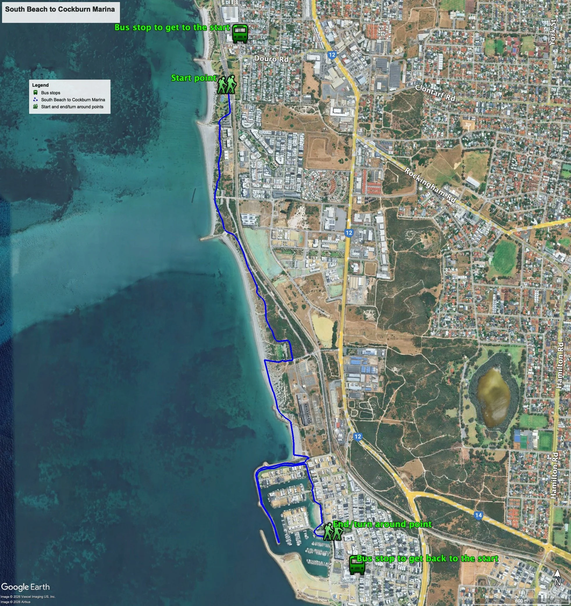
Figure 1: Map showing the South Beach to Coogee Marina walk - including how to walk to the bus stop at the turn around point, if you don't want to do the out and back walk
Walking guide
Plate 1 shows the South Beach café which is the starting point.

Plate 1: South Beach Cafe
The South beach carpark is a favorite place for campervan overnight stops (Plate 2).

Plate 2: Campervan in South Beach carpark
There is a toilet block just south of the café.
Just ahead is the northern edge of a relatively new housing estate with multi-storey apartments located closest to the beach (Plate 3).

Plate 3: Multi-story apartments
The path continues to the west of the apartments, passed another Café (Plate 4).

Plate 4: Beach front café.
From here, the coastal path proper begins, which is quite winding and undulating, and has views of the ocean from the high points. Most of the beach adjacent to this part of the path is a dog beach, and there are many people walking their dogs on the path as well as on the beach, not all of them on a lead (Plate 5). The path is also popular with cyclists.

Plate 5: Path south of South Beach, showing the ocean views.
It’s worth noting that in the warmer months, snakes are often seen crossing the path and there is a warning on the path to remind people of this (Plate 6).

Plate 6: Snake warning on the path
Along the way there are a couple of elevated sites with nice views over the ocean.
The land to the east of this section of the path is old and now rehabilitated industrial land. One of the main industries here was the Robb Jetty abattoir, and the remains of the jetty can still be seen on the beach at low tide (Plate 7) as well as the remains of an unknown shipwreck (Plate 8).

Plate 7: Old Robb Jetty at low tide

Plate 8: Unknown ship wreck at O’Connor Beach (part of the old Robb Jetty in the background)
Just off shore is a statue of a horse and horse rider, which celebrates the historic use of this section of the beach for horse training (Plate 9). The beach still gets regularly used by at least one horse trainer.

Plate 9: Statue of a horse and horse rider at O’Connor Beach
On the path adjacent to the above there is some art that recognizes the former abattoir (Plates 10 and 11).
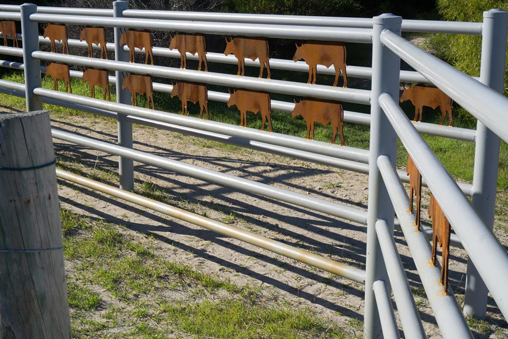
Plates 10: Art adjacent to the path recognising the former abattoir at Robs Jetty

Plates 11: Art adjacent to the path recognising the former abattoir at Robs Jetty
As you continue, the old South Fremantle power station becomes the obvious landscape feature. Before we got there, there is a larger grassed area, carpark, toilet and drinking water tap part of C Y O’Connor Park (Plate 12).
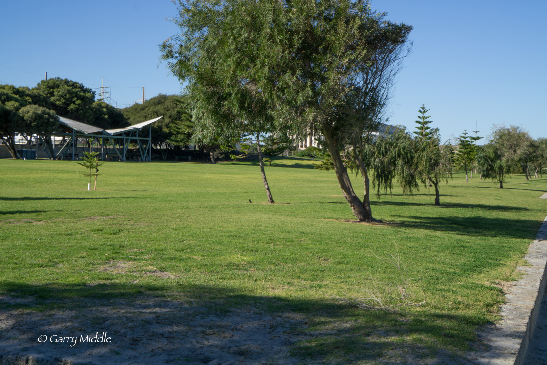
Plate 12: C Y O’Connor Park
As you approached the park, there is a sandy track off to the right, so you can take this track or continue on the bitumen path (Plate 13). The track goes to west of the park and the bitumen path goes through the park.

Plate 13: Sandy track that goes around C Y O’Connor Park
The path effectively ends here, as the old power station and associated substation needs to be walked around (Plate 14). There is a path and old road that is to the east of the old power station and sub-station, but it is more interesting to take the sand track at the southern end of the carpark or walk on the beach towards the marina (Plate 15). The mapped trail is the along the sand track. Beach matting is laid on this track and onto the beach each summer season.

Plate 14: View of old power station at the eastern end of the C Y O’Connor Park. This is also where the sand track starts. It that either goes direct to the beach or veer left passed the power station.
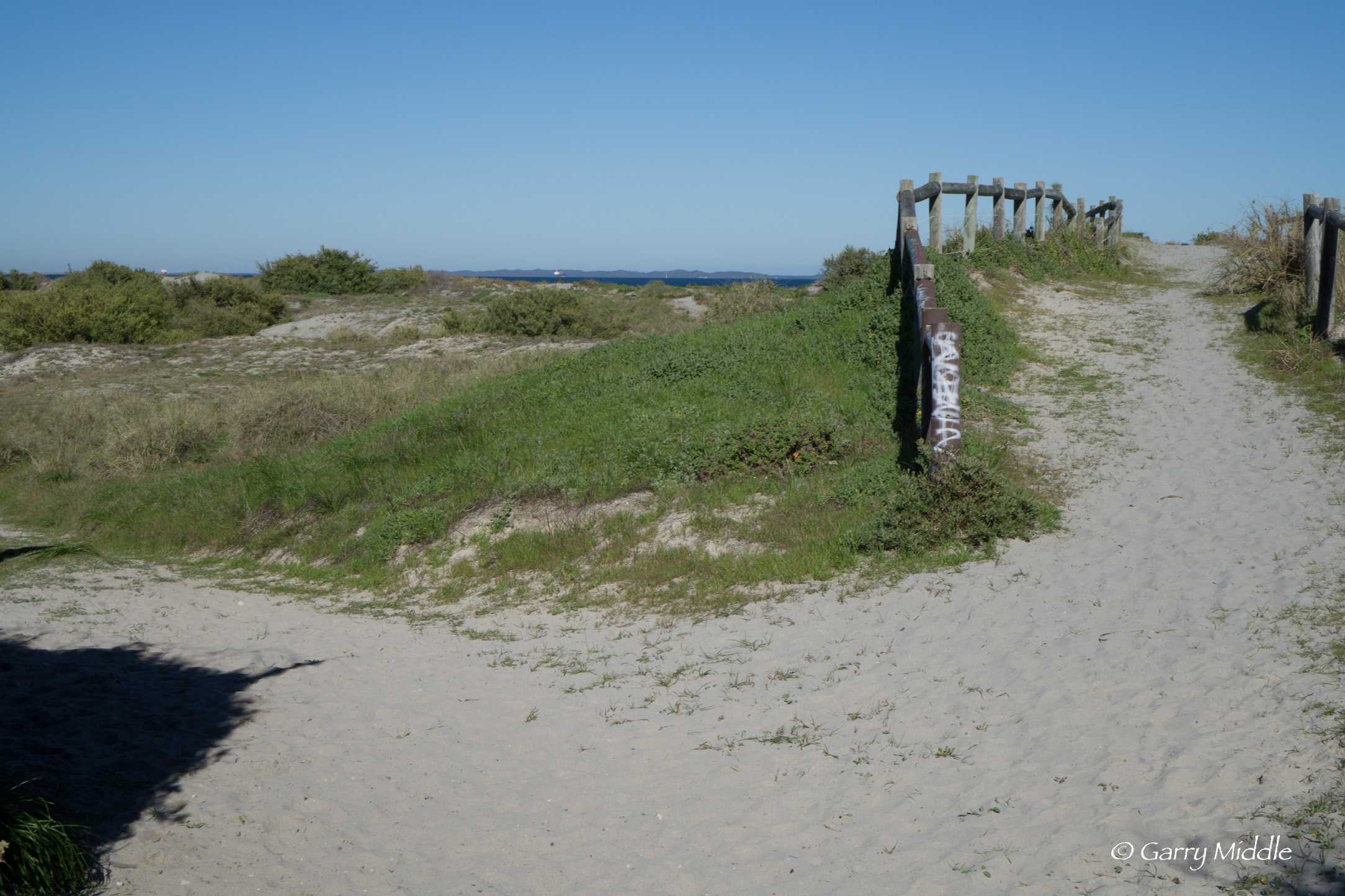
Plate 15: Sand track from end of carpark. Walk straight ahead for the beach of take the track to the left to walk passed the powered station
As you walk passed the power station you will come across a pond, or water body, that seems to be an old cooling pond for the power station (Plate 16). There is also an old jetty-like structure on the beach adjacent to the pond (Plate 17).

Plate 16: Pond in front of the old power station

Plate 17: Old jetty-like structure adjacent to power station
Continue either along the path near the fence that protects the power station, or along the beach until you get to the marina rock wall (Plate 18). It easiest to climb the wall up passed the vegetation line, near where the sand track ends.
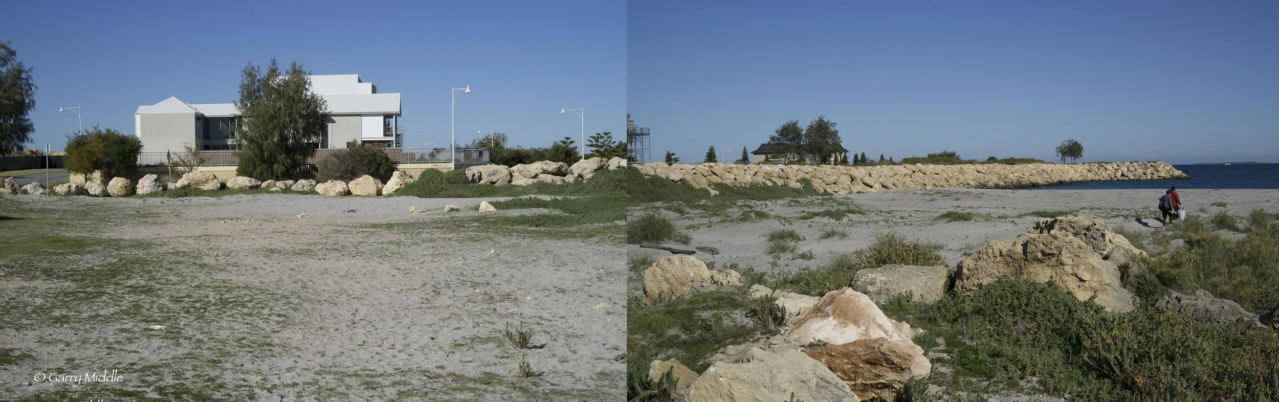
Plate 18: A poor ‘stitch’ of two photos showing where to climb the marina wall up passed the vegetation line.
Once you climb up the wall, you should be near a car park (near the right angle bend of Caledonia Loop), and there should also be a formal path and park (Plate 19), which then turns into a crushed limestone track. Take this path heading west. Alternately, a shorter walk it to continue along Caledonia Loop.

Plate 19: The park adjacent to the path near the start of the sea wall.
The wall is popular for fishing (Plate 20). There are many vacant blocks in the marina, but less so in the land-backed part of the marina, and there doesn’t seem to be any vacant boat pens. (Plate 21)

Plate 20: Fishing off the marina wall.
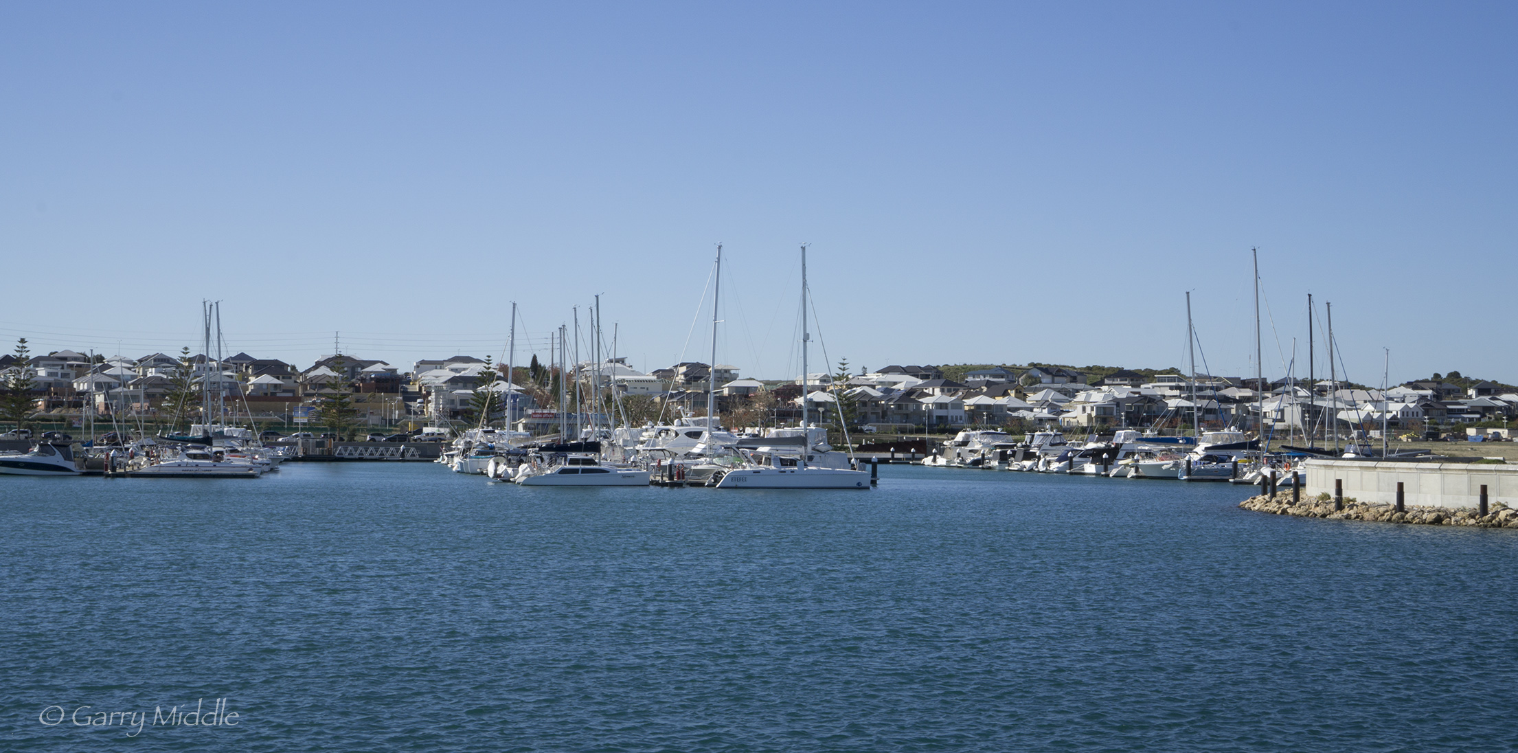
Plate 21: View of boats pens and land-back part of Cockburn Marina
Once you reach the southern tip of the seawall (Plate 22), turn around and head back and once you get to the spot where you climb the wall, find the right angle bend of Caledonia Loop, and head South.

Plate 22: The turn-around point at the end of the Cockburn marina northern sea wall
Continue along of Caledonia Loop until it turns sharp left and intersects with Medina Parade. Turn south along Medina Parade passed and artificial beach and grassed foreshore inside the marina (Plate 23), which is popular with families.
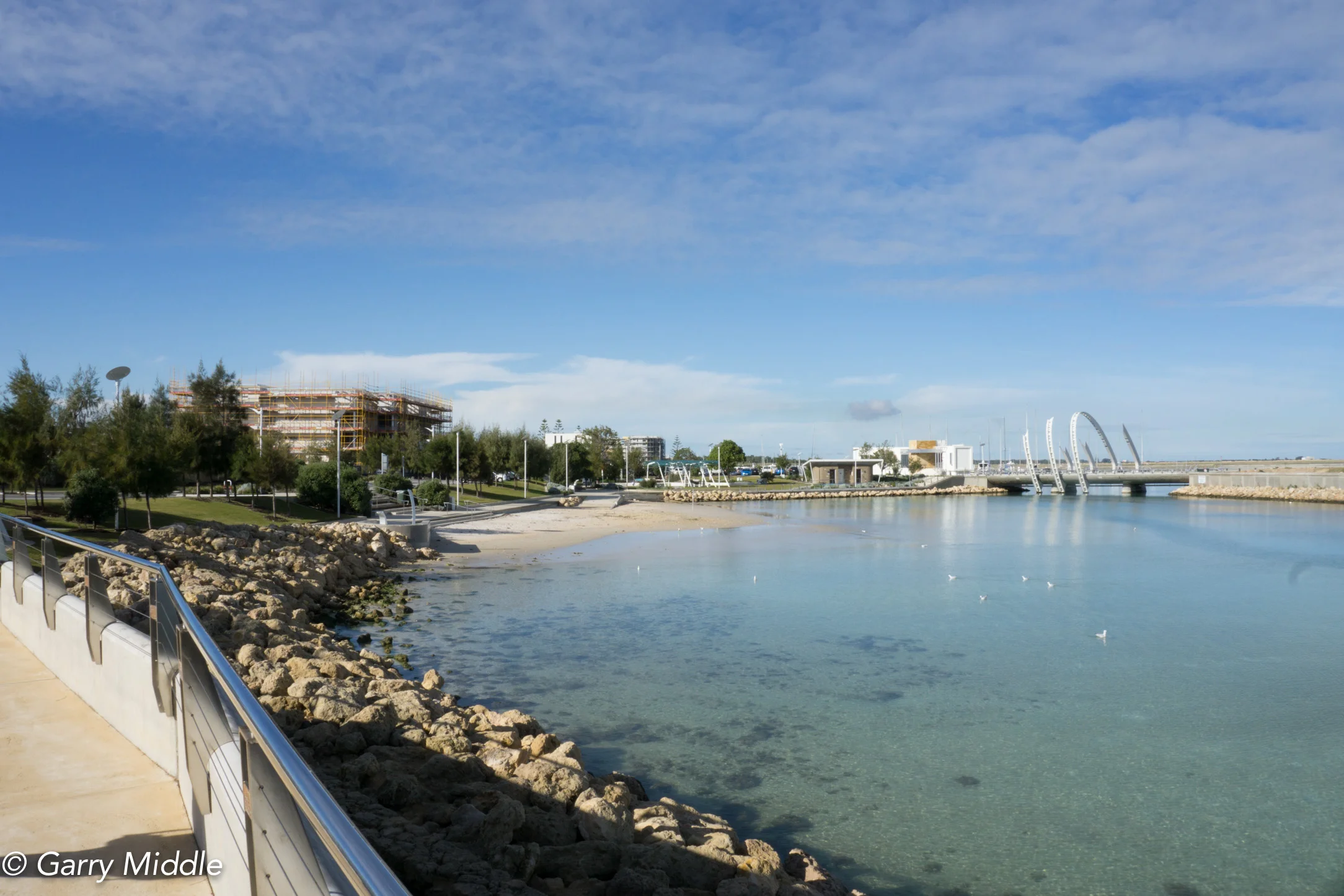
Plate 23: Popular artificial beach and grassed foreshore inside the marina
Walk along passed the beach passed a toilet block and up to the start of the bridge visible in Plate 22. Go up the stairs and down the stairs on the other side of the road and head left (south) on a board walk around some buildings and continue until you get to the Dome Café, the end/turn around point. (Some of the photos were taken when the trail was originally walked in July 2014).
Garry Middle, January 2026