
Overview - January 2026 revision
This page has a full description of this section of the trail, including supporting photographs. You can read this page and/or
Starting point – arriving by car
The starting point is Jindalee Beach at the end of Jindalee Boulevard. There is a café here (Jindalee Beach Shack), toilets, showers and drinking fountain.
Getting there using public transport and starting point
The best way to the start using public transport is to catch the train on the Joondalup line, get off at the Butler Station and catch the 481 bus. From the train station the bus heads west along Butler Boulevard then left (south) on to Marmion Ave. It will then turn right (west) along Roundhouse Parade and then left (south) on to Barquentine Ave and then left (east) onto Jindalee Boulevard. There is a bus stop just after the bus turns left (heading east) along Jindalee Boulevard. It’s a 510m walk west to the starting point at the end of Jindalee Boulevard.
Turn around point
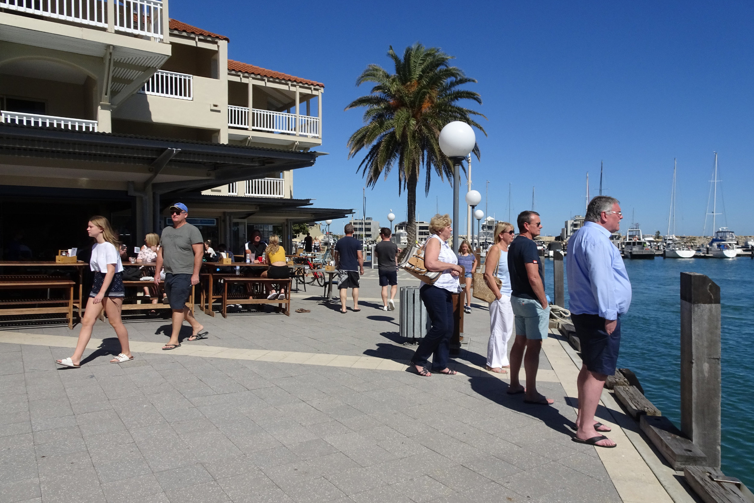
The turnaround point is the end of the main board walk in front of the cafes/restaurants at Mindarie Keys Marina.
Getting back to the start from the turn around point – if you don’t want to do an out-and-back walk
The best way to get back to the start using public transport is to walk back along the boardwalk passed the boat jetty, about 200m, to Swansea Promenade and head east up the road to the roundabout (250m), straight through the roundabout and on to Honiara Way for another 250m to a T junction and turn right on to Rothesay Heights – the bus stop is about 150m along Rothesay Heights. Catch the 480 bus heading south to Clarkson Station. Catch the train heading north and get off at the Butler Station and catch the 481 bus. From the train station the bus heads west along Butler Boulevard then left (south) on to Marmion Ave. It will then turn right (west) along Roundhouse Parade and then left (south) on to Barquentine Ave and then left (east) onto Jindalee Boulevard. There is a bus stop just after the bus turns left (heading east) along Jindalee Boulevard. It’s a 510m walk west to the starting point.
Summary of the walk
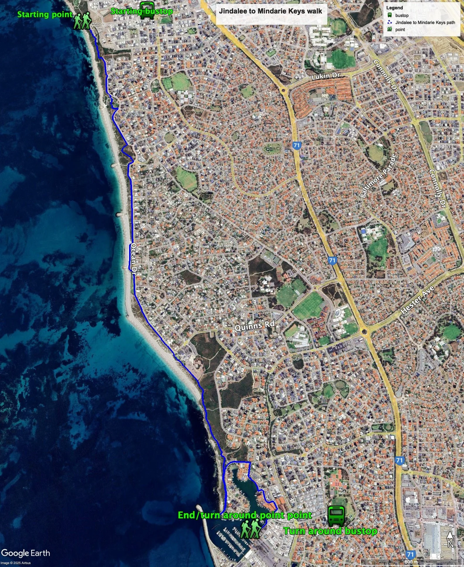
Figure 1 below shows the route, bus routes and bus stops. There are two options for this walk – the longer one is recommended. The total one-way distance for the longer walk is 6.4km, making it a 12.8km out and back walk. The total one-way distance for the shorter walk is 5.43km, making it a 10.9km out and back walk.
Water and toilets
Any toilet blocks are noted below in the text initalics. These are also sources of potable water. Any additional drinking water taps and showers are also noted initalics.
Walking guide
This walk is described walking south from the starting point.
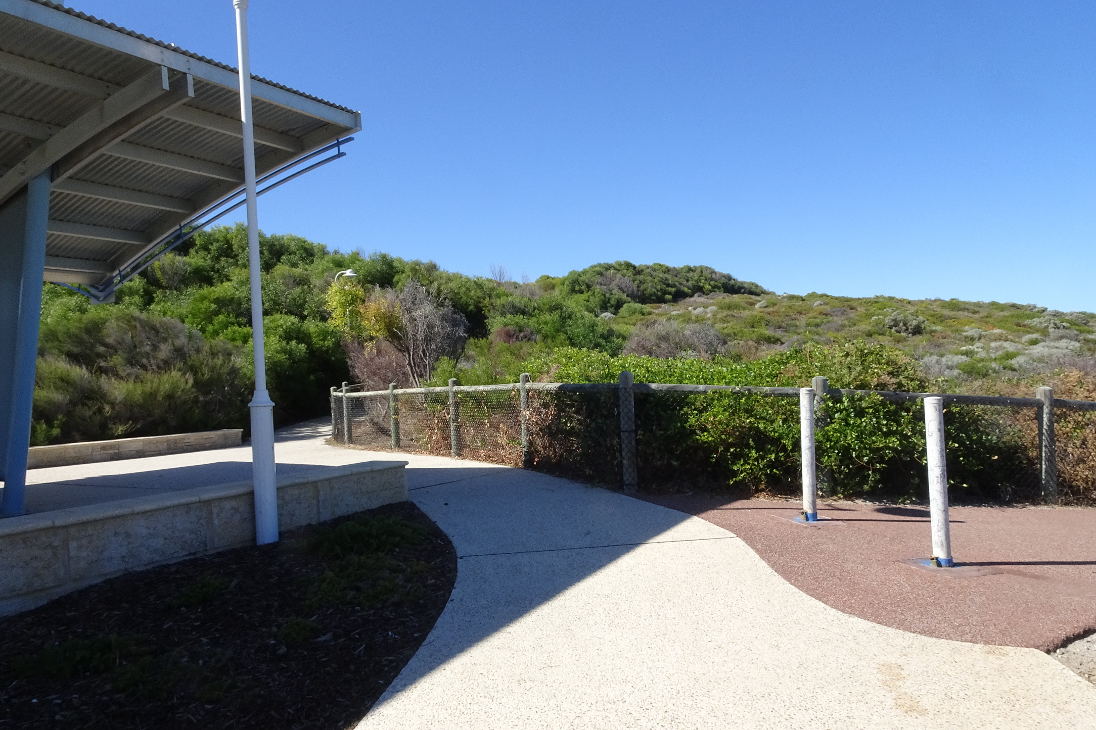
From the starting point (there is a toilet, showers and a drinking water tap) you can take in the views from the viewing platform (Plates 1, 2 and 3).
Plate 1: The viewing platform at the start of the walk

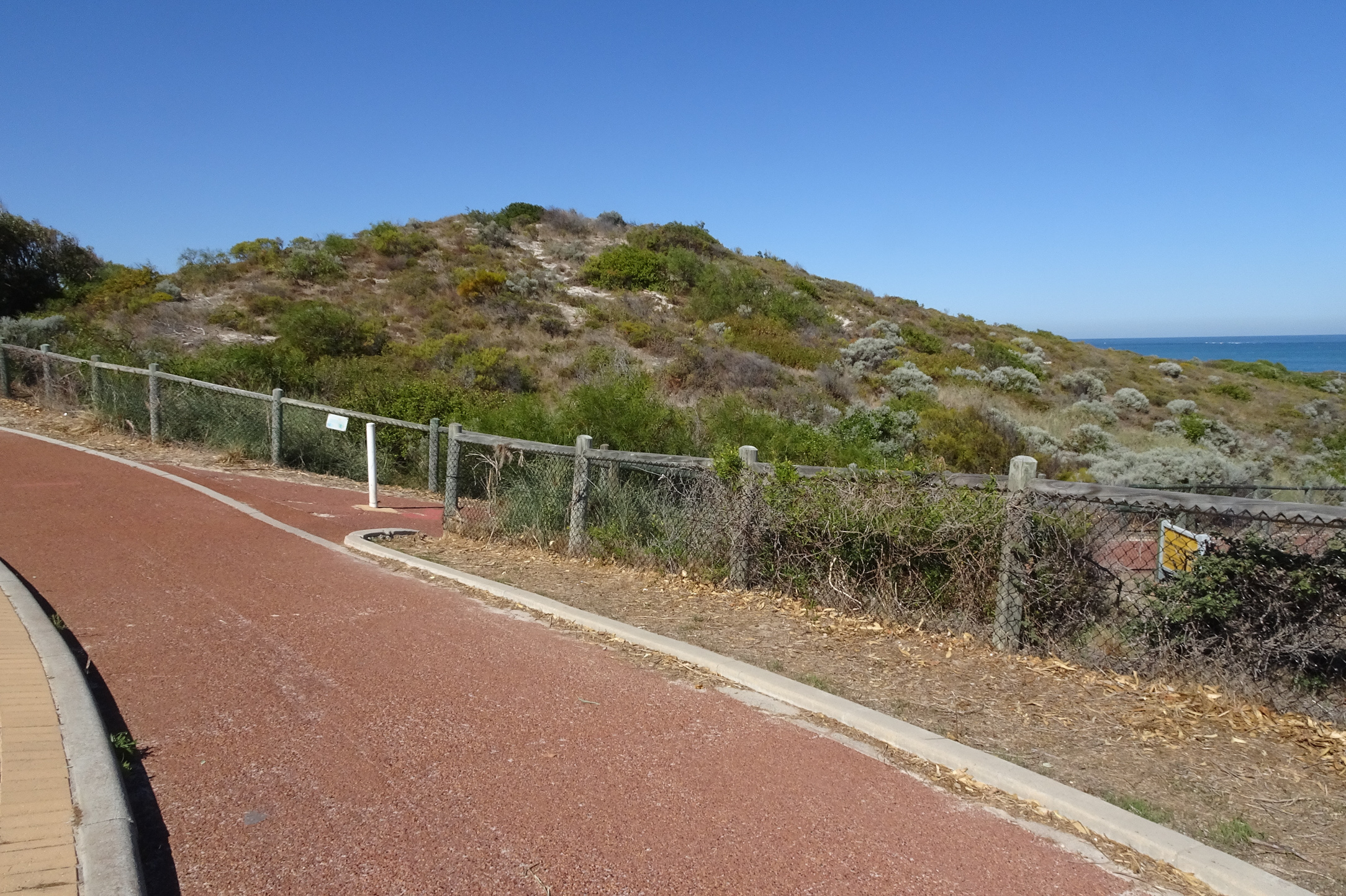
Plate 2: The views south from the viewing platform

Plate 3: The views north from the viewing platform

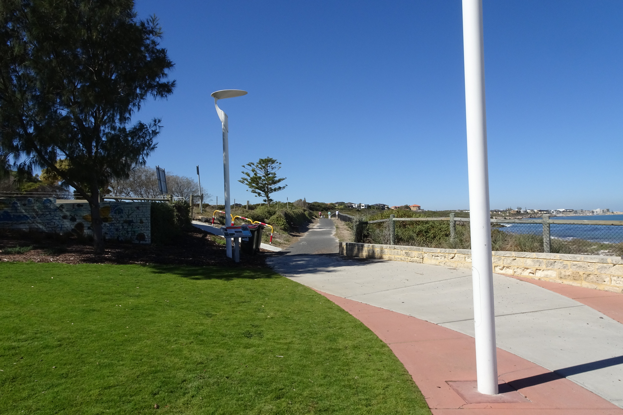
You will notice that the path heads north from here – this is the end section of the Shorehaven to Jindalee walk. Start the walk by heading south along the path in front of all the infrastructure past the carpark, a grassed area and a shade structure where there is a concrete path heading up into the dunes and a red bitumen path heading along the coast (Plate 4).
Plate 4: The red bitumen path going off to the right at the end of the grassed area
Take the red bitumen path and walk for about 200m where the path come out onto the cul de sac road Waterland Point. Follow this path onto Ocean Drive for about 200m, follow the path through Queenscliff Park, and back onto the Ocean Drive path. Just before the Ocean Drive Weymouth Boulevard T-junction (about 350m) take the red bitumen off to the right. (Plate 5).
Plate 5: The red bitumen path going off to the right near the end of the Ocean Drive path
After about 280m the path re-joins Ocean Drive after going through a carpark, where there is a drinking tap and shower. After about 750m take the steps down to the carpark (Plate 6) where there is a toilet block, and continue on through the car park and the grassed area back onto the path running next to Ocean Drive.
Plate 6: The steps down to the carpark

Follow this path for about 630m and you will arrive at Quinns Beach, which has a café, toilet block, showers and drinking water tap. There’s and interesting large piece of art here (Plate 7).
Plate 7: The art work at Quinns beach

Walk along the path passed all the facilities and onto the black bitumen path (Plate 8).
Plate 8: The black bitumen path at the southern end of Quinns Beach
Along this section there are a couple of good look out points (Plate 9) as well as some interpretative signs (Plate 10).
Plate 9: Look out point

Plate 10: Interpretative signs

After 800m you will notice a carpark just off the path which has a toilet block and drinking water tap. This is the point where you can choose to finish your walk either via a longer or shorter walk (Plate 11).
Plate 11: Carpark where you choose to complete the walk the longer or shorter way

For the longer walk, continue south along the path for about 350m to a set of stairs which you climb and then head on to the end of the north groyne at the entrance of Mindarie Keys Marina (Plate 12), and enjoy the views up the coast (Plate 13).
Plate 12: The end of the north groyne at the entrance of Mindarie Keys Marina

Plate 13: The views north from the end of the north groyne at the entrance of Mindarie Keys Marina

Head back along the path to the carpark and take the footpath east along Rosslare Promenade/Clarecastle Retreat for about 150m and turn right into Syros Court, and at the end, walk along the paved foreshore until you have to follow the road away from the waterway. Take the first right onto Itea Place and then right at the T junction onto Toulon Court (about 50m). After 70m take the steps on the right (Plate 14) down to the foreshore.
Plate 14: The steps down to the foreshore from Toulon Court

Walk down the steps and follow the boardwalk around the foreshore to the cafes/restaurants at Mindarie Keys Marina (Plate 15) – this is the end of the walk.
Plate 15: The end of the walk at the main cafes/restaurants area at Mindarie Keys Marina
For the shorter walk, from the carpark take the footpath east along Rosslare Promenade/Clarecastle Retreat about 150m and turn right into Syros Court and at the end walk along the paved foreshore until you have to follow the road away from the waterway and take the first right onto Itea Place and then right at the T junction onto Toulon Court (about 50m). After 70m take the steps on the right (Plate 14) down to the foreshore and follow the boardwalk around the foreshore to the cafes/restaurants at Mindarie Keys Marina (Plate 15).
Garry Middle, January 2026