
Overview - updated February 2026
This page has a full description of this section of the trail, including supporting photographs. You can read this page and/or
Starting point
If you want to do this walk as part of a north to south walk, then the starting point is the main beach area at Port Beach. There is plenty of carparking here.
The simplest way to do this as an out and back walk is head north from Fremantle Station.
NOTES
This is not a pleasant walk as it involves walking on paths adjacent to busy roads for the most part;
At the time of writing, the old Fremantle traffic bridge is closed to traffic and pedestrians, and so this walk in the interim and described here uses the Striling Bridge to cross the Swan River. Once the work on the replacement bridge is complete, I will update this walk to use the new bridge to cross the Swan River. It is likely to be some time in 2027.
Getting there using public transport
The best way to get to the start using public transport is to take the Fremantle train and alight at North Fremantle station. It’s a 1.1kmn walk to the start. Head west along the wide mall in the middle of Freeman Loop which ends at Leighton Beach commercial and recreational node. Take the red bitumen path south for about 900m to the start point.
Turn around point
The turnaround point is the Fremantle train Station.
Getting back to the start from the turn around point – if you don’t want to do an out-and-back walk
The best way to get back to the start using public transport is to take the Fremantle train and alight at North Fremantle station. It’s a 1.1kmn walk to the start. Head west along the wide mall in the middle of Freeman Loop which ends at Leighton Beach commercial and recreational node. Take the red bitumen path south for about 900m to the start point.
Summary of the walk
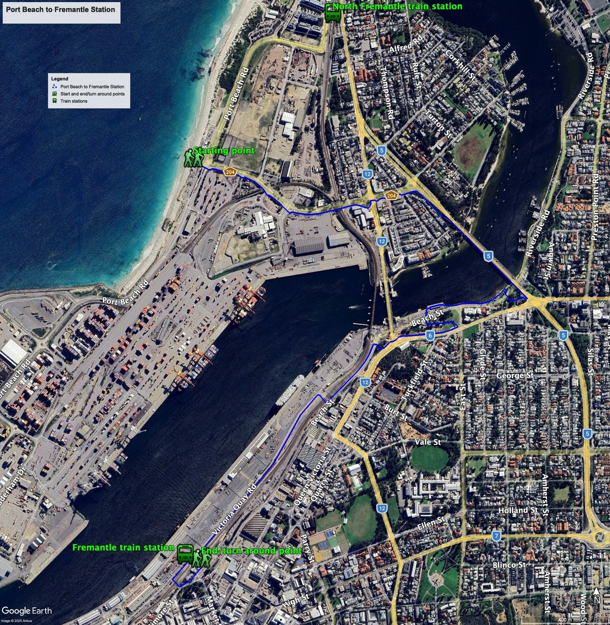
Figure 1 below shows the route. The total one-way distance is 4.75 km, making it a 9.5 km out and back walk.
Figure 1
Water and toilets
Any toilet blocks are noted below in the text initalics. These are also sources of potable water. Any additional drinking water taps and showers are also noted initalics.
Walking guide
At the start (Plate 1) there is a café/restaurant, toilet block, showers and drinking taps at the start.
Plate 1: Starting point

Cross the road at the traffic lights and take the path on the southern side of Tydeman Road. After about 900m, is the main intersection of Tydemen Road with Queen Victoria Street. Cross over the off ramp and over Queen Victoria Street at the traffic lights and continue on the foot path on the south side of Tydemen Road. The path bends to the south and runs parallel with Stirling Highway towards Stirling Bridge as a red bitumen path. After about 150m there is a concrete path on the left which will take you to the Stirling Bridge. If you miss this path, you can access the bridge at the end of the path via the steps.
Continue across the Stirling Bridge, and as you get close to the intersection of Stirling Highway with Canning Highway, take the concrete path on your right down to the River, cross over Riverside Drive and take the path west towards the port.
This will take you passed the East Street Rottnest island ferry boarding place.
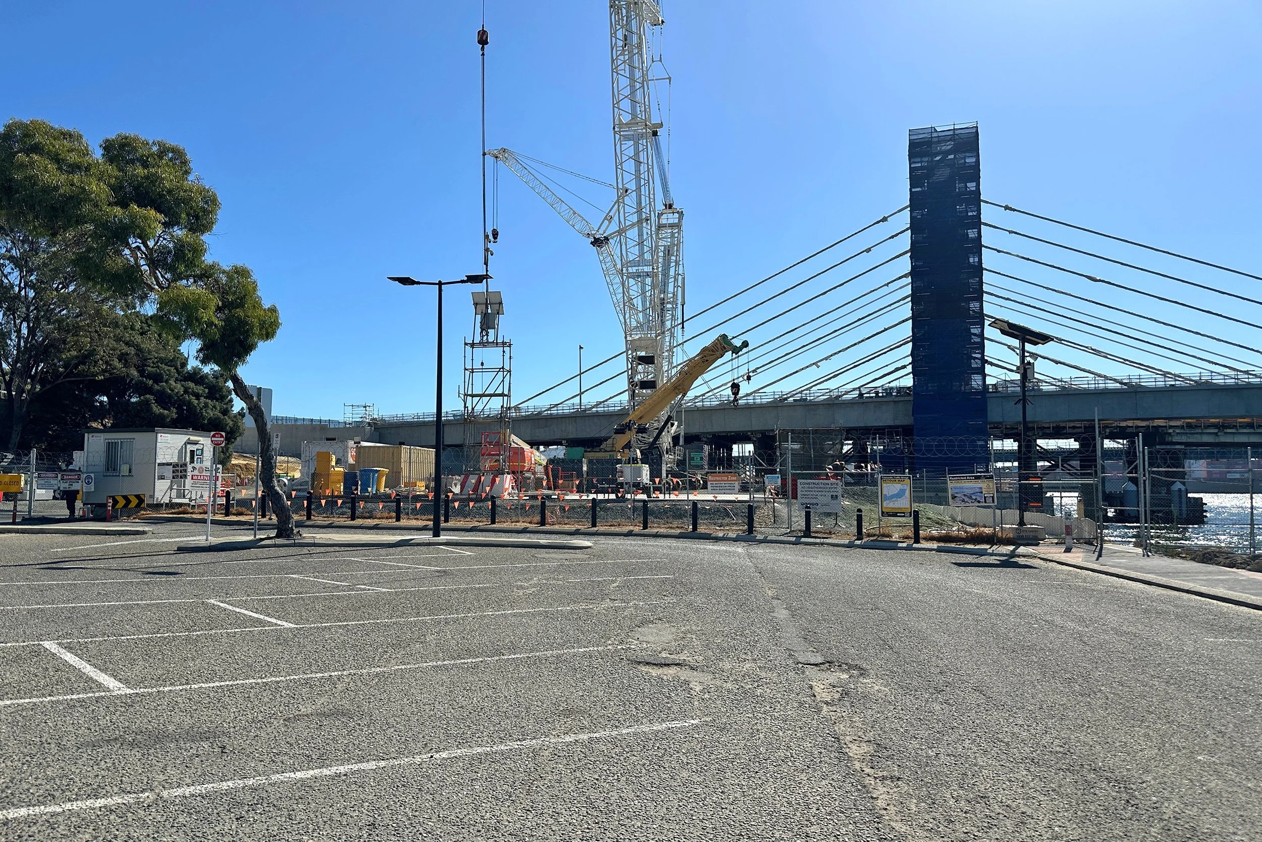
Ahead of you, you will notice the major works for the replacement of the old traffic bridge. The path ahead is not blocked (Plate 2).
Plate 2: Bridge works replacing the old traffic bridge
Just passed the Jetty Bar and East is a temporary crosswalk to your left heading passed a toilet block and heading towards the rainbow shipping container art (Plate 3). Take this path up to Canning highway and turn right towards Fremantle.
Plate 3: Path up to Canning Highway

Continue on this path and cross Queen Victoria St/Stirling Highway at the Traffic lights.
After about 40m take the path off to the right downhill towards Beach Road, cross Beach Road and turn left heading onto the path that runs next to the road towards Fremantle
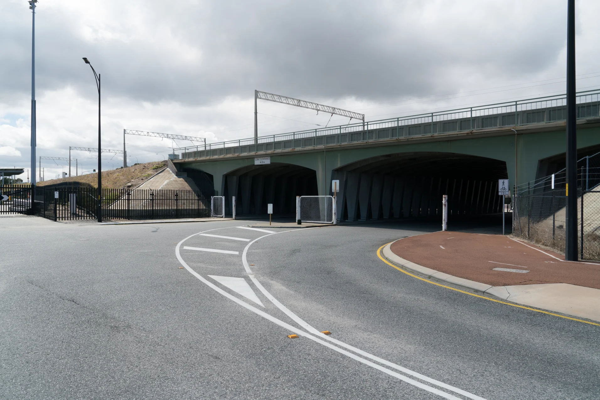
After about 400m, there is a road T junction with a road heading off to the right towards the port under the railway line. Turn right onto the path that follows this road (Plate 4) through the open gate (NOTE if the gates are locked you will have to continue along Beach Road for about 500m to the turnaround point in front of the train station).
Plate 4: The road and path that passes under the railway line and heads towards the port
Follow the path along the road for about 900m where the path bends rights then 180 left and then right again to continue parallel to the railway line opposite the train station.
NOTE: there is a toilet block at the B shed and the E shed markets, and several cafes at E Shed, which are about 100m beyond the red brick buildings
After about 130m take the fenced and gated path on your left that crosses over the railway lines (Plate 5).
Plate 5: The fenced and gated path that crosses over the railway lines
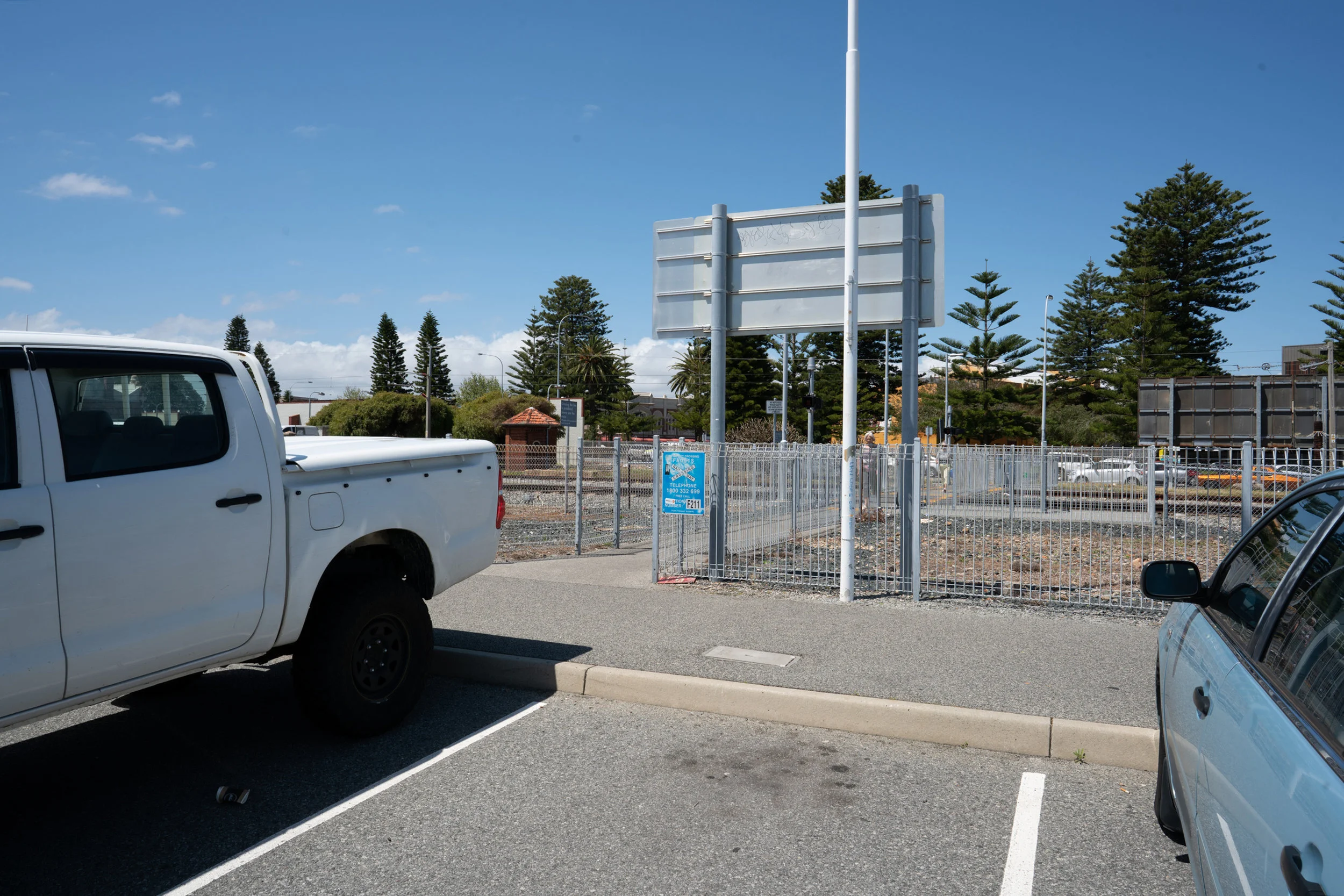
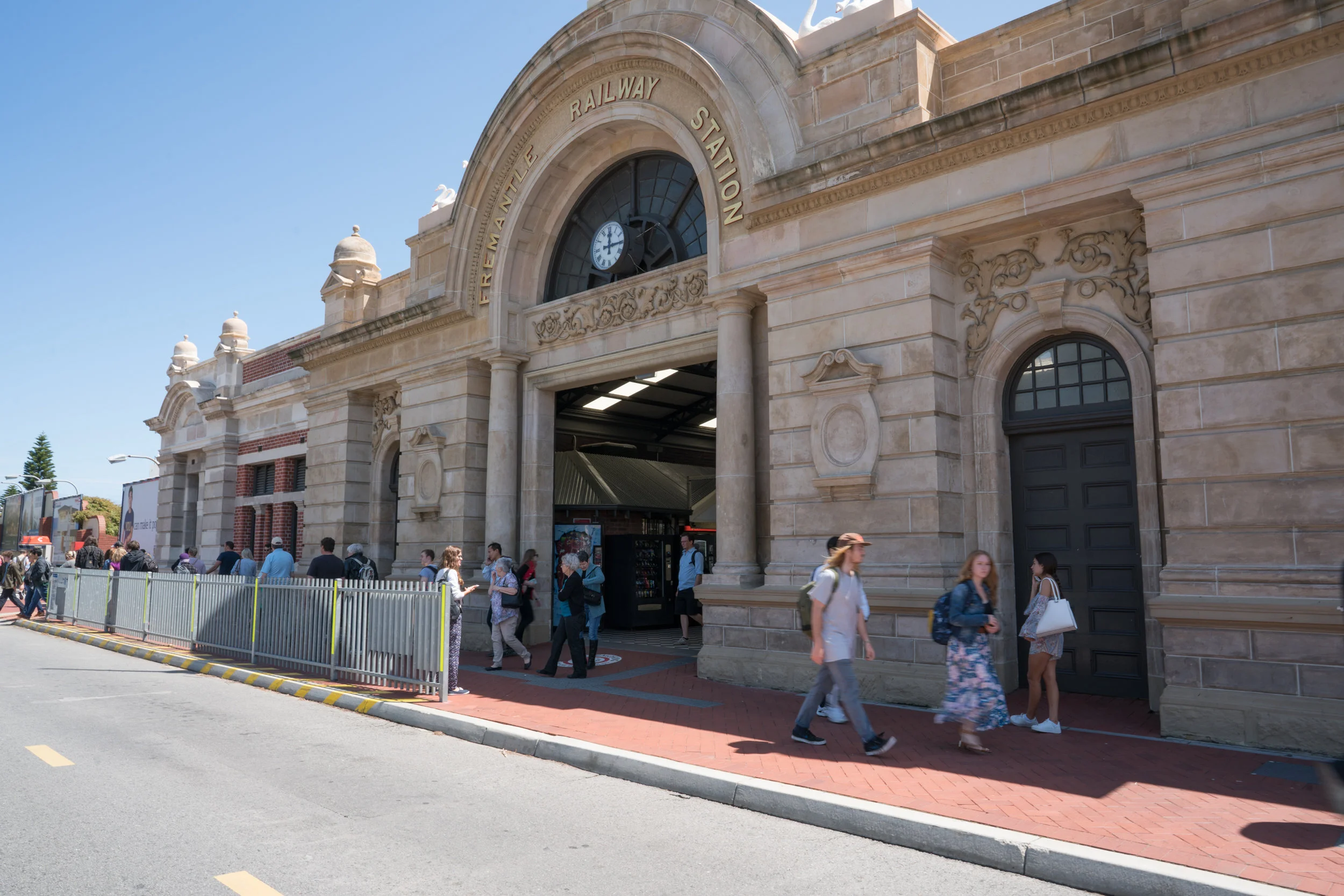
Turn left at the end of this path and the train station is ahead (about 160m). This is the turn around point (Plate 6).
Plate 6: Front of the Fremantle train station
Garry Middle, February 2026.