Overview - updated January 2026
This page has a full description of this section of the trail, including supporting photographs. You can read this page and/or
Starting point – arriving by car
The starting point is the North Beach jetty. There is a small carpark just north of Malcolm Street, and take the track from the car park to the jetty – 100m walk.
Getting there using public transport
The best way to get using public transport is to catch the 423 bus from either Stirling or Warwick train stations. Get off at the bus stop on West Coast Highway between Malcolm and James Sreet. Head north along the path along West Coast Highway for 100m, and take the track off to the left which will take you to North Beach jetty – 100m.
Turn around point
The turn around point is the amphitheatre at Scarborough Beach.
Getting back to the start from the turn around point – if you don’t want to do an out-and-back walk
The best way to get back to the start using public transport is to first catch bus 421, which terminates/starts from bus stop directly east of the amphitheatre past the clock and the roundabout and before West Vcoast Highway – 150m. The bus first heads north from Scarborough Beach along West Coast Highway, turns right onto Pearl Parade and then onto Sackville Terrace. Get off at the bus stop just passed Huntriss Road. Cross over the road and at the same bus stop catch the 423 bus back to the start - get off at the bus stop on West Coast Highway between Malcolm and James Sreet. Bus 421 ends up at Stirling Train station.
Summary of the walk
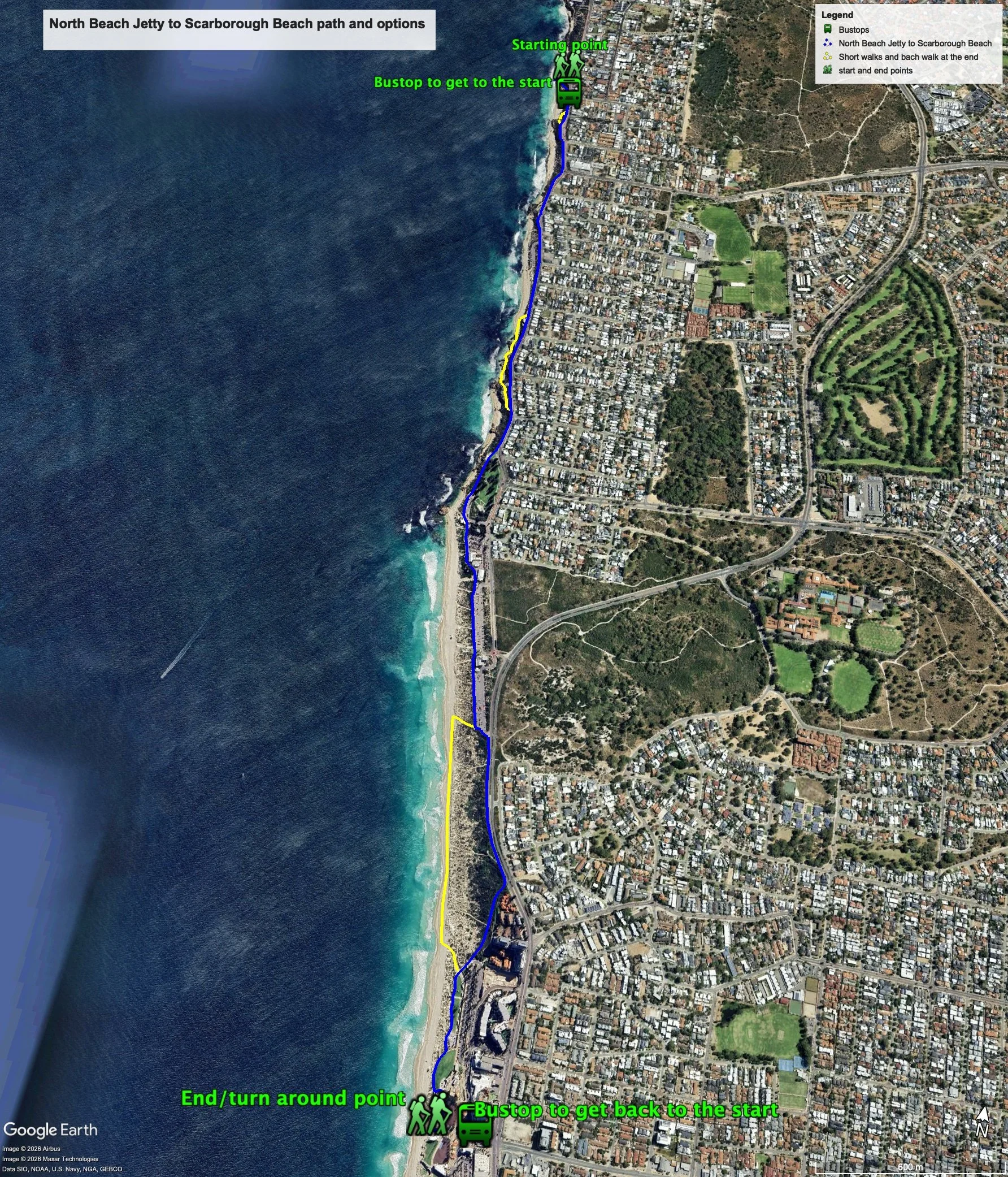
Figure 1 below shows the options for this walk. There are a number of ways to do this walk. The simplest way is to walk all the way along the dual use path that, for the most part, runs parallel to West Coast Drive. The total one-way distance of this walk is 4.5 km, making it a 9.0 km out and back walk.
The more interesting way to do the walk is to take two short side tracks between the main path and the ocean. As well, there is also a section of the dual use path which runs parallel to a very busy section of West Coast Terrace/Highway. It is recommended that the beach walk is a more enjoyable way to walk this section. The total one-way distance of this walk is 4.64 km, making it a 9.28 km out and back walk.
Of course, you can opt to do only one of the side tracks and/or not do the beach walk.
Water and toilets
Any toilet blocks are noted below in the text initalics. These are also sources of potable water. Any additional drinking water taps and showers are also noted initalics.
Figure 1
Walking guide
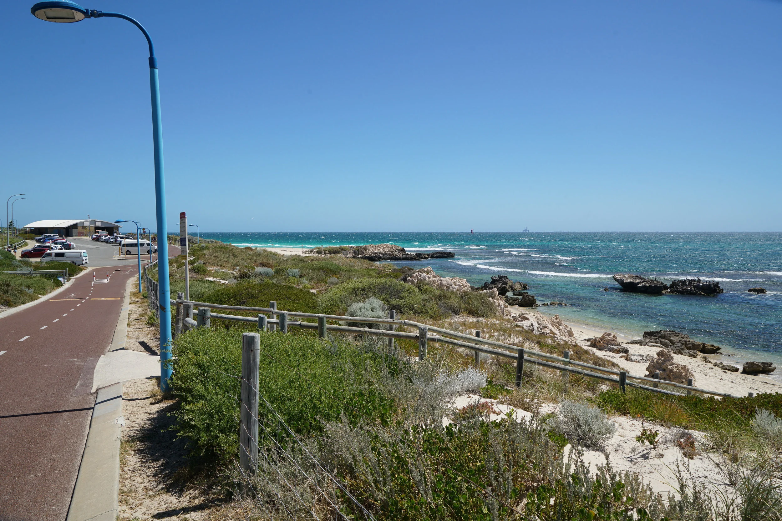
There is a shower just opposite the jetty on the path.From the jetty, head south along the path, which joins the main coastal path after about 90m. This path runs adjacent to West Coast Drive for about 2km (Plate 1).
Plate 1: Section of the path that runs parallel to West Coast Drive and the start of the first short side path.

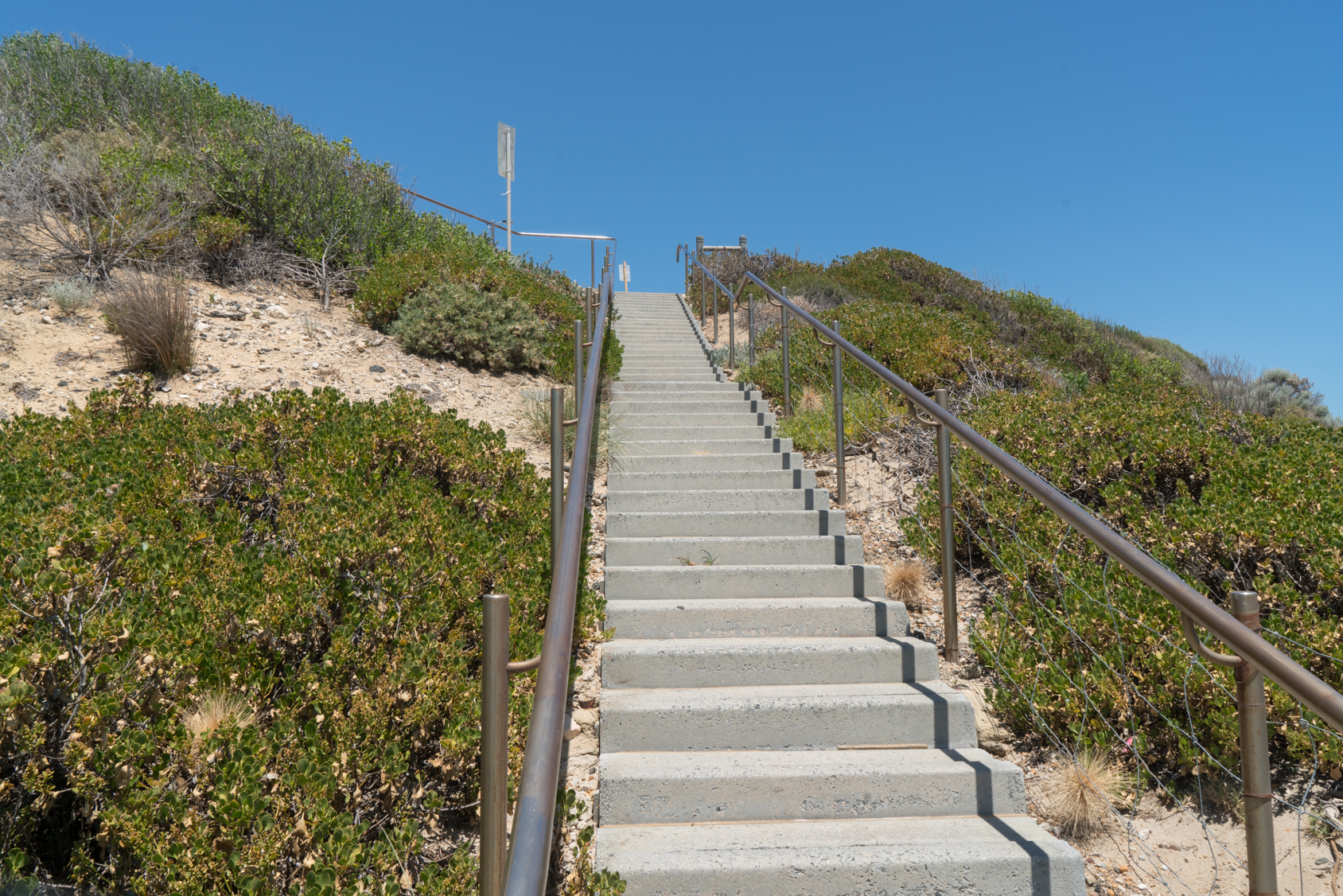
After about 100m there is a concrete path that off to the right which is the start if the first short side path (see Plate 1 above). This narrow path ends at a set of steps (Plate 2) which then re-joins the main path at the start of a carpark after about 60m.
Plate 2: Steps at the end of the first short side path.
There is a park area with toilet block after another 550m, (750m from the start)
After another 200m you will walk passed Mettams Pool Beach carpark, and after another 400m you will arrive at Mettams Pool proper with a lookout and a toilet block and shower.
From here you can either
· Keep walking along the dual use path;
· Head down to the beach – recommended!
If you head down to the beach, head south and after 100m there is a shelter and a path. The path winds back up the dual use path or continues to two rocky beaches – take this option. The track re-commences at the southern end of the second beach (Plate 3) and leads back to a car park. Walk through the car park and take the path back to the dual use path at the southern end of the carpark.

After another 250m along the dual use path is the northern end of the main grassed area at Trigg Beach, and the path leaves West Coast Highway and follows the western edge of the grassed area (Plate 4).
Plate 4: Main grassed area at the northern end of Trigg Beach.

The path goes through a larger carpark, passed a toilet block through the main carpark and facilities, including café/restaurant, and toilet block. The path runs along the western edge of the main carpark, through a grassed area with toilet block and passed another large carpark.
At the southern end of the carpark, the path continues, heads left and runs parallel to West Coast Highway for about 600m, where the path bends right away from West Coast Highway between some apartments and the foreshore. Given the level of traffic on West Coast Highway (Plate 5), this is not a pleasant walk and is not recommended. I you continue, the path will, after about 250, come to the northern end of the main Scarborough Beach area and head towards the beach away from West Coast Highway (Plate 6).
The recommended route is described after Plate 6.
Plate 5: Showing the path that runs parallel to West Coast Highway and the busy traffic.

Plate 6: Path leading off to the main Scarborough Beach

The recommended route from the southern end of the last carpark of Trigg beach – there is a drink fountain and shower here (Plate 7) - is to take the track to the beach, and head south along the beach for about 750m and take the track up to the start of the grassed area at Scarborough Beach.
Plate 7: The drink fountain at the southern end of the last carpark, with the track to the beach heading right.

From the northern end of the main Scarborough Beach area take the main path through the area until you arrive at the amphitheatre – about 500m. This is the turn around point. There are several toilet blocks here.
Garry Middle, January 2026.