
Overview - updated January 2026
This page has a full description of this section of the trail, including supporting photographs. You can read this page and/or
Starting point
The starting point is the amphitheatre at Scarborough Beach. There is plenty of parking here.
Getting there using public transport
The best way to get using public transport is to catch the high frequency bus 990 from Glendalough train station, which takes you to the main beach area at Scarborough.
Turn around point
The turn around point is the club rooms and kiosk at Floreat Beach.
Getting back to the start from the turn around point – if you don’t want to do an out-and-back walk
The best way to get back to the start using public transport is to catch either buses 83 (not on weekends) or 82 (every day).
Bus 83 has a terminus near the roundabout on the corner of Chipping Road and Catesby Street. Walk back along the path that runs parallel with West Coast Highway about 230m to the T junction where The Boulevard joins West Coast Highway. Cross the road and take the path on the northern side of The Boulevard for about 250m and turn left along the path next to short road, and then turn left along the path that runs next to Chipping Road which will take you to the roundabout on the corner of Chipping Road after about 200m. The bus will take you all the way back to the Roe Street Bus station. From there you can walk to the Perth Underground Train Station and take the Joondalup line and get off at the Glendalough train station. From here catch the high frequency bus 990 to the main beach area at Scarborough.
To get to the nearest bus stop for bus 82 walk back along the path that runs parallel with West Coast Highway about 230m to the T junction where The Boulevard joins West Coast Highway. Cross the road and take the path on the southern side of The Boulevard for about 750m and turn right along Templetonia Cresent. There is a bus stop after about 70 on the western side of the road (The bus will head north along Templetonia Cresent). The bus will take you all the way back to the Roe Street Bus station. From there you can walk to the Perth Underground Train Station and take the Joondalup line and get off at the Glendalough train station. From here catch the high frequency bus 990 to the main beach area at Scarborough.
Summary of the walk
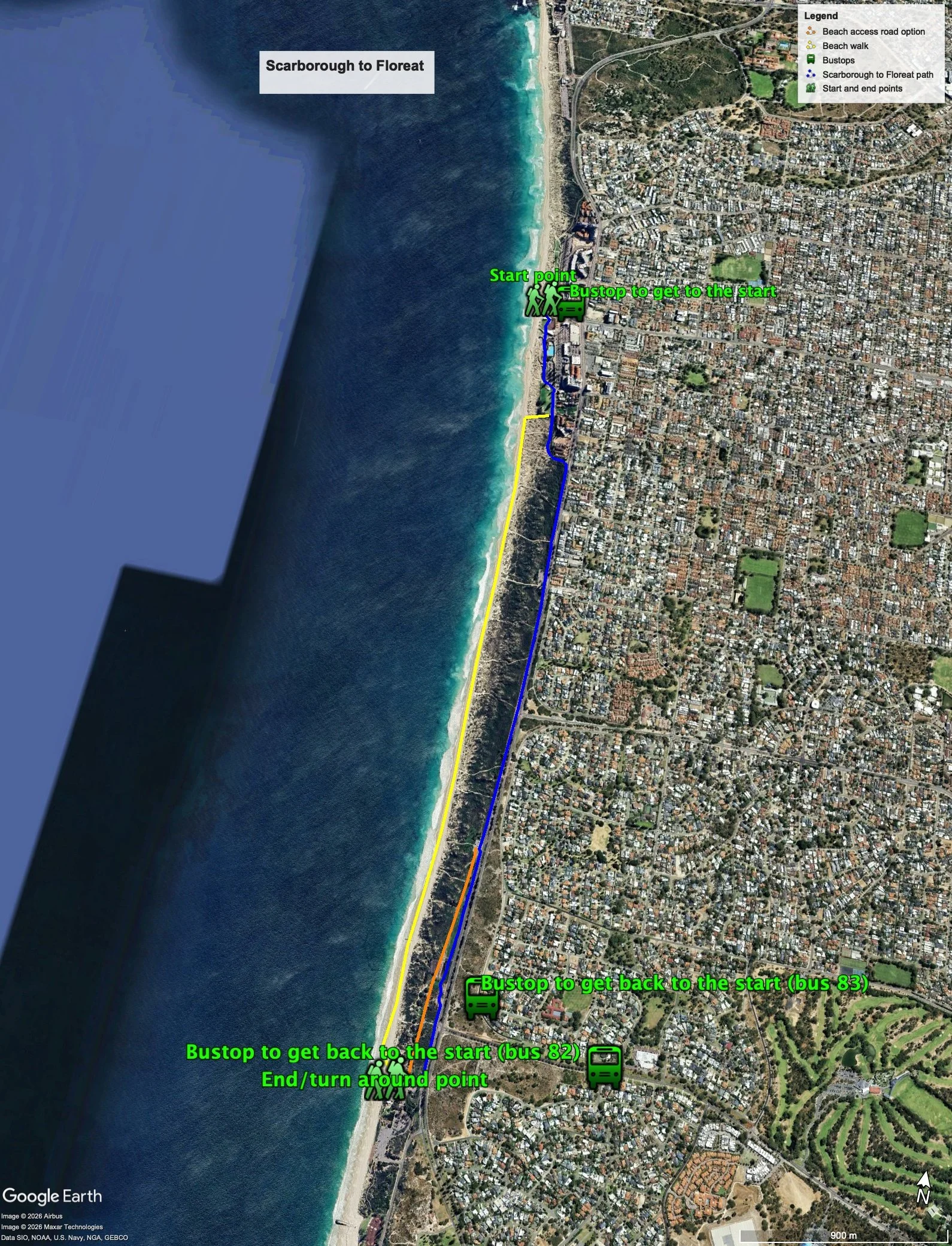
Figure 1 below shows the route. As can be seen, there are three options to do the walk:
mostly along the dual use path that runs parallel to West Coast Highway,
mostly along the beach; or
mostly along the dual use path and a beach access road that runs parallel to West Coast Highway.
The total one-way distance for the path walk and the beach access road option is 4.24 km, making it an 8.5 km out and back walk, and the beach walk is 4.17 km, making it an 8.3 km out and back walk.
Each walk option has its issues: the path walk can be unpleasant as the path runs parallel to a busy section of West Coast Highway, is flat and there are no views of the ocean; and, the beach walk can be difficult during times when the sand is soft, especially in winter and high tides.
Figure 1
Water and toilets
Any toilet blocks are noted below in the text initalics. These are also sources of potable water. Any additional drinking water taps and showers are also noted initalics.
If you take the beach walk, there are only taps and toilets at the start and finish of the walk. If you walk along the path, there are also two showers along the way.
Walking guide
Head south from the start and after going past a large carpark there is a large grassed area, and the path runs to the east of this. At the end of the grassed area you have the choice of either continuing along the red bitumen path or head to the beach and do the beach walk (Plates 1 and 2).
Plate 1: The red bitumen path at the end of the grassed area and the track to the beach

Plate 2: Sand track to the beach

As noted above, the walk along the beach can be difficult if the amount of firm sand is limited. Plate 3 was taken in January 2018 and, as can be seen, the width of possible firm sand is very narrow.
Plate 3: The beach heading south from the southern end of Scarborough beach
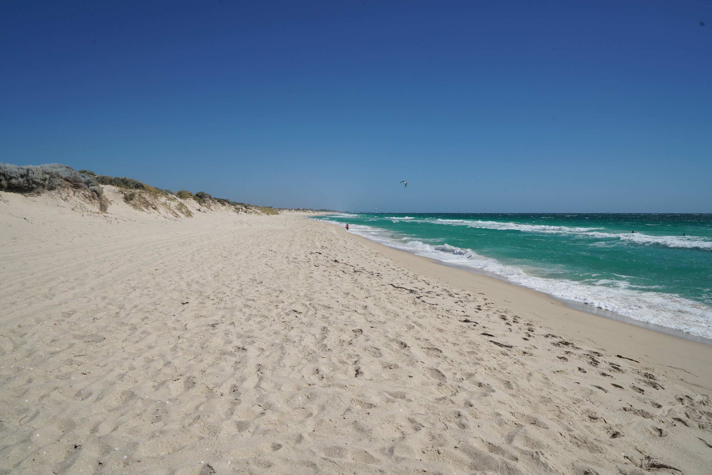
The beach walk is about 3.2 km, and the track up to the Floreat beach surf life club is obvious, which is the turnaround point. NOTE: if you choose the beach walk, and you find the going tough, there are numerous tracks up through the dunes that will take you to the path, where you can continue. In general, it’s about a 200m walk from the beach to the path.
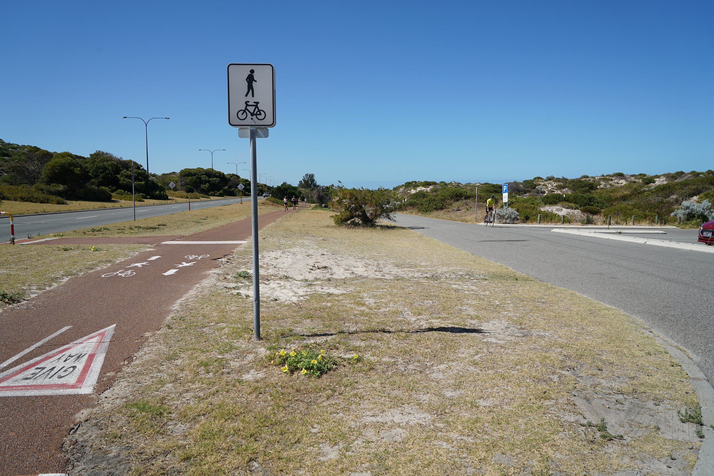
If you choose to take the path from the end of the grassed area, the path continues south through the dunes for about 170m and then bends left (east) for about another 170m where it meets West Coast Highway. The path then heads south running parallel and mostly next to West Coast Highway (Plate 4).
Plate 4: The section of the path running parallel and next to West Coast Highway

After about 650m there is a small carpark and shower.
After another 1.3km there is another small carpark and shower.There is a separate road that runs south of this carpark, to the west of West Coast Highway, which provides car access to several other smaller carparks.
You could either continue along the dual use path or walk along the access road – it gradually moves away from being close to West Coast Highway, so this maybe a more pleasant walk. Plate 5 shows the start of the access road.
Plate 5: The section of the path running parallel and next to West Coast Highway
After another about 1.0km the path turns right and leads to the Floreat surf lifesaving club, as does the beach access road. This is the turn around point – there are toilets, showers drinking taps and kiosk here (Plate 6).
Plate 5: The turnaround point at Floreat surf lifesaving club and kiosk

Garry Middle, January 2026.