Overview - updated January 2026
NOTE: there is a gap in these walks - from Hall Park to the Strat of this walk - Victor Adam Park. Most of this walk is on a patchy next to a busy road, with access to the water front limited because of the canal estates.
This page has a full description of this section of the trail, including supporting photographs. You can read this page and/or
Starting point
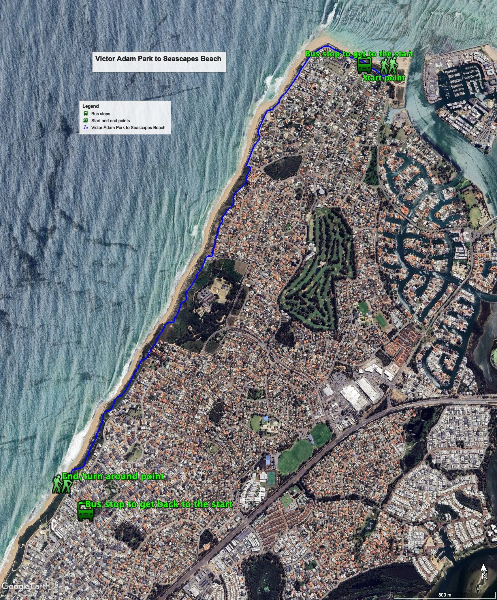
The starting point is the carpark next to the Mandurah Yacht Club within Victor Adam Park.
Getting there using public transport
The best way to get using public transport is to catch bus 591 from Mandurah train station, and get off the bus at the first bus stop on Janis Street after the bus turns off Halls Head Parade. Walk back up to Halls Head Parade turn right and the carpark is about 200m along.
Turn around point
The turn around point is the end of the scenic path at Seascapes Beach, opposite the end of Sugarwood Terrace.
Getting back to the start from the turn around point – if you don’t want to do an out-and-back walk
The best way to get back to the start using public transport is to catch bus 591 from the Manduarh train station. Walk down Sugarwood Terrace and turn right onto Peelwood Parade. The bus stop is about 20m along. Get off the bus on the first bus stop passed the Casuarina Drive intersection with Peelwood Parade. Catch the 591 bus from the same bus stop. Get off the bus at the bus stop on Janis Street just before the bus turns off Halls Head Parade. Walk back up to Halls Head Parade turn right and the carpark is about 200m along. Both buses end at the Mandurah train station.
Summary of the walk
Figure 1 below shows the route. The total one-way distance is 5.5 km, making it a 11 km out and back walk. This is a long out and back walk, but is one of the most interesting of all the Perth-Peel coastal walks. Buses 591 and 592 run parallel to the coast on road a couple of streets back from the coast - 300-500m from the coast - and there are plenty of bus stops you can use if you want a shorter walk back.
Water and toilets
Any toilet blocks are noted below in the text in italics. These are also sources of potable water. Any additional drinking water taps and showers are also noted in italics.
Figure 1
Walking guide
From the carpark (Plate 1), head west along the path that runs parallel to Halls Head Parade, which runs around the first carpark you come to.
Plate 1: Carpark and Mandurah Yacht club
There’s a toilet block at this carpark. The path re-joins Halls Head Parade just before it bends left. After 700m you’ll come to another car park at Blue Bay with a toilet, showers etc. slightly hidden to the south of the carpark (Plate 2).
Plate 2: ‘Hidden’ toilet at Blue Bay
After about 600m there is another carpark where Halls Head Parade ends, bends left and becomes Clipper Way (or Janis Street). Just down Clipper Way at the end of the carpark, a coastal path begins, running in front of row of houses (Plate 3).
Plate 3: Start of coastal path running in front of row of houses at the end of Halls Head Parade
After about 900m the path comes out onto a carpark at the end of Calypso Road, which has a toilet etc. There is a lookout with good views at the northern end if the carpark (Plate 4).
Plate 4: View from the lookout at the carpark at the end of Calypso Road
The path south from here is one of the best section of coastal walking in the Perth-Peel region, as the path is set within a wide foreshore reserve well away from houses, and is both winding and undulating offering many spectacular views (Plate 5).
Plate 5: An example of the winding and undulating path of this section, and the views
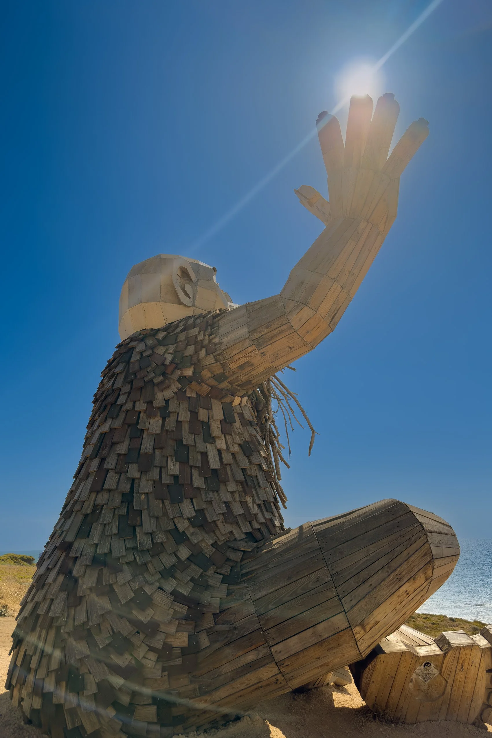
You will pass the Water Corporation’s Halls Head wastewater treatment plant (Plate 6). You will also pass one of the Giants of Mandurah (Plate 7)
Plate 6: Water Corporation’s Halls Head wastewater treatment plant
Plate 7: One of the Mandurah Giants
Some of the undulations are quite steep, but the views from the top are worth the effort (Plate 8).
Plate 8: An example of the steep undulations on this section of the path – looking north
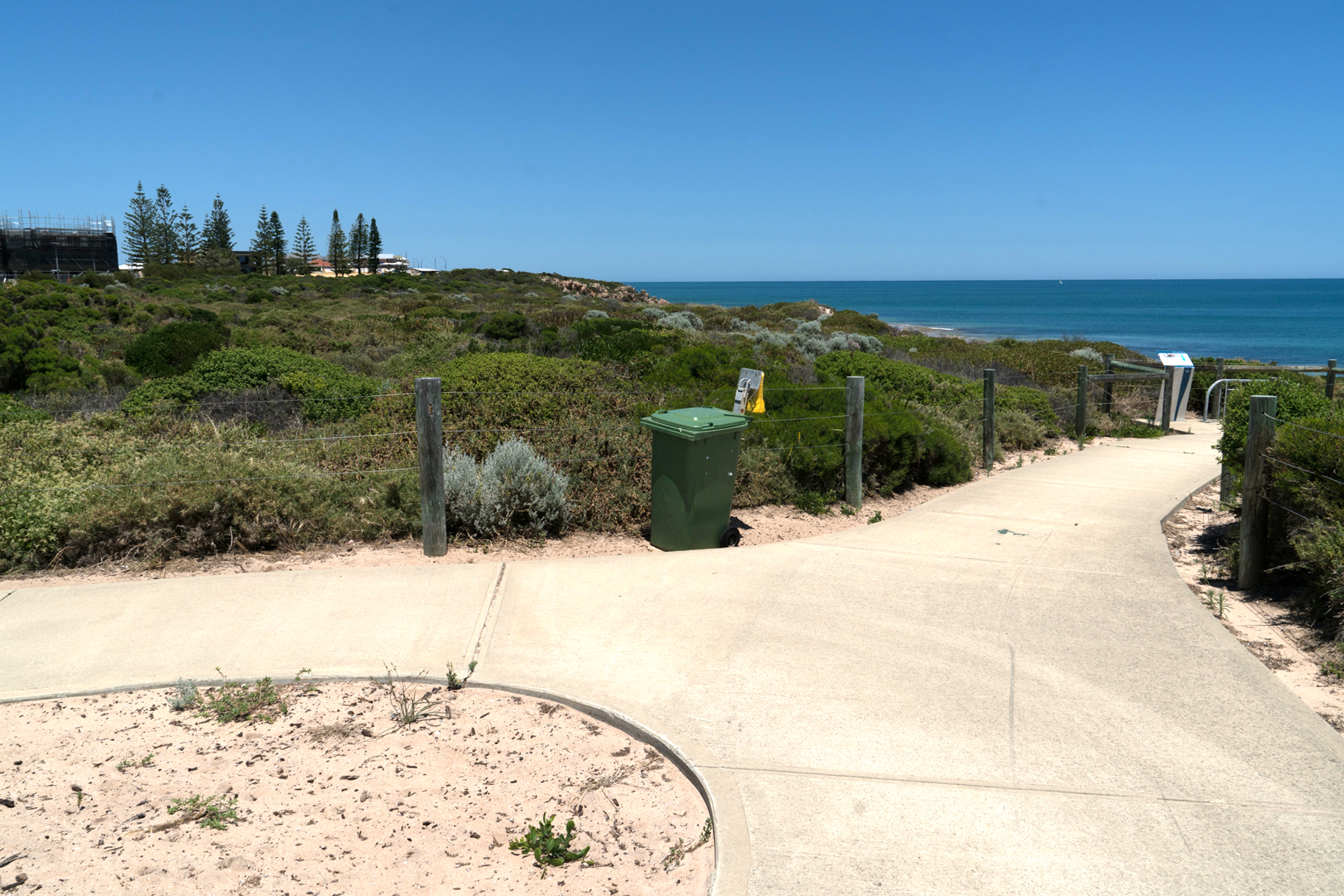
After 900m you will arrive at small carpark, and the path continues on the other side of the carpark (Plate 9). This is the start of the Seascapes Interpretive Walkway, which is about 1.5km in length.
Plate 9: The start of the Seascapes Interpretive Walkway from the small carpark
There are a number of interpretive signs along the way, which adds to the interest of the walk (Plate 10).
Plate 10: One of the interpretive signs on the the Seascapes Interpretive Walkway
The coast in the section is a mix of sandy beaches and beaches with limestone cliffs and features (Plate 11).
Plate 11: A section of the coast with a limestone feature
The end of the walk – the turn around point - is at the end of the Seascapes Interpretive Walkway (Plate 12), just opposite Sugarwood Terrace, where the path returns to being adjacent to the coastal road, in this case Boardwalk Boulevard.
Plate 12: End of Seascapes Interpretive Walkway – the turn around point
Garry Middle, January 2026


