
Overview - updated January 2026
This page has a full description of this section of the trail, including supporting photographs. You can read this page and/or
Download a PDF summary of this (click on this link); and
Starting point
The starting point is the Dome Café within the Port Coogee marina area.
Getting there using public transport
The best way to get to the start using public transport is catch the 548 or 512 bus from The Fremantle Train station, both of which stops opposite the Woolworths shopping centre. From there head north along Orsino Boulavard, turn left (west) along Pantheon Ave and right (north) along Chieftain Esplanade and you will see the Dome Café ahead. Total walk is 400m.
Turn around point
The turn around point is the main grassed area within the John Graham Reserve.
Getting back to the start from the turn around point – if you don’t want to do an out-and-back walk
The best way to get back to the start using public transport is catch bus 548. There is a bus stop on Cockburn road in-between Nyyerbup Cir and Fairbairn Road almost exactly where the path that goes from the toilet block through the grassed area and north of the car park come out on to Cockburn Road. Its about a 600m walk. Get off at the stop just south of the Woolworths shopping centre on Orsino Boulavard.
Summary of the walk
Figure 1 below shows the route. The total one way distance is 3.9km, making it a 7.3km out and back walk (if you don’t repeat the walk along other jetty - see below). NOTE: the southern ‘arm’ of the marina is undergoing development and so it will be possible to walk further along here and eventually to the end of the rock wall.
Water and toilets
Any toilet blocks are noted below in the text in italics. These are also sources of potable water. Any additional drinking water taps and showers are also noted in italics.
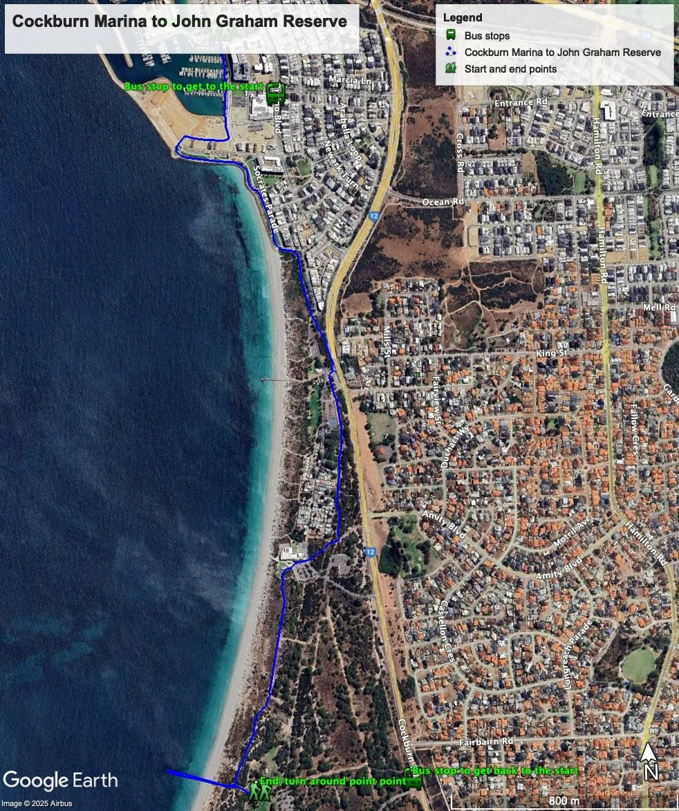
Figure 1: Map showing the Coogee Marina to John Graham Reserve walk
Walking guide
From the Dome Café, walk along the waterfront board walk or path adjacent to Chieftain Esplanade. Walk passed the earth works for new developments occurring west of Chieftain Esplanade and turn right (west into Liberty Vis, and after about 150m the riad bends left and will take you to a grassed foreshore area supported by a rock wall. Take the limestone path at the edge of the foreshore passed a toilet block and heading east.
NOTE: as works continues access to the remained of the marina housing area will become available to walk through.
The path bends south and the foreshore area extends to the south adjacent to Socrates Parade, so keep on this path until it ends and joins the main concrete path.
As you south along the sea wall you will noticed an old wreck just offshore (Plate 1). This is the Omeo Wreck, which sank here in 11/9/1905 (http://www.wrecksite.eu/wreck.aspx?53928 ).

Plate 1: Omeo wreck just off the southern sea wall of the Cockburn Marina
This path continues south to the end of the grassed area and then curves around the section of the foreshore reserve with extensive native vegetation passed a piece of art commemorating trotting or horse pacing (Plate 2).

Plate 2: Art commemorating trotting (horse pacing) in WA
The path ends at the northern end of carpark at Coogee Beach after crossing Perlinte View. There is a short path that goes around the carpark (Plate 3) which goes between the carpark and Cockburn Road, but the walk through the carpark is probably better as it is away from Cockburn Road.

Plate 3: End of Path at the northern end of Coogee Beach carpark showing the short path that goes around the carpark
The carpark goes passed Coogee Beach Café (Plate 4).

Plate 4: Coogee Café.
The coastal path starts again as a black bitumen path just passed café, after crossing Powell Parade, which is the main entrance into Coogee Beach (Plate 5).

Plate 5 Commencement of coastal path passed Coogee café.
There are public toilets and drinking taps in the park area south of the café.
The path continues passed the Coogee Beach Holiday Park (Plate 6), although “Holiday Park” may overstate what it is as many of the chalets look permanently occupied.

Plate 6: Path passed Coogee Beach Holiday Park.
There is an old railway track which runs parallel to the path, which is visible is a few places (Plate 7), which used to service the old munitions storage/dump site further south before Woodman Point and the old quarantine site.

Plate 7: Old railway track parallel to the path.
The black path ends just passed the Holiday Park and joins a red bitumen path, which joins Cockburn Road to the east (Plate 8).
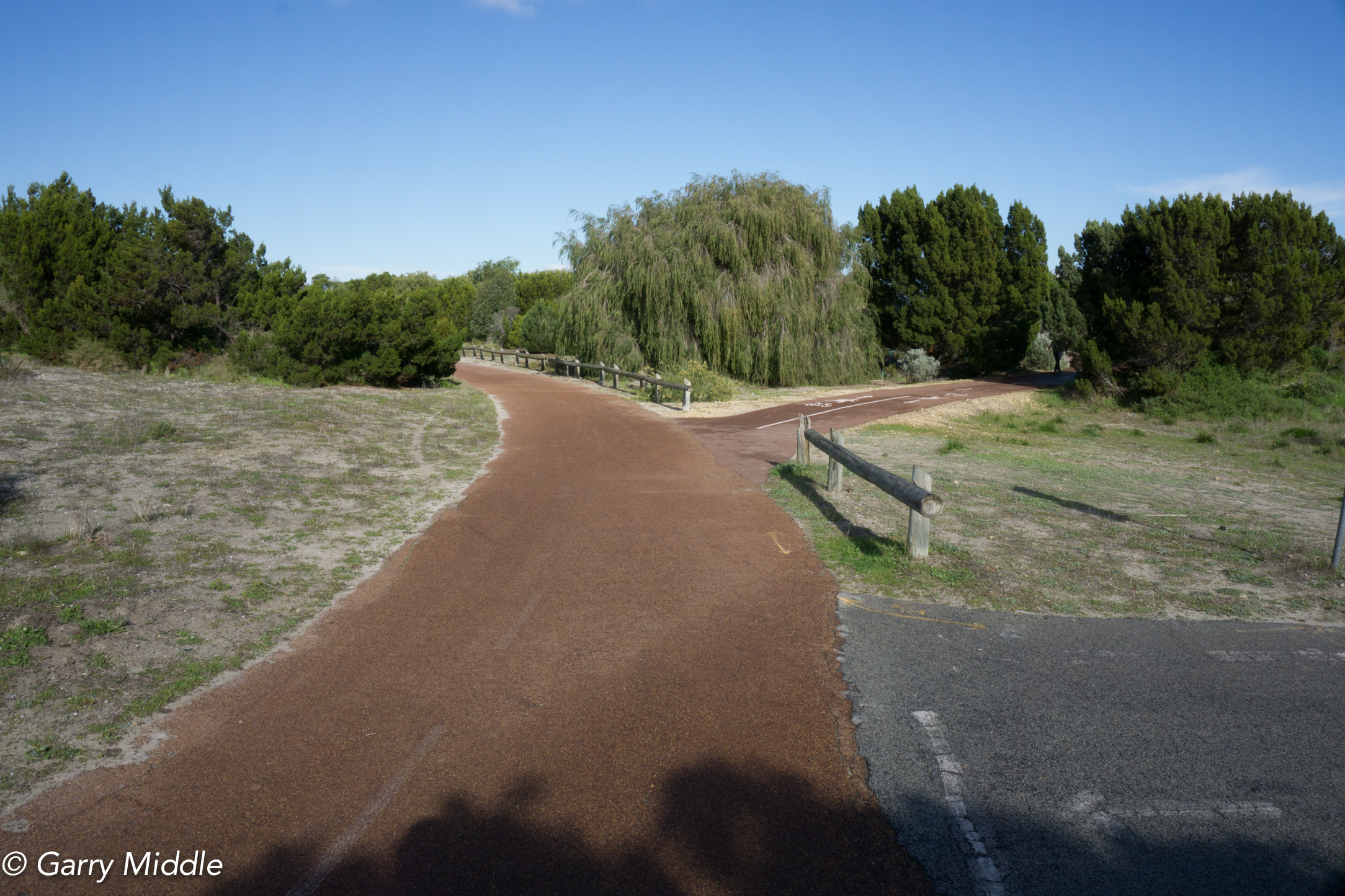
Plate 8: End of black bitumen path. Turn right and right again
Turn right and then right again at the next path intersection, which takes us to the Coogee Beach Surf Lifesaving complex, including café (Plate 9).

Plate 9: Coogee Beach Surf Lifesaving complex
There’s a playground just to the south of this complex, and walk through this to rejoin the coastal path, which continues all the way to John Graham Reserve. Although it is set back from the beach, there are good ocean views for most of the way (Plate 10).

Plate 10: The path south of the Coogee Beach Surf Lifesaving complex
As you approach John Graham Reserve, there is a path with goes off to the right – take this path (Plate 11).

Plate 11: Narrow path between John Graham Reserve and the coast
The path goes over some higher dunes and there are a couple of places with seats and good views over the ocean (Plate 12).

Plate 12: One of the seats near John Graham Reserve with ocean views
Near the end of this track, just before the jetty is a memorial for the former settlement of Clarence, which took in most of the Woodman Point area (Plate 13). It was gazette as a townsite in 1836 and was named after an earlier settlement by Thomas Peel called Clarence set up in 1829, but abandoned in 1830. Recent evidence suggests the 1929 site was at Mt Brown. (http://inherit.stateheritage.wa.gov.au/Public/Inventory/PrintSingleRecord/66ac6f42-adcb-4ec5-9338-c6548844f8fb ). The 1836 townsite included the original quarantine station at Woodman Point, which was still operating at late as 1954.
There is a website you can go to to find out more - http://www.woodmanpointquarantinestation.com/index.html
The site is now a recreation camp run by the Department of Sport and Recreation.

Plate 13: Memorial plaque for the former Clarence settlements
The path ends not far passed this memorial (Plate 14). Turn right, and walk to the end of the jetty (Plate 15). Turning left leads to main part of John Graham Reserve – see below.

Plate 14: End of the path near John Graham Reserve
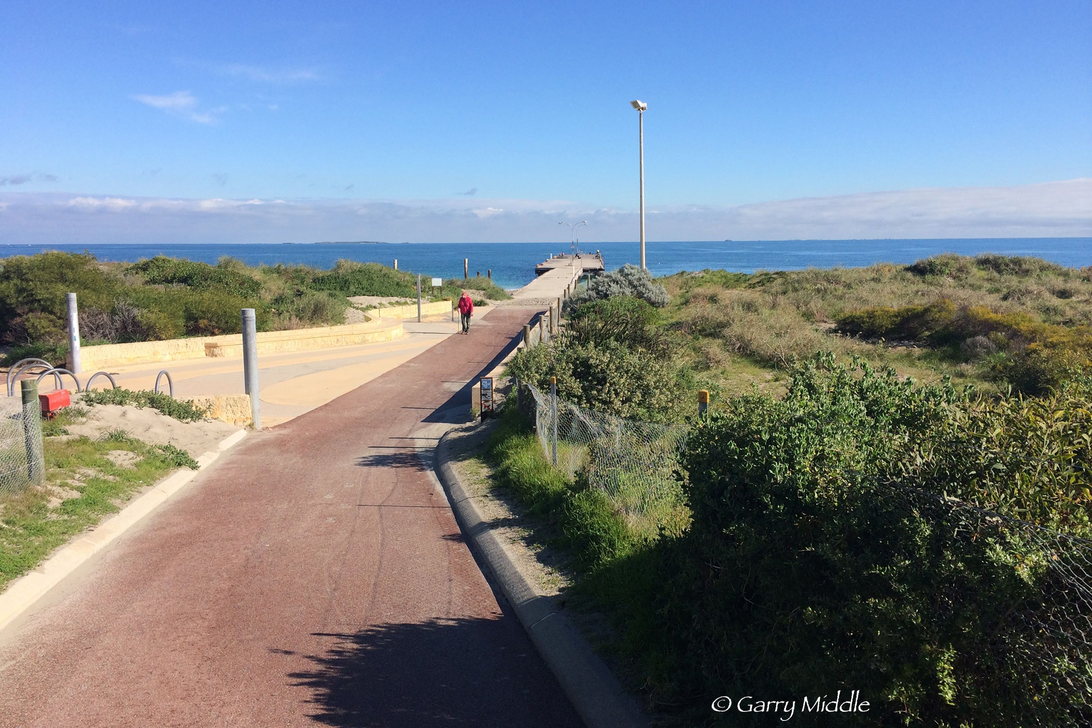
Plate 15: Path leading to the jetty near John Graham Reserve.
The jetty is very popular for fishing (Plate 16).

Plate 16: Fishing at the jetty near John Graham Reserve
NOTE: during 2026 the jetty will be upgraded so access may not be possible.
It is a short walk back along the same track to the main part of John Graham Reserve where there is a toilet block and drinking taps
Garry Middle, January 2026