
Overview - updated January 2026
This page has a full description of this section of the trail, including supporting photographs. You can read this page and/or
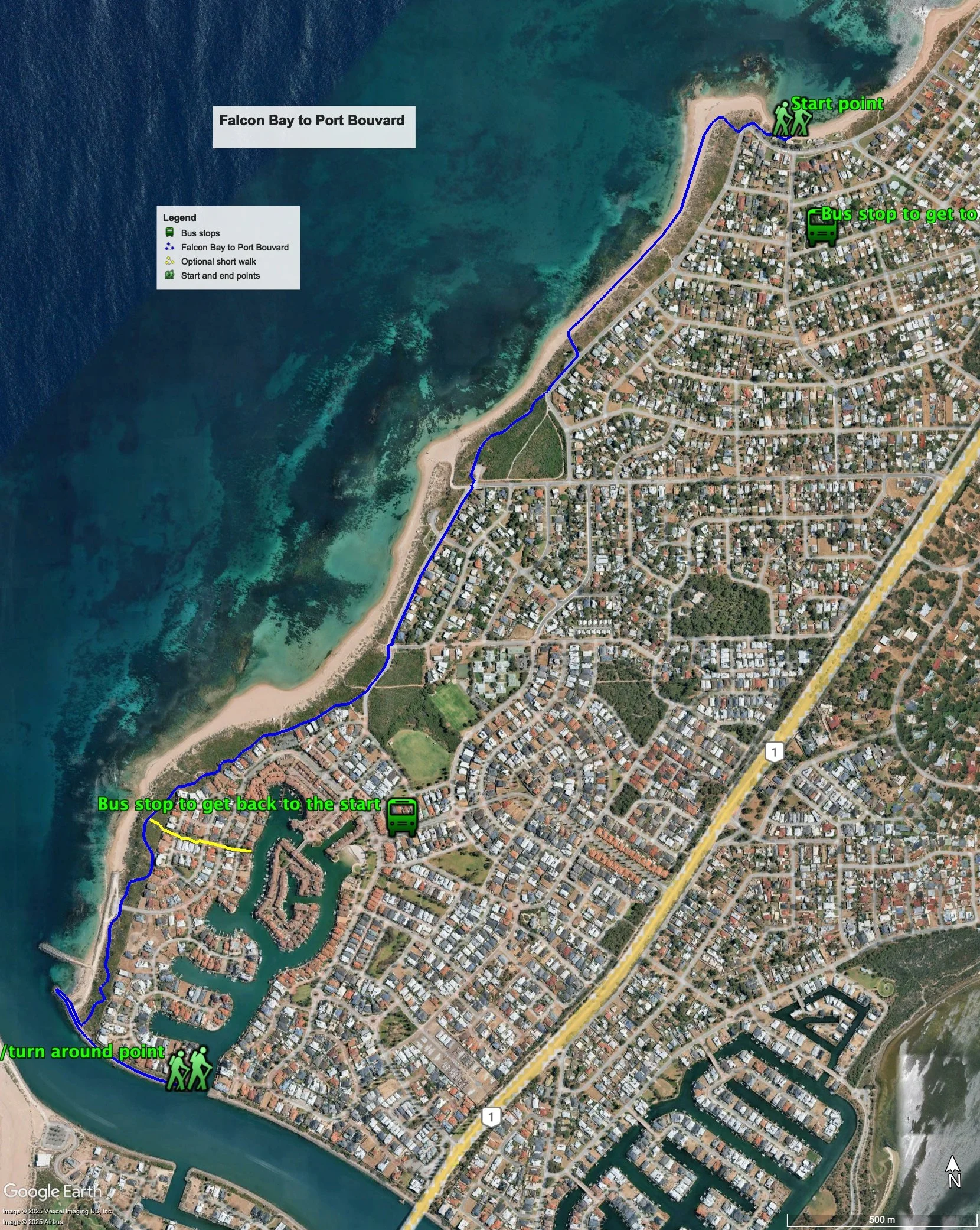
Starting point
The starting point is Falcon Bay Beach.
Getting there using public transport
The best way to get using public transport is to catch Bus 592 from Mandurah train station. Once the bus turn into Corfu Street after it crosses Mercedes Ave, get off at the next bus stop. Continue along Corfu Street 50m and turn right into Thera Street. Walk 250m to the beach.
Turn around point
The turn around point is end of the path along the Dawesville Channel seawall – see Figure 1.
Getting back to the start from the turn around point – if you don’t want to do an out-and-back walk
There isn’t a bus stop near the end of the walk and the nearest one is about a 2km walk. If that is too far for you, can catch a taxi/Uber from the carpark at the bend in Westview Parade. To catch the bus walk back the way you came until you get at the second carpark – it’s on the bend of Westview Parade. Head left along Westview Parade and take the fourth turn left (the second round about) into North Port Boulevard. The bus stop is about 50 along. Catch the 592 bus. Get off at the bus stop on Corfu Street before it crosses Mercedes Ave. Walk back along Corfu Street 50m and turn right into Thera Street. Walk 250m to the beach
Summary of the walk
The Figure over the page shows the route. The total one-way distance is 4.0 km, making it a 7.8 km out and back walk (without repeating the walk to north groyne).
Water and toilets
Any toilet blocks are noted below in the text in italics. These are also sources of potable water. Any additional drinking water taps and showers are also noted in italics.
Figure 1
Walking guide
There is a toilet block and showers at Falcon Bay Beach. From the Beach head to the north-western end of the carpark and follow the path along about 50m until you arrive at the steps to the lookout (Plate 1).
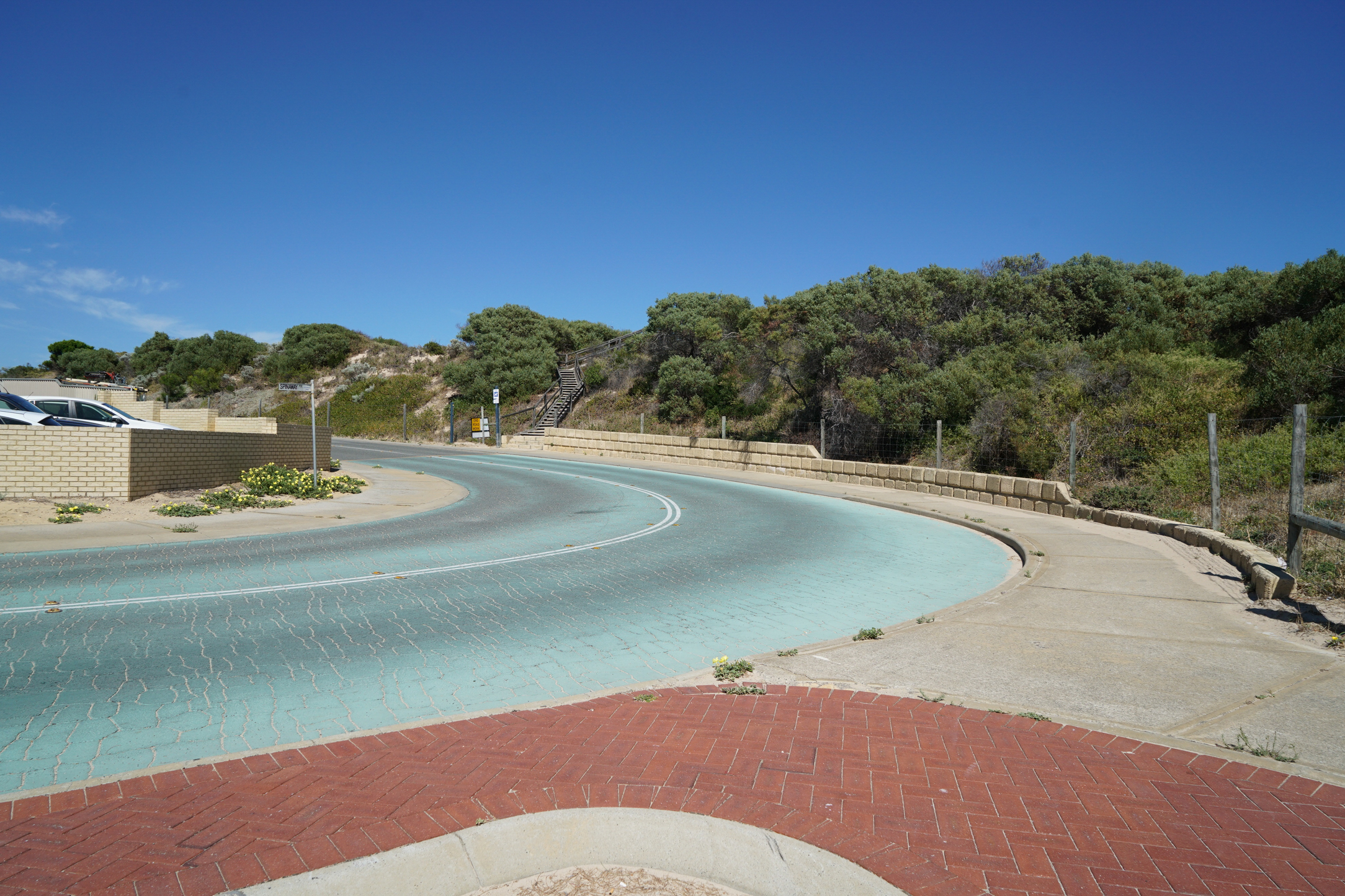
Plate 1: Steps up to the first lookout visible at the end of the path
Take the steps to the lookout as the views are worth the climb (Plate 2).

Plate 2: Views from the lookout
One option from here is to head back down the steps and walk along the path that runs along Panamuna Drive. This is not recommended, as there are no views to the ocean. Instead, it is recommended that you head down to the beach from the lookout, and then head south along the beach. After about 700m of beach walking, take the track up to the small park and carpark with the two tall Norfolk Island pines easily visible from the beach (Plate 3) – there is a shower and drinking water tap here.

Plate 3: The path up to the carpark – the Norfolk Island pines and easily visible
Walk south through the park and carpark and then along the path that runs next to Panamuna Drive for about 80m, and take the coastal path where Panamuna Drive bends to the left (Plate 4).

Plate 4: The start of the coastal path where Panamuna Drive bends to the left – before the arrows
After about 350m the path ends and come out at a bend in the road: head south along the path adjacent to Avalon Parade. After about 150m there is a carpark and small park with toilet block, showers and drinking water tap. Continue down Avalon Parade passed another carpark – which has a lookout (Plate 5) - for about 450m and take the coastal path to the right just where Avalon Parade begins to bend left. This is the start of the Port Bouvard Estate (Plate 6).

Plate 5: The lookout

Plate 6: The start of the coastal path of the Port Bouvard Estate foreshore
This path runs all the way to the Dawesville Channel, first in front of a row of houses, and this through the foreshore reserve. After about 300m there is a carpark with a toilet block and showers – this is the exit carpark to the return to the start bus stop (see above). After another 450m there is a path off to the left to a lookout – Plate 7.

Plate 7: Path to the lookout and to the canal waterfront
At this point, if you wanted to get a sense of the canal estate, walk up passed the lookout into the estate and along a liner path to the water's edge - 600m there and back. You will notice that the water front here is private access only, with no public access (Plate 9).

Plate 8: The Linear path through the estate to the canal waterfront

Plate 9: The water font of the canal estate – no public access
Continue on the coastal path through another carpark and to the end of the path at the Dawesville Channel – about 600m from the lookout - (Plate 10).
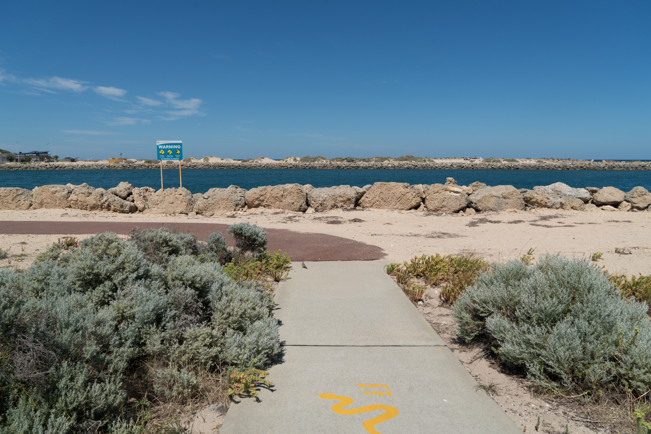
Plate 10: The end of the coastal path at Dawesville Channel
Turn right and head to the end of the rock groyne (Plate 11), then head back passed the coastal path and along the path that runs along the rock wall of the Channel. The path ends at the water entrance to the canal estate – this is the turn around point (Plate 12).

Plate 11: The view from the end of the rock groyne at the mouth of the Dawesville Channel

Plate 12: The view from the end of the path that runs along the rock wall of the Channel
If you do the return walk, there is no need to do the walk to the rock groyne (and the walk to the canal).
Garry Middle, January 2026