
Overview - updated January 2026
This page has a full description of this section of the trail, including supporting photographs. You can read this page and/or
Starting point
The starting point is the Port Bouvard Surf Lifesaving Club, at the end of Southport Boulevard.
Getting there using public transport
The best way to get using public transport is to catch bus 593 or 594 from Mandurah train station. Get off the bus on Old Coast Road at the first bus stop after crossing the Dawesville Channel. Walk south along Old Coast Road for about 50m, turn right into of Southport Boulevard and follow this to the end – another 1.2km. Another option is to take a taxi/Uber to get there.
Turn around point
The turn around point is Melros Beach carpark.
Getting back to the start from the turn around point – if you don’t want to do an out-and-back walk
The best way to get back to the start using public transport is to catch bus 593. Walk east along Melros Beach Road for about 400m and turn right into Sutherland Street, and then left into Oceanic Drive – the bus stop, which is the terminus stop for bus 593, is about 50m along. Get off the bus at the stop on Old Coast Road just passed Country Club Drive. Walk south along Old Coast Road for about 50m and turn right into Southport Boulevard and follow this to the end and the starting point – another 1.2km. Bus 593 terminates at Mandurah train station. Another option is to take a taxi/Uber to get there.
Summary of the walk
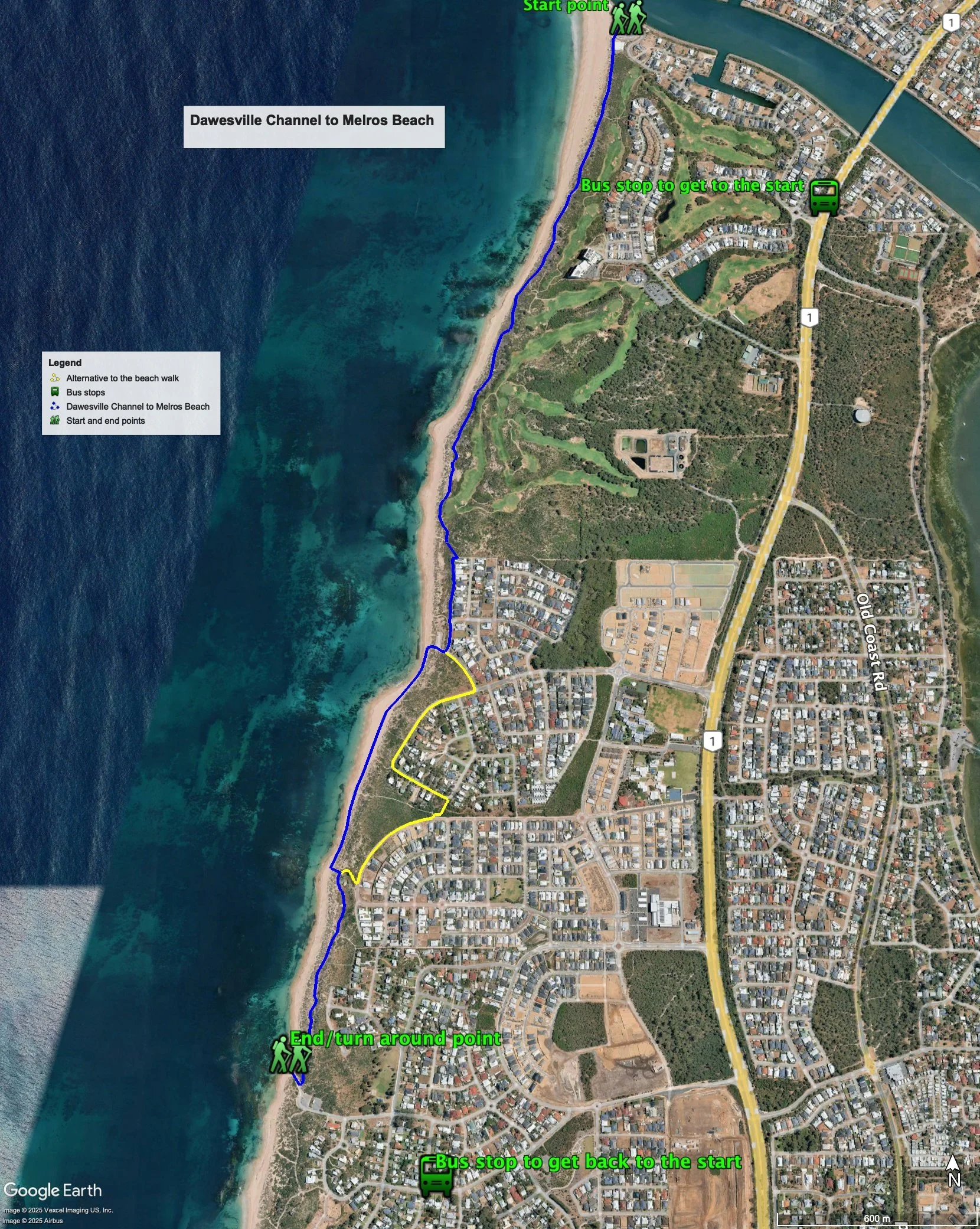
Figure 1 below shows the route. The total one-way distance is 4.0 km, making it an 8.0 km out and back walk. The recommended walk involves a beach walk. The alternative is to walk along some roads, which adds 400m (one way) to the walk. In this case, the total one-way distance is 4.4 km, making it an 8.8 km out and back walk.
Water and toilets
Any toilet blocks are noted below in the text in italics. These are also sources of potable water. Any additional drinking water taps and showers are also noted in italics.
Figure 1
Walking guide
There is a toilet and showers at the surf lifesaving club. From the surf lifesaving club, head south along the coastal path (Plate 1).

Plate 1: The start of the coastal path
The path is winding and undulating with frequent views of the ocean, and runs next to a golf course (the Cut) – Plate 2.

Plate 2: The Cut golf course adjacent to the coastal path
After about 1km there is a lookout on the left (Plate 3) which has good views of the coast (Plate 4), and can be accessed from the path that runs off the main coastal path – it’s about a 200m out and back walk to the look out.

Plate 3: The path to the lookout – just visible

Plate 4: Views from the lookout
Continue along the coastal path for another 1km, which ends at a path that links the Melros residential estate to the beach (Plate 5). Turn left and up the path and then turn right when you get to a large retaining wall and follow the path at the edge of the foreshore reserve in front of a row of houses (Plate 6).

Plate 5: End of the coastal path, and the path up to the Melros residential area

Plate 6: The path at the edge of the foreshore reserve in front of a row of houses
The path ends after after about 300m, at a carpark. There is a toilet block and showers about 70m from the carpark up from the carpark on Hunter Street.
There is a gap in the coastal path here so a beach walk from here is recommended, although the sand can be soft at certain times of the year and the beach near the car park can also have a steep erosion cliff in the sand. (Plate 7).
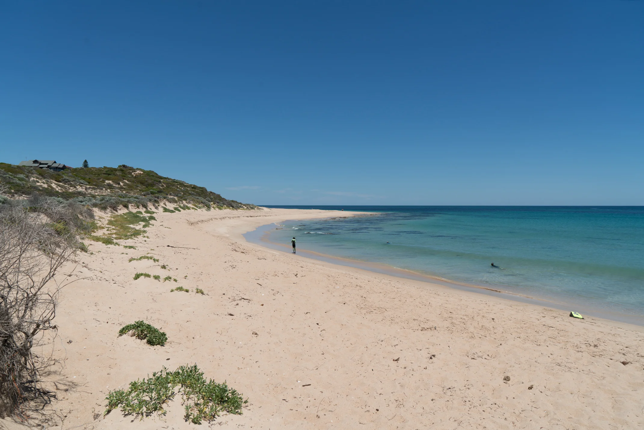
Plate 7: The start of the beach walk from the Hunter Street carpark
After about 750m of beach walking there is a small park with large metal umbrellas set back about 50m from the beach (Plate 8).

Plate 8: Start of the coastal path at a small park with large metal umbrellas
The alternative (shown in yellow) is to head up Hunter Street, turn right onto Florida Parade, which turns sharply left into Vista Street. Where Vista Street turns left, there is a path off to the right which will take you to Nullagine Pass (60m). Turn right along Nullagine Pass, which becomes Ballladonia Parade, and after about 350m take the path leading on the right leading to the same small park.
The coastal path re-starts from this park, and after about 700m, the path ends at a carpark with toilets and showers. This is the turn around point.

Plate 9: Start of coastal path which ends and Melsos Beach
Garry Middle, January 2026