
Overview - updated February 2026
This page has a full description of this section of the trail, including supporting photographs. You can read this page and/or
Starting point
The starting place is the beach front at the end of Railway Terrace on the grassed lookout. There is plenty of parking here, although on the weekends in summer, it will be busy unless you arrive first thing in the morning. Check the parking signs to make sure you aren’t parking in a time limited zone. There’s plenty of parking behind the shopfronts on Rockingham Beach Rd just north of Railway Tce.
Getting there using public transport
The best way to get using public transport is to catch the 555 bus, which starts at the Rockingham Train Station – this is a high frequency bus. It travels along the beach front - Rockingham Beach Road – and terminates 50m up Railway Terrace in the centre of the beach front area.
Turn around point
The turn around point is a small sandy beach just passed a large carpark at Cape Peron.
Getting back to the start from the turn around point – if you don’t want to do an out-and-back walk
There is no public transport that services the Cape Peron area, and the nearest bus stop is at the western end of ParkinStreet – bus 551. This is over half way back to the start – about 2.5km. The 551 returns to the Rockingham train Station but there is a bus stop on Parkin Street just past May Street. Walk about 100m northwards and turn left into Railway Terrace on to the starting point – about 200m.
Summary of the walk
Figure 1 below shows the route. The one-way distance is 4.6 km, making it an 9.2 km out and back walk.
Water and toilets
Any toilet blocks are noted below in the text in italics. These are also sources of potable water. Any additional drinking water taps and showers are also noted in italics.
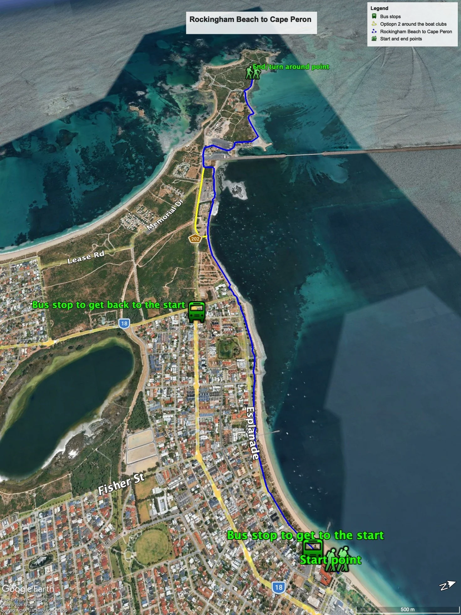
Figure 1: The walking trail
Walking guide
Just to the north of the starting point is a toilet block and drinks fountain. From the grassed lookout (Plate 1) head west towards Cape Peron passed the café strip on the foreshore.
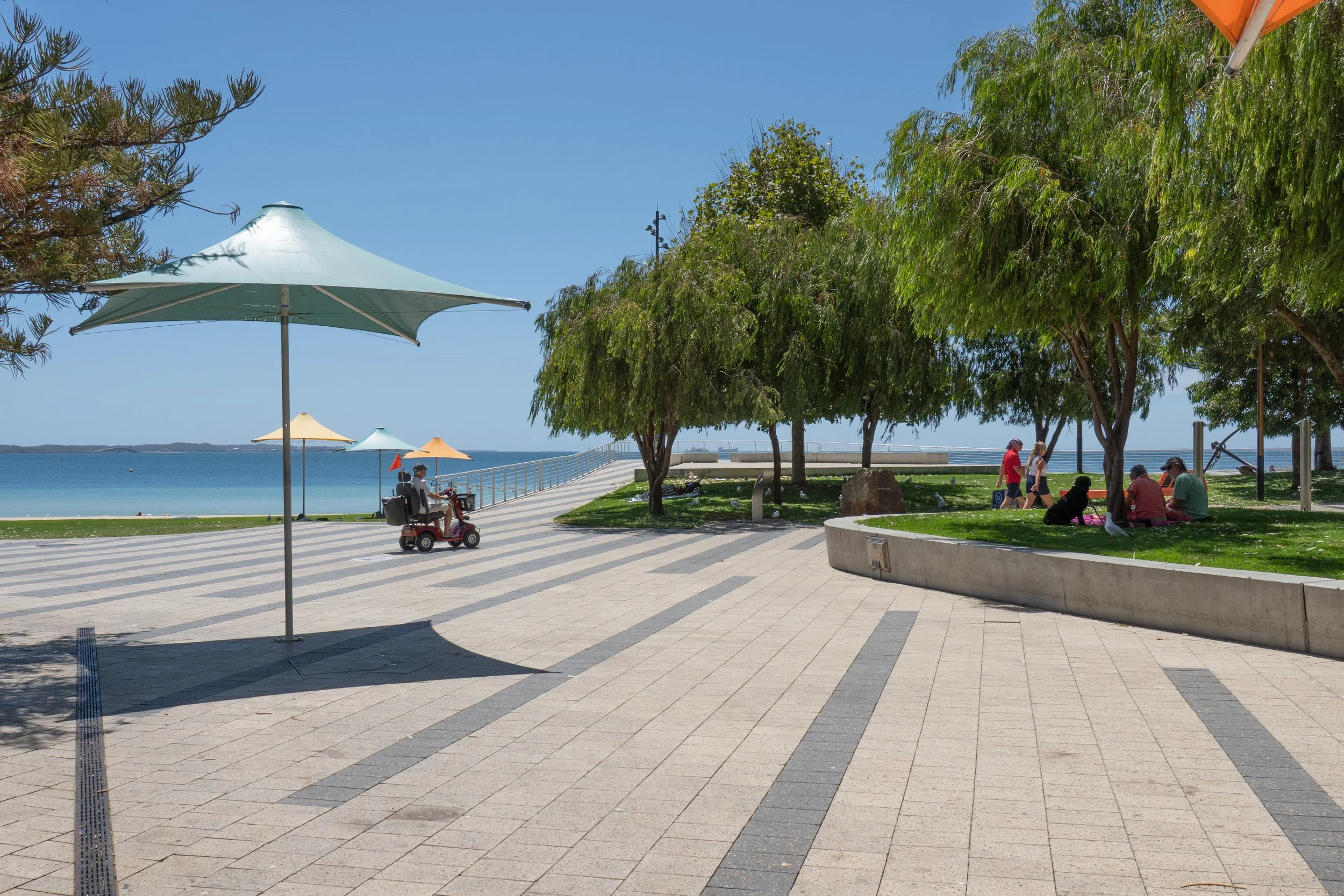
Plate 1: Start of the walk
Most of the Rockingham foreshore and the Palm Beach foreshore is very narrow with houses, roads and foreshore infrastructure close to the beach (see Plate 2).

Plate 2: Path along Palm Beach foreshore
These setbacks were determined over 50 years ago, before concerns about climate change and sea level rise. As well, the coast is very low energy, primarily because of Garden Island and the causeway (see later). Sediment movement along this beach is very small compared with beaches further south, not protected by Garden Island. Once passed the café strip, the path continues (concrete now) along the Palm Beach foreshore. The vegetation is low scrubland and grassland offering sweeping views of Cockburn Sound.
Before Palm Beach jetty, there is a curious memorial to a group of Irish convicts who were considered to be revolutionaries – Fenians - sent to WA in the early days of European settlement. The memorial commemorates an 1876 attempt to free this group who were being held in Rockingham (Plate 3).

Plate 3: Memorial to the Irish convicts held in the Rockingham area following European settlement
The path continues passed the Palm Beach jetty running parallel to the road, until the end of the residential area and the beginning of the Cape Peron recreation and conservation reserve. There is a toilet block just after Palm Beach Jetty and another near the boat launching ramps opposite Rotary Park. This is also where the path ends, where the road takes a sharp left hand turn (Plate 4).

Plate 4: End of the Residential area and start of Cape Peron Reserve area.
As can be seen in Plate 4, there is a narrow path that runs between the beach and the first of the holiday villages. Take this path. This is also where the beach erosion commences and continues all the way to the Causeway (Plate 5).

Plate 5: Start of the Beach erosion near the eastern boundary of the Cape Peron Reserve area.
The path soon ends so continue along the beach passed the holiday village until you reach the boat club, which is fenced off. There is a track heading away from the beach along the boundary fence of the boat club (Plate 6). There are two options to proceed from here with the first one having the risk that you may have to back track to this point.
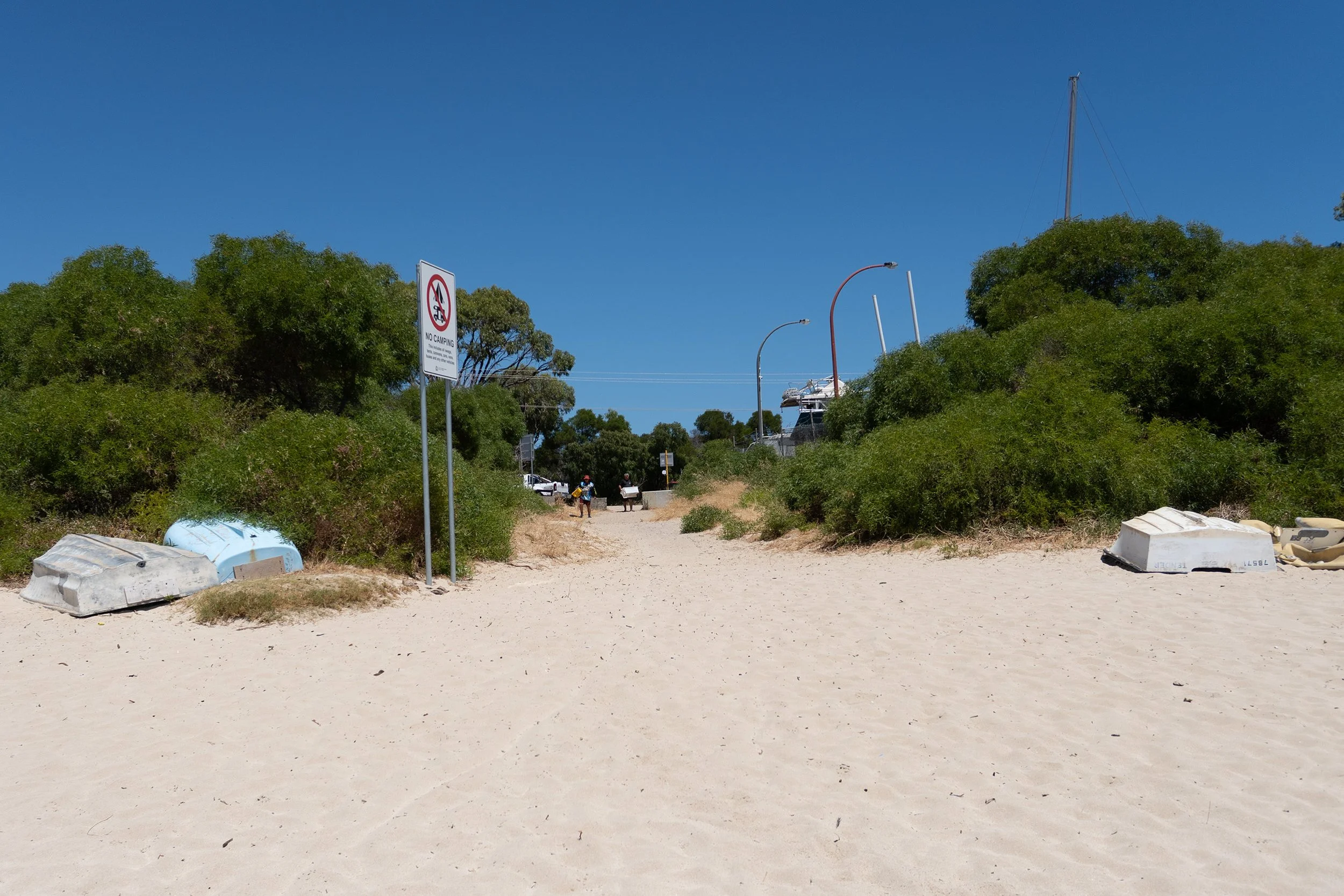
Plate 6: track heading away from the beach along the boundary fence of the boat club
The first option is to continue along the beach until you get to a boat launching ramp and a boundary fence around the next boat club. There is a gate that should be open that will give you access to the boat club, (Plate 7) but the only public access in the club is along the beach in front of the club house. HOWEVER, at high tide the beach is underwater and only visible up the coast (Plate 8).
You, therefore, will have to turn back and take the second option.
If the beach is accessible, walkalong the beach until you arrive at the Causeway connecting the mainland to Garden Island (Plate 9). Access to the island is only for defense purposes – the Stirling Naval Base is on Garden Island. This small beach is the launching place for jet skis. From here walk up to the main road (Point Peron Road).
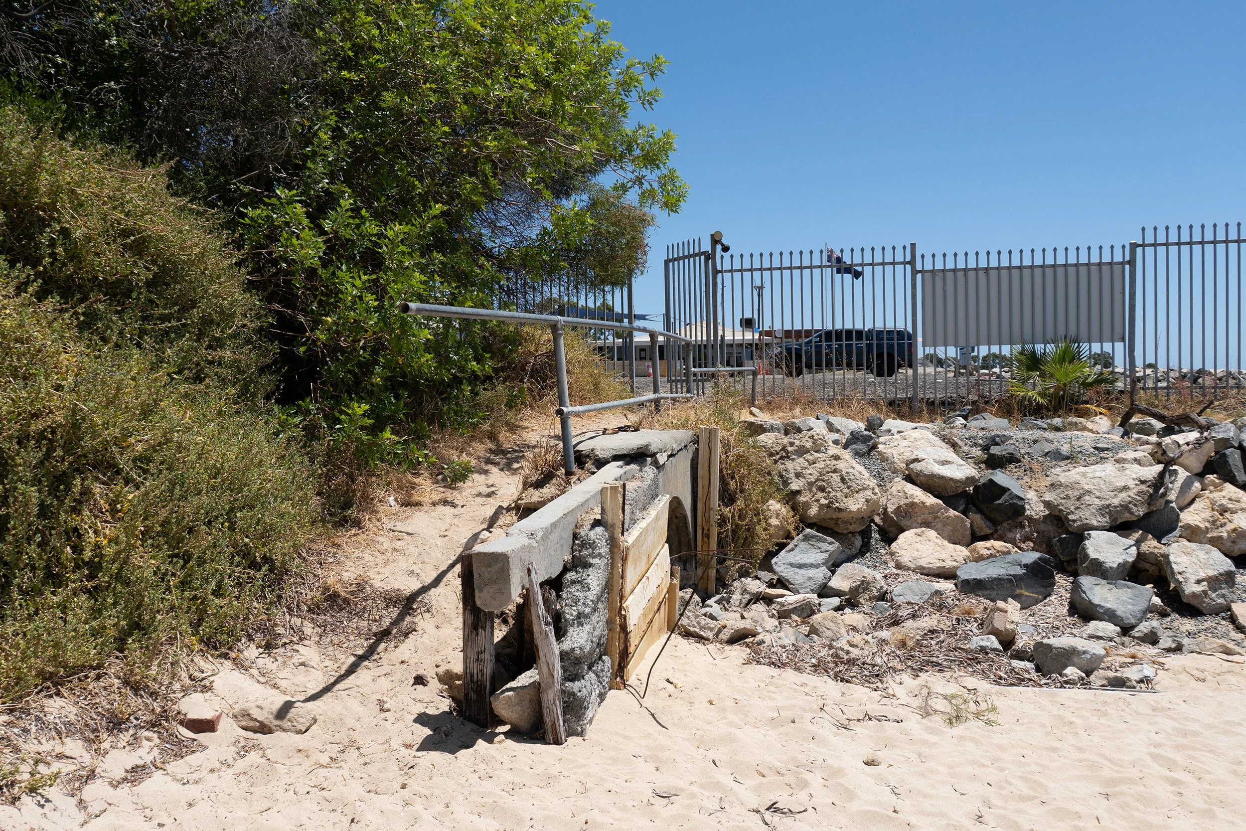
Plate 7: Gate ALLOWING public access to the beach in front of the boat club.
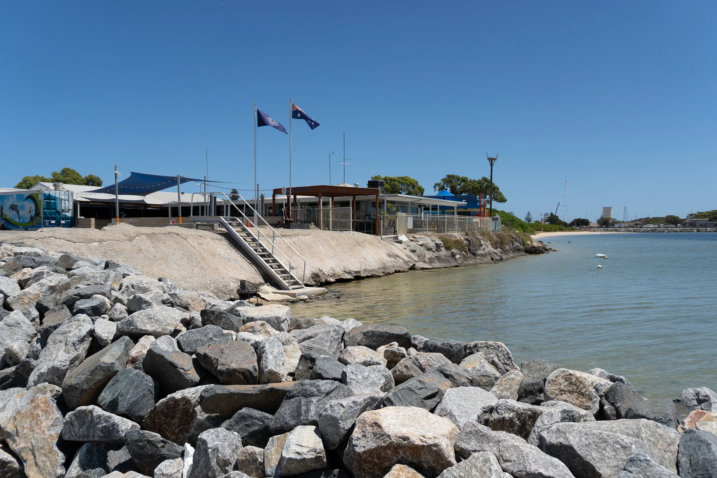
Plate 8: absence of beach in front of the boat club rooms at high tide.
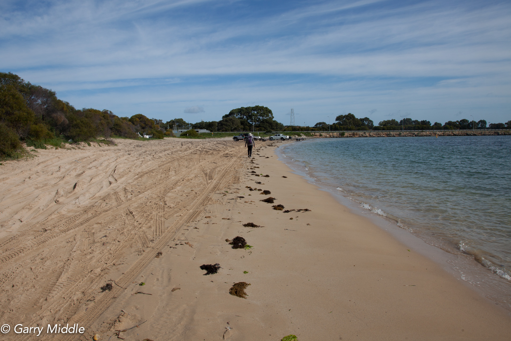
Plate 9: The beach walk passed the boat club with the Causeway just ahead.
The second option is to take the track heading away from the beach along the boundary fence of the first boat club and then head west along the main road (Point Peron Road).
Both options take you on to the main road (Point Peron Road).
Walk along the beach until you arrive at the Causeway connecting the mainland to Garden Island (Plate 10). Access to the island is only for defence purposes – the Stirling Naval Base is on Garden Island.

Plate 10: Road on the Causeway to Garden Island.
Walk along the road passed the causeway, and take the next turn right into the carpark and boat launching area justpassed the Causeway. Follow the main road in the carpark which becomes one-way, and passed the main toilet block. At the end of the road is a track which leads to the beach – take this track (Plate 11).

Plate 11: Track to the beach.
Walk up the beach across and gryone made out of sand bags (Plate 12), which is trying to control the erosion further up the beach (Plate 13).

Plate 12: Gryone made out of sandbags.
As you near the end of the beach, the erosion is obvious, as was the last attempt at beach replenishment visible when I walked the trail (Plate 13). Take the bitumen path on top of the stone wall (Plate 14) to a small sandy beach you can sit on the steps and take a rest (Plate 15). This path leads from a carpark, which is where the next walk will start from. This is the turn-around point.

Plate 13: End of beach walk with erosion and sand replenishment obvious.

Plate 14: Bitumen path on top of the stone wall.

Plate 15: The turn around spot.
Garry Middle, February 2026