
Overview - revised in January 2026
This page has a full description of this section of the trail, including supporting photographs. You can read this page and/or
Starting point – arriving by car
The starting point if arriving by car is the northern most carpark along Capricorn Esplanade, where Holiday Way leads from the carpark to the beach.
Getting there using public transport and starting point.
Take the train to Yanchep Station and then catch the 494 bus, which heads west from the Station along Botanic Boulevard. It will turn left (south) along Two Rock Road. Get off at the next bus stop, which is opposite Seaside Park just past the T Junction with Zamia Rise. Walk west through Seaside Park and onto Summerhome Parade at the roundabout. After 600m you will come to Capricorn Esplanade and the carpark is 200m north (right).
Turn around point
The turn around point is southern end of Trumpeter Drive.
Getting back to the start from the turn around point – if you don’t want to do an out-and-back walk
Bus 494 terminates on Lagoon Drive, about 830m from the end point. Head back along Trumpeter Drive and continue along it when it turns right and heads inland. Turn left along Lagoon Drive for about 200m to the bus stop. This will take you either back to Yanchep Station or the Eglinton Station.
Summary of the walk
Figure 1 below shows the route.
Figure 1: Showing the route, starting and end points, and the bus stops nearest to the start & end points.
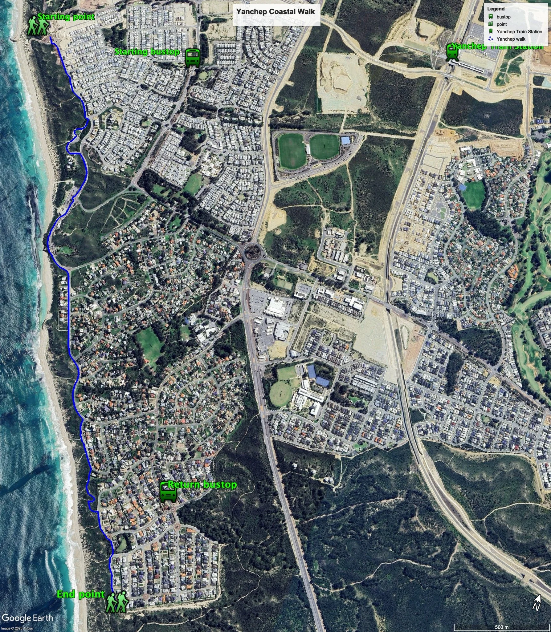
The total distance one-way distance is 4.0 km, making it an 8.0 km out and back walk (not taking into account visiting the lookouts).
This section is an isolated walk adjacent to the Yanchep and is not connected to the continuous walk further south. The walking path is well setback from the coast and generally runs along the eastern edge of the foreshore reserve. The views to the ocean are limited. However, there are several paths that will take you to the beach (as you can see on the map), so you could break up the walk with walking along the beach.
Water and toilets
Any toilet blocks are noted below in the text initalics. These are also sources of potable water. Any additional drinking water taps and showers are also noted initalics.
Walking guide
This walk is described walking south from the starting point.
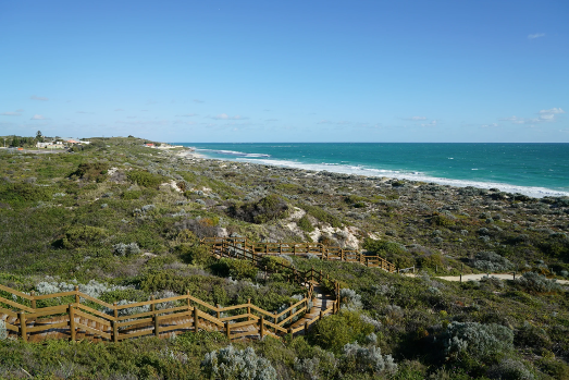
From the start head south along the path adjacent to the road (Capricorn Esplanade) and after about 100m you will see the first of the lookouts of the walk (Plate 1) – the views are worth the walk (Plate 2) – about 200m there and back.
Plate 1: The first lookout
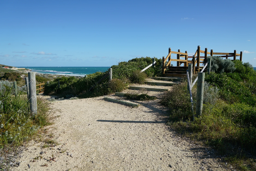
Plate 2: Views from the lookout
After about another 200m you will notice a park and the historic Mary Lindsay Homestead, built in between the two world wars – here’s the link to information on the homestead - http://inherit.stateheritage.wa.gov.au/Public/Inventory/PrintSingleRecord/49f77fc9-fd09-47b8-a479-d01ba670bdf7.
Head through the park into the carpark and take the path that along the entry road. You will see another look out along a track just after the start of the entry road. The path along the entry road will take you back to Capricorn Esplanade, and continue along this path.
After about 300 m you will arrive at the Yanchep Lagoon Beach node, with a shower, café and toilet block.
Continue along the path passed a park on the left with shower and toilet block).
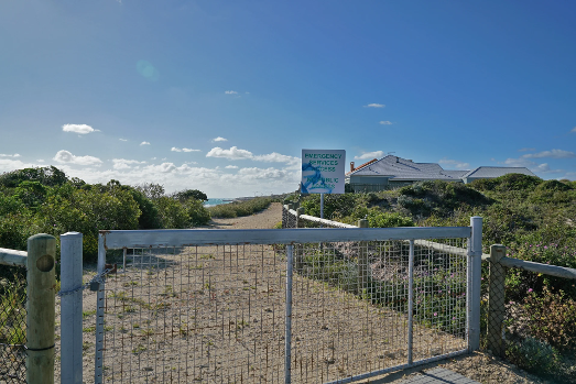
At the roundabout, turn right into Brazier Road. There is a row of houses between the path and the coast which blocks part of the view, and, whilst there is a track that runs in front of the houses, it is a fire emergency access track as required by Council for the use of the residents of these houses with no public access. (Plate 3).
Plate 3: Emergency access path in front of the row of houses
After about 350m the row of houses ends, and the foreshore reserve expands to be adjacent to the road. There is a drinking tap in a small carpark about half way along Brazier Road. Just as Brazier Road begins to bend left - Compass Circle goes off to the right - follow the path that runs adjacent to this road and the foreshore reserve.
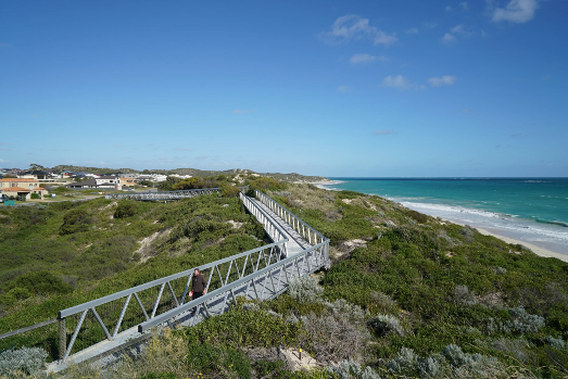
Just as the road start to bend to the left and the first house appears on the coastal side of Compass Circle you will see a coastal path going off to the right. Take this path which will take you to a lookout (Plate 4) and a metal boardwalk (Plate 5), which ends at a red bitumen path.
Plate 4: Lookout
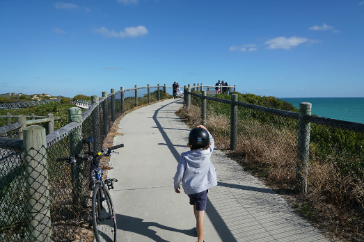
Plate 5: Metal boardwalk
Turn left into the path which ends at a road (Foreshore Vista). Follow the path here heading south through a roundabout to the end of a Cul de Sac and along a short path that links to Trumpeter Parade. Take the path along this road to the end (Plate 6) – this is the turnaround or end point.
Plate 6: The end of Trumpeter Parade
Garry Middle, January 2026