
Overview - updated January 2026
This page has a full description of this section of the trail, including supporting photographs. You can read this page and/or
Starting point
The starting point is the carpark at the end of Melros Beach Road.
Getting there using public transport
The best way to get using public transport is to catch bus 593 from Mandurah train station. Get off at the last bus stop, which is on Oceanic Drive. Continue west along Oceanic Drive for 50m and turn right at the first round about into Sutherland Street, and then left into Melros Beach Road at the end of Sutherland Street. It a 400m walk to the carpark.
Turn around point
The turn around point is Tims Thicket Beach
Getting back to the start from the turn around point – if you don’t want to do an out-and-back walk
This is a relatively short walk and easy to do as an out and back. However, the only option to return without walking is via a taxi/Uber from the Tims Thicket Beach carpark.
Summary of the walk
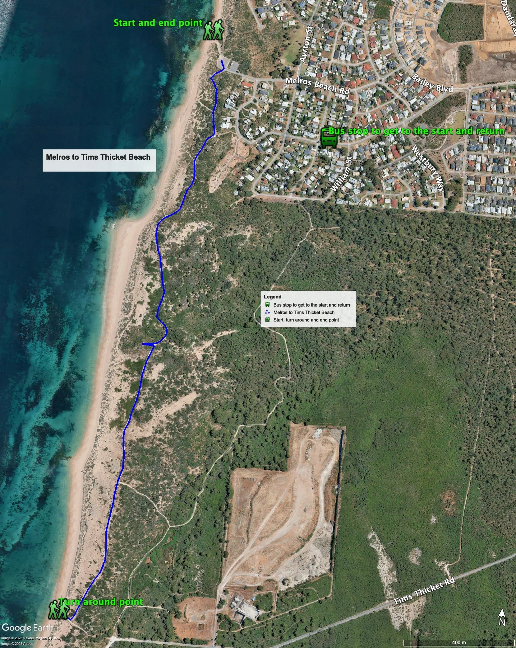
Figure 1 below shows the route. The total one-way distance is 2.4 km, making it a 4.8 km out and back walk.
Water and toilets
Any toilet blocks are noted below in the text in italics. These are also sources of potable water. Any additional drinking water taps and showers are also noted in italics.
NOTE: The only water and toilet block is at the start.
Figure 1
Walking guide
The carpark has toilets and showers.
Take the coastal path that starts from the southern end of the carpark just opposite the toilet block (Plate 1).

Plate 1: Start of coastal path
This is a winding and undulating path with frequent views of the ocean (Plate 2).

Plate 2: Views along the path
This path ends after about 1.3km at a lookout (Plate 3).

Plate 3: Lookout at the end of the coastal path – just visible at top right
Continue beyond the lookout along the wide limestone track (Plate 4), which is also used by off road vehicles.
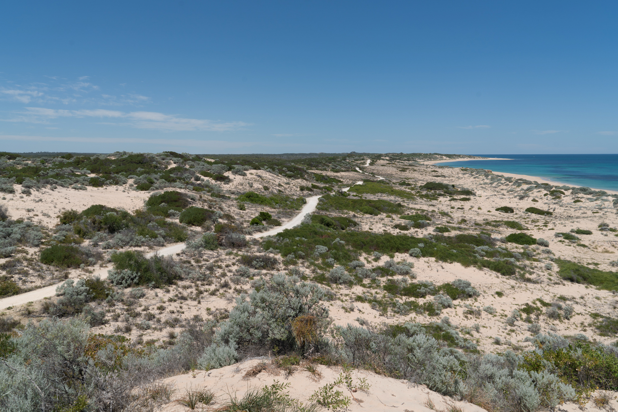
Plate 4: View of limestone track to Tims Thicket Beach form the lookout
The track is reasonable straight but quite undulating, and it is a bit rough under foot in places. The track end after about 1.1km at Tims Thicket Beach, and south of here is Yalgorup National Park (Plate 5).
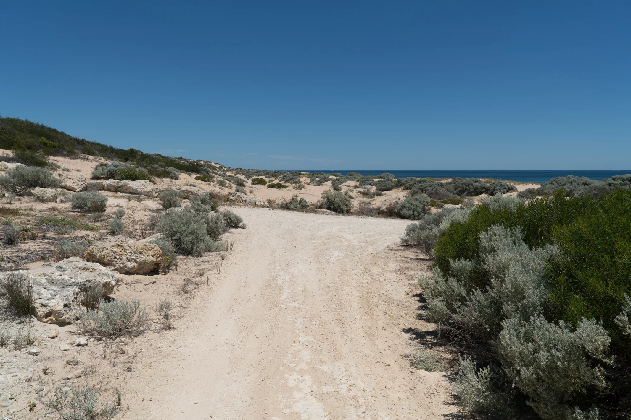
Plate 5: End of limestone track and the start of Yalgorup National Park
Tims Thicket Beach is to the right and is a very remote and rarely visited beach (Plate 6).

Plate 6: Tims Thicket Beach
There is a rough carpark at the end of Tims Thicket Road, which is about 200m along the beach access track from where the track ends. There are no facilities at the carpark other than rubbish bins (Plate 7).

Plate 7: Carpark at the end of Tims Thicket Road
Garry Middle, January 2026