Overview - updated January 2026
This page has a full description of this section of the trail, including supporting photographs. You can read this page and/or
Starting point
The starting point is the sand beach access track CMB50 at north Swanbourne beach. There is street parking on Challenger Parade next to the start if the track to the beach.
Getting there using public transport
The best way to get to the start using public transport is to catch the Bus 81 which terminates near the turn around point: HOWEVER it only runs on week days. After you get off the bus, continue south along Launceston Ave for about 120m then turn right on Challenger Parade and the start of the track to the beach is about 200m.
The only other option is to take a taxi/Uber.
Turn around point
The turn around point is the main beach area at Cottesloe.
Getting back to the start from the turn around point – if you don’t want to do an out-and-back walk
The best way to get back to the start using public transport is to first catch bus 102 heading south from the main beach area at Cottesloe, which will take you to the Cottesloe train station. Get off at the central Perth train station, and it’s a short walk to the Roe Street Busport where you can catch the 81 bus back to the start. On weekend bus 81 doesn’t run so it might be best to catch a taxi/Uber from Cottesloe back to the start.
Summary of the walk
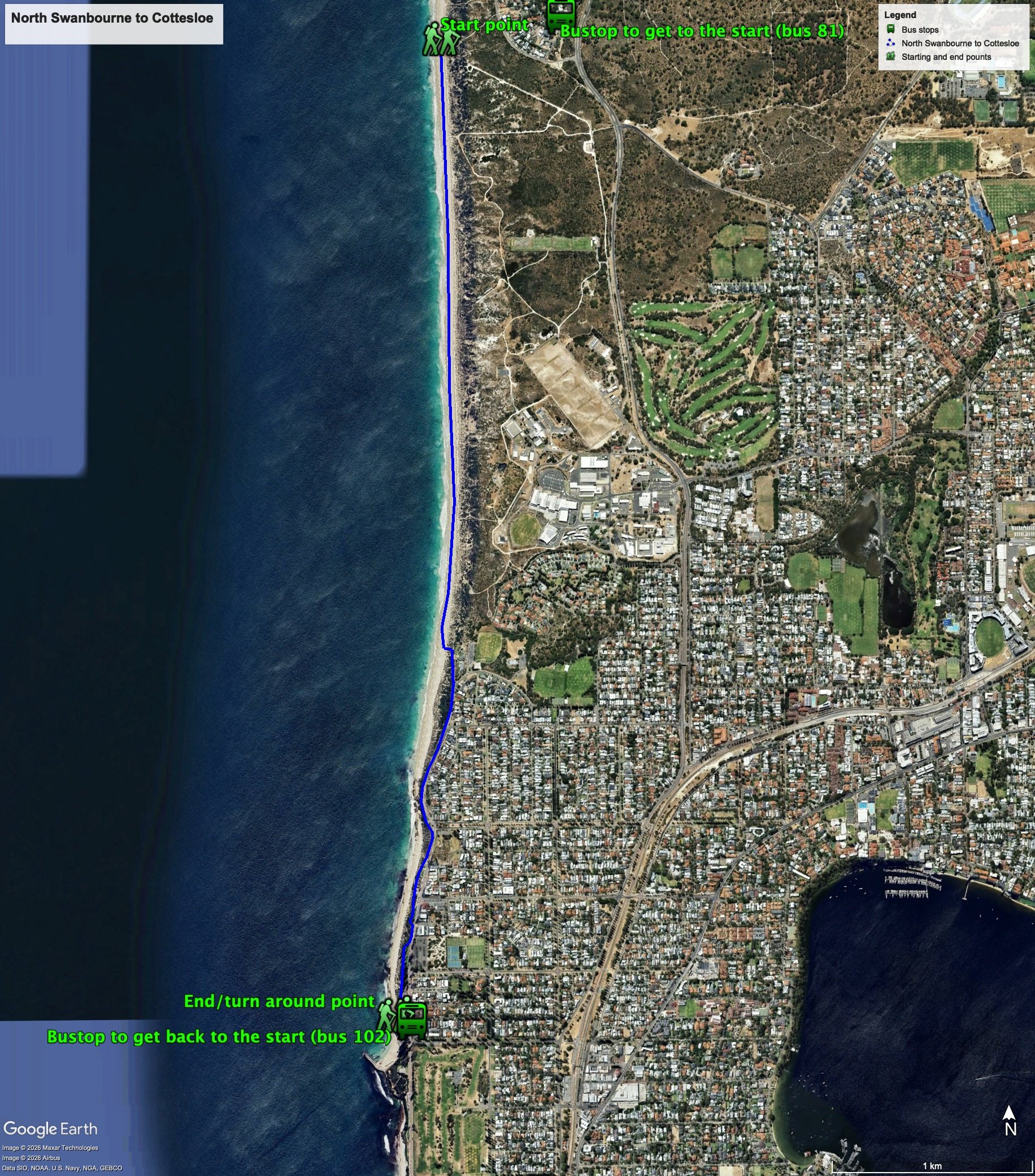
Figure 1 below shows the route. This is one of the longer walk segments – it’s a trade-off for the shorter walk from Floreat to this starting point. The total one-way distance is 5.0 km, making it a 10.0 km out and back walk.
Figure 1
Water and toilets
Any toilet blocks are noted below in the text in italics. These are also sources of potable water. Any additional drinking water taps and showers are also noted initalics.
Walking guide
There are no drinking taps etc. at the start, with the first one at the end of the beach walk, about 3.1km.
Also note – Swanbourne beach is a nude bathing beach to be warned!
To get to the starting point take the sand beach access track CMB50 at north Swanbourne beach and head south along the beach.
The beach can be difficult depending on conditions and tide. It is generally quite wide here, but the width of hard sand varies over the year and is particularly narrow, and often absent, in winter (Plate 1). This photo was taken in May.
Plate 1: Part of the beach walk showing the width if the beach and the narrowness of the firm sand area.
After about 3km take the sand track off the beach when we see the grassed area and buildings of the Swanbourne Nedlands Surf Life Saving Club. There is a ‘clothing optional beach’ sign at the start of the track up from the beach (Plate 2). There are drinking taps, showers and toilets here.
Plate 2: The end of the beach walk
Walk on the beach side of the Swanbourne Nedlands Surf Life Saving Club infrastructure onto a path that runs next to the entrance road and continue on the path as it runs next to Marine Parade. It’s an easy walk from here along a busy dual use path from here to the turnaround point (1.9km) with sweeping views of the ocean (Plate 3).
Plate 3: Section of the walk adjacent to Marine Parade showing the sweeping ocean views (looking north)
After about 1.1km from where the path starts is the North Cottesloe Surf Life Saving Club and two restaurants/bars, and it’s possible to walk on the beach side of these buildings.
Continue on the path and the turnaround point is the main commercial and recreational centre of Cottesloe beach. There are plenty of toilets, showers and drinking taps, as well as cafes here
Garry Middle, January 2026.


