
Overview - updated January 2026
This page has a full description of this section of the trail, including supporting photographs. You can read this page and/or download the following information:
Starting point
The starting point is the main beach area at Cottesloe, in front of the iconic Indiana Tea house building. There is plenty of carparking here but much of the parking on the beach front of it is time limited. Parking on the side streets is less likely to be time limited.
Getting there using public transport
The best way to get to the start using public transport is to first catch the Fremantle line train and get off at Cottesloe train station. From the Station catch the 102 bus, which will take you to the beach front and starting point. The 102 terminates/starts on Railway Street opposite the station.
Turn around point
The turn around point is the main beach area at Port Beach.
Getting back to the start from the turn around point – if you don’t want to do an out-and-back walk
The best way to get back to the start using public transport is to walk to the North Fremantle train station – about 1.1km. Head back the way you came until you get to the Leighton Beach commercial and recreational node (Plate 9). Turn right (east and walk along the wide mall in the middle of Freeman Loop which will take you to the train station. Get off at Cottesloe and catch the 102 bus back to the start.
Summary of the walk
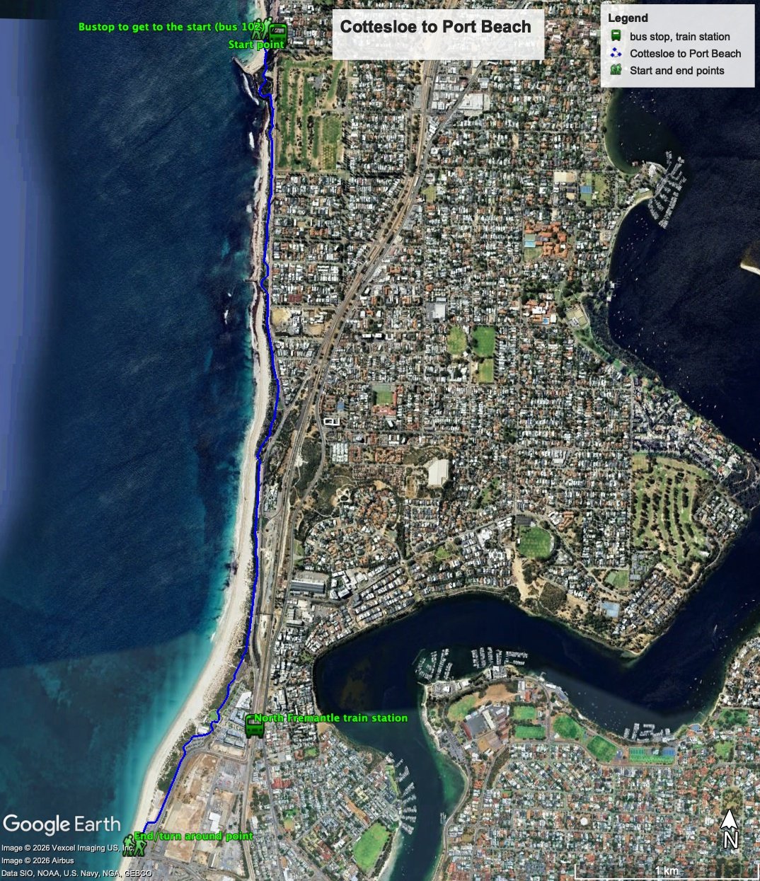
Figure 1 below shows the route. The total one-way distance is 4.9 km, making it a 9.8 km out and back walk.
Figure 1
Water and toilets
Any toilet blocks are noted below in the text initalics. These are also sources of potable water. Any additional drinking water taps and showers are also noted initalics.
Walking guide
There are plenty of toilets, showers and drinking taps, as well as cafesat the starting point. Head south along either the upper path from in front of Indiana’s or the lower paths between the grassed area and the beach. The path goes around the Cottesloe Surf Life Saving Club, and just after the path bends back towards Marine Terrace take the path going off to the right. This path leads to a large sun dial clock (Plate 1), passed a large sculpture/public art (Plate 2) and back on to the main path running parallel to Marine Terrace at the northern end of a carpark.
Plate 1: The sun dial clock

Plate 2: the large sculpture/public art near the sun dial

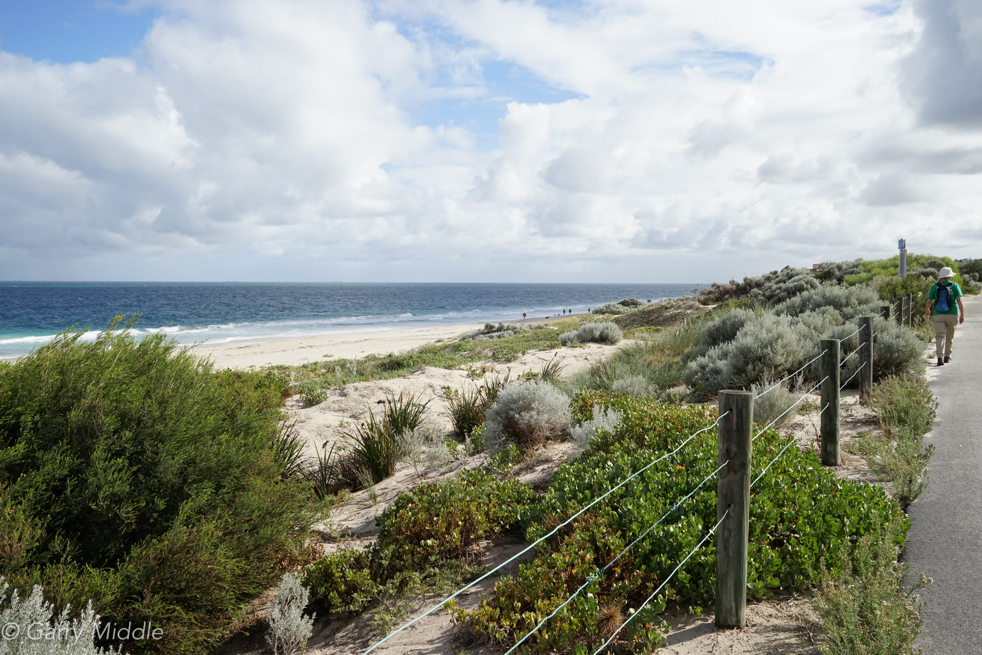
For the next nearly 1.0km the path runs next to Marine Terrace with sweeping views over the ocean (Plate 3). There are several showers along this stretch of the walk.
Plate 3: Views from the path that runs next to Marine Terrace (looking north).

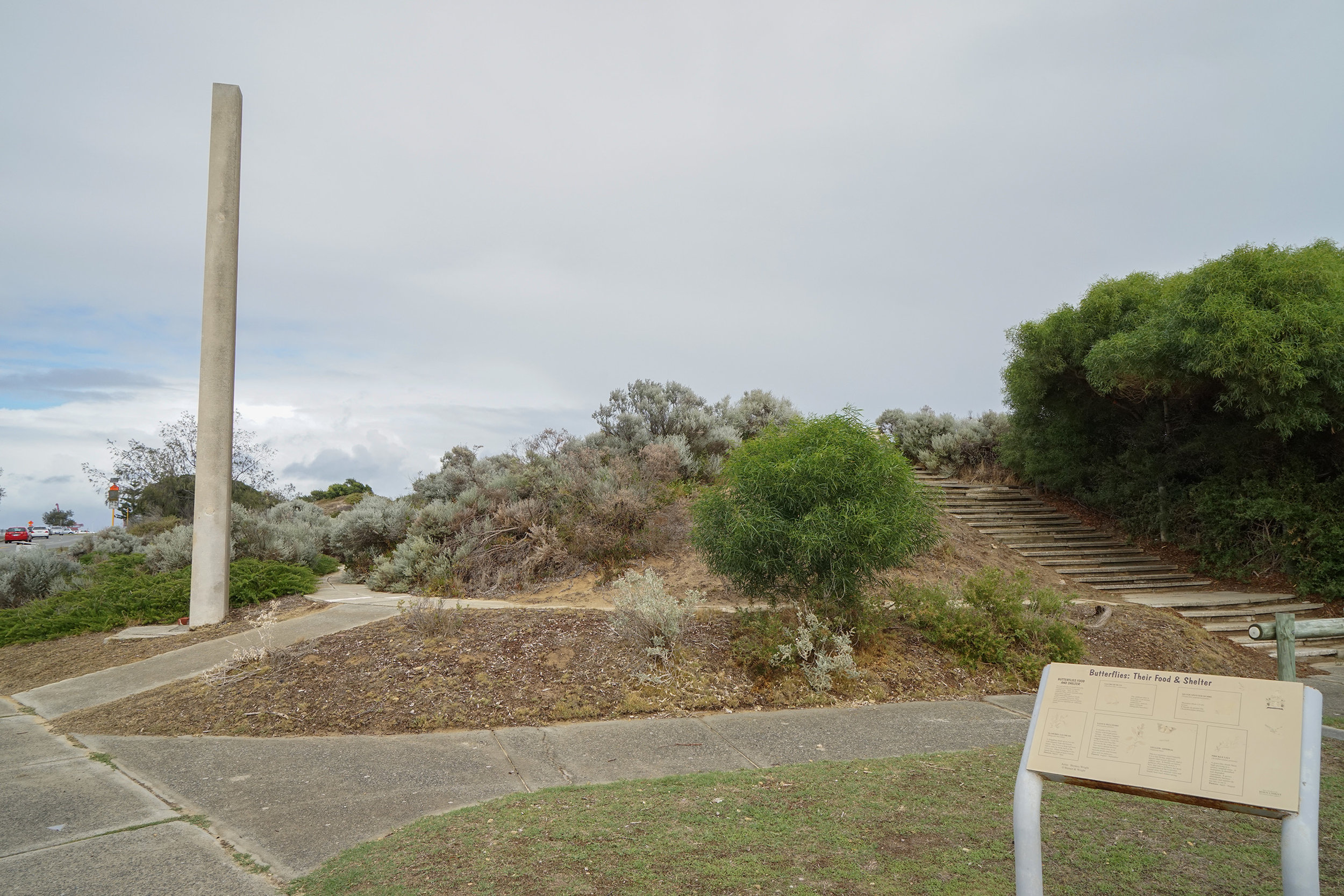
After about 1km, as you approach the south Cottesloe Groyne, the path bend right away from the road around a dune and then back next to Marine Terrace. After another 500m the paths bends right away from Marine Terrace and after another 270m there is a set of steps leading up to a lookout (Plate 4) - the Vlamingh Memorial (Plate 5) is easily visible next to the steps, which commemorates the landing of Willem de Vlamingh party in January 5 1697 on Cottesloe Beach.
Plate 4: View from the lookout at the site of the Vlamingh Memorial

Plate 5: The Vlamingh Memorial
Continue south from the look out down the steps and along a sand track (Plate 6) which after 100m ends at a set of wooded steps (Plate 7).
Plate 6: The sand track south of the lookout, looking north

Plate 7: Where the sand track meets the wooden steps, looking north

Head up the steps onto a concrete path that runs on the coast side of a carpark, parallel to Curtin Ave. This section of the walk has sweeping views of the ocean (Plate 8) and continues for about 1km, where the path and road separate. There are no drinking taps along this section of the walk.
Plate 8: Views from the section of the walk that runs parallel to Curtin Ave (looking north)
After about 350m, the path comes out at a grassed area (Plate 9) which is part of the Leighton Beach commercial and recreational node. There are toilets, showers, drinking taps and cafes here.
Plate 9: The grassed area at the Leighton Beach commercial and recreational node

The path continues south of here around a carpark and then rejoins and runs next to coastal Port Beach Road for about 400m reaching the northern end of the main carpark at Port Beach. Continue past the café/restaurant, and the turnaround point is the toilet block opposite the traffic lights (Plate 10).
Plate 10: The toilet block at Port Beach – the turnaround point is on the beach side

Garry Middle, January 2026.