
Overview - updated January 2026
This page has a full description of this section of the trail, including supporting photographs. You can read this page and/or
Starting point
The starting point is the main grassed area of John Graham Recreation Reserve, part of the Woodman Point Regional Park.
Getting there using public transport
The best way to get there using public transport is to catch bus 548 from Fremantle station. Get off at the bus stop on Cockburn road in-between Nyyerbup Circle and Fairbairn Road. This is almost exactly where a path that goes from Cockburn Road to the grassed area John Graham Recreation Reserve comes out. Take the path to the starting point.
Turn around point
This is a loop walk so there is no turn around point and you end up where you started.
Summary of the walk
Figure 1 below shows the route. The total distance of the walk is 7.0km. There is a shorter option, which is not to do the walk out to Woodman Point. This takes 2.4km off the walk – i.e. a walk of 4.6km.
Water and toilets
Any toilet blocks are noted below in the text in italics. These are also sources of potable water. Any additional drinking water taps and showers are also noted in italics.
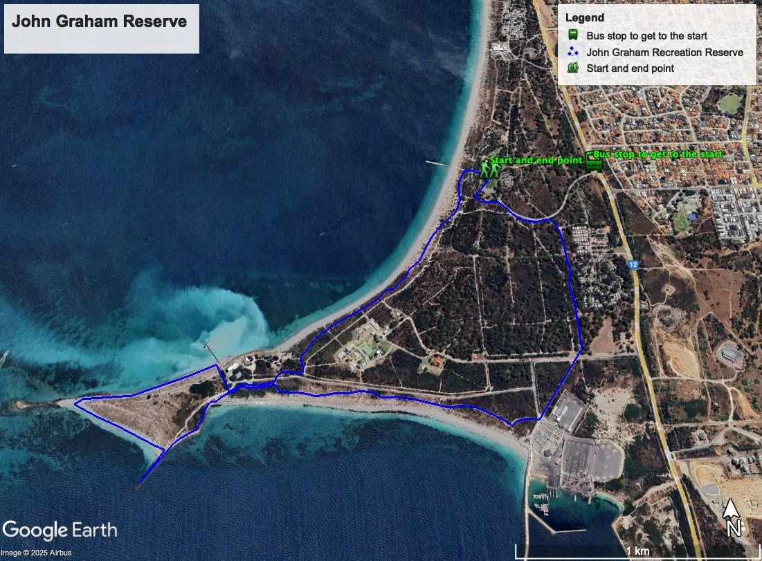
Figure 1: Map showing the John Graham Reserve to Woodman Point loop walk
Walking guide
The starting point has a toilet block and drinking water taps. From here, take the the path towards the jetty but turn left on the red bitumen path before you get to the jetty and beach (of course, the jetty is well worth a visit either now or when you return as the views are spectacular).
The path is set back from the beach and is gently undulating with ocean views at the high points (Plate 1).

Plate 1: A section of the path south of John Graham Reserve with views of the Cockburn Sound
The path goes for nearly 2km passed the old quarantine site, now recreation camp (see notes for previous walk) and passed the Jervoise Bay Sailing Club (Plate 2) before arriving at the Woodman Point View Road.

Plate 2: Jervoise Bay Sailing Club
Just after crossing Woodman Point View Road you will come to a path intersection (Plate 3) – if you want to do the full walk take the path to the right which goes to Woodman Point. The path runs parallel and to the south of Woodman Point View. You will later return to this intersection where you will take the other path.
If you want to do the shorter walk continue along the path to the Cockburn Power Boats Association complex – see below. This path is mostly flat passing through scrubby coastal vegetation. You will later return to this intersection and you will take the other path.

Plate 3: Path intersection just after crossing Woodman Point View Road
For the full walk, the path runs parallel and to the south of Woodman Point View Road, passed the company Cockburn Cement’s jetty, and shellsands processing plant (Plates 4 & 5). Cockburn Cement dredge the shellands in Owen Anchorage and does the primary processing of the material at this plant before piping the processed material as a slurry to the main processing plant in Munster.

Plates 4 & 5: Cockburn Cement’s shellsands processing plant. Second photo is the view from near Woodman Point

As you continued along the path, you will also pass the Water Corporation’s emergency sewerage outfall pipe (Plate 6). This only gets used if the main outlet at Cape Peron fails (see a later walk).

Plate 6: Water Corporation’s emergency sewerage outfall pipe
The path provides views of the Henderson marine complex and Kwinana industrial area to the south (Plate 7).

Plate 7: Views of the Henderson marine complex and Kwinana industrial area
The path ends at a groyne, which is popular for fishing (Plate 8), but this is not Woodman Point.

Plate 8: The groyne at the end of the walk path
To get to Woodman point, walk along the beach that heads to the north (right) of the groyne (Plate 9).

Plate 9: Beach walk to Woodman Point.
Woodman Point is connected to a small island by and artificial rock groyne (Plate 10).

Plate 10: Woodman Poin
Continue walking along the beach on the northern side of Woodman Point heading east rather than going back along the path (Plate 11).

Plate 11: Beach on the northern side of Woodman Point
Once you arrive at the Cockburn Cement’s shellsands processing plant, head inland around the plant and cross Woodman Point View Road to re-join the path you were on before – i.e. which led to rock groyne. Turn left and head back the way you came, until you arrived at the previous path intersection (Plate 3). Rather than turn left and go back the way you came, turn right towards the Henderson marine complex. This path is mostly flat passing through scrubby coastal vegetation (Plate 12).

Plate 12: Path heading towards the Henderson marine complex
The path ends at the Cockburn Power Boats Association complex (Plate 13). You will notice a café about 150m straight ahead. There are two toilet blocks here. One is about 100m down the road to the right you come to as the path ends. There is a drinking water tap here.

Plate 13: End of the path at the Cockburn Power Boats Association complex
Continue on the path to the left on the western edge of the buildings back towards the start (Plate 14).

Plate 14: Path back towards the start – looking north east
The paths crosses over a road (O’Kane Court) (Plate 15) and then through a lovely Tuart woodland (Plate 16).

Plate 15: Path crossing over Woodman Point View Road.

Plate 16: Tuart woodland
The path goes passed the Woodman Point Holiday Park (Plate 17).
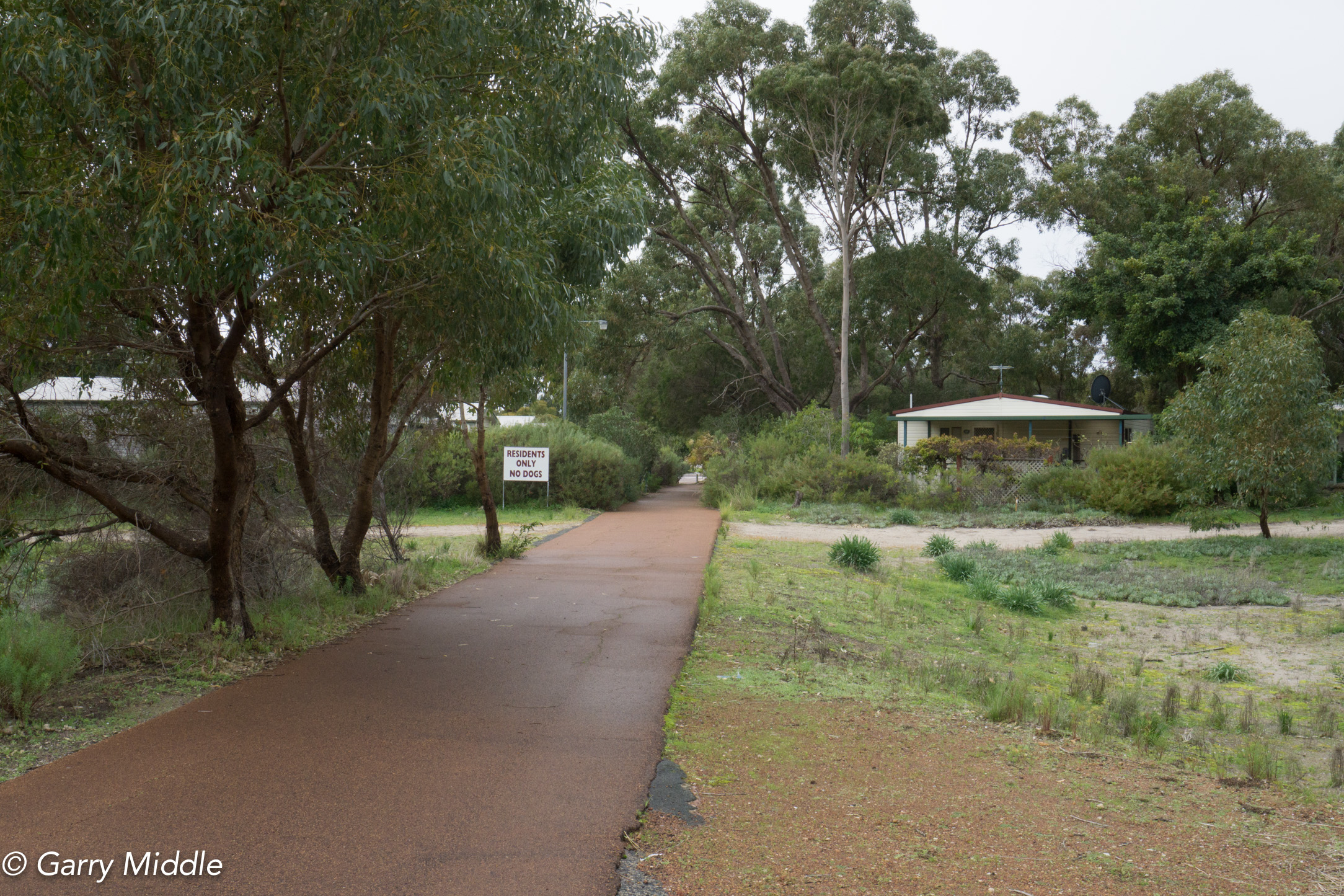
Plate 17: Woodman Point Holiday Park (the path in the photo is not the path back to the start)
Near the end of the walk you will come across a couple of old bunkers that used to have buildings storing munitions magazines. One building remains, which is listed on the State Register of Heritage Places (Plate 18).

Plate 18: One of the old bunkers that used to have buildings storing munitions magazines. The one remaining building can be seen in the background
As you approach the end of the walk and Nyyerbup Circle, the path veers off to the left (Plate 19).
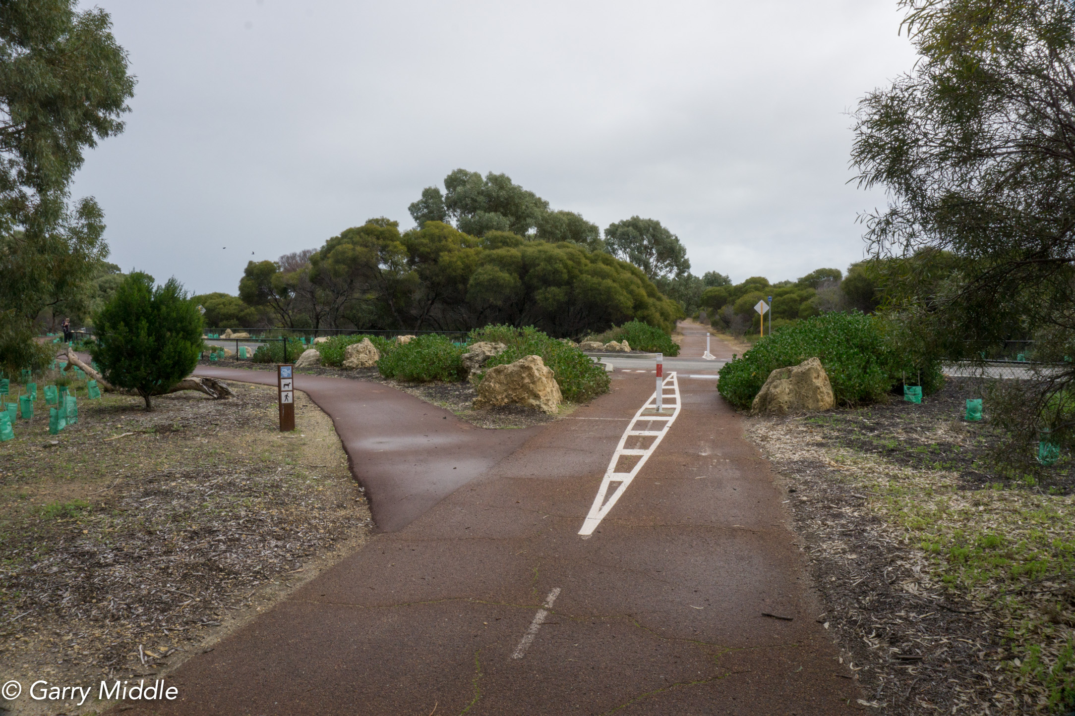
Plate 19: Near the end of the walk at Nyyerbup Circle.
Take this path and you will notice one of several interesting speed humps used to calm the traffic into the park (Plate 20). The park managers have used some of the old railway sections to create a speed hump.

Plate 20: A speed hump using an old railway section
Finally, as you approach the carpark near the starting point you will notice the fenced area to the south (left) of the path (Plate 21). This contains the Nature Reserve section of the Regional Park, which not only contains significant vegetation, but also at least six significant historic sites. Access to this area is restricted for these reasons.

Plate 21: Fenced off nature reserve section of Woodman Point Regional Park
Additional information
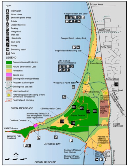
Finally, below is the management map from the Management Plan for the Woodman Point Regional Park for reference (Source: https://www.dbca.wa.gov.au/management/plans/woodman-point-regional-park )
Figure 2: Recreation planning for Woodman Point
Garry Middle, January 2026