
Overview - updated February 2026
This page has a full description of this section of the trail, including supporting photographs. You can read this page and/or
Starting point
The starting point is the main beach area at Port Beach. There is plenty of carparking here.
NOTE: There is only one way to do this walk and that is an out and back walk – see below.
Getting there using public transport
The best way to get using public transport is to take the Fremantle train and alight at North Fremantle station. It’s a 1.1km walk to the start. Head west along the wide mall in the middle of Freeman Loop which ends at Leighton Beach commercial and recreational node. Take the red bitumen path south for about 900m to the start point.
Turn around point
The turnaround point is the end of North Mole.
Getting back to the start from the turn around point – if you don’t want to do an out-and-back walk
This is a straight out and back walk and you will finish where you started.
Summary of the walk
Figure 1 below shows the route. The total one-way distance is 3.24 km, but this is an out and back walk only so the total distance of the walk is 6.48 km.
Water and toilets
Any toilet blocks are noted below in the text initalics. These are also sources of potable water. Any additional drinking water taps and showers are also noted initalics.
Figure 1

Walking guide
At the start (Plate 1) there is a café/restaurant, toilet block, showers and drinking taps at the start.
Plate 1: Starting point

Head south through the carpark and onto the path that runs next to Port Beach Road. After about 500m the path bends right, which is the start of the land reclamation area for Rous Head. Plate 2 is a view looking north from the strati of the land reclamation area where the end of the beach can be seen.
Plate 2: View from land reclamation area looking north showing the end of the beach and the start of the land reclamation

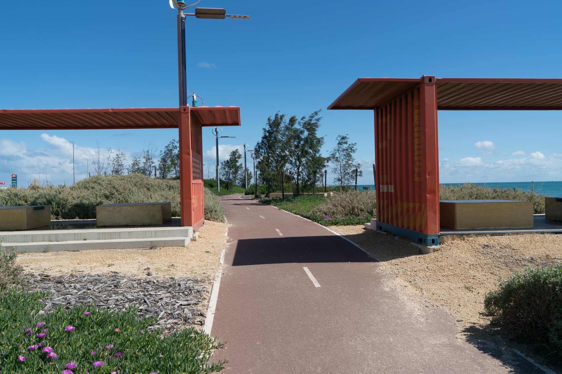
The path passes through shaded area made from old containers to celebrate the port (Plate 3), and there us a drinking fountain just passed these structures.
Plate 3: Shade structure made from old containers to celebrate the port
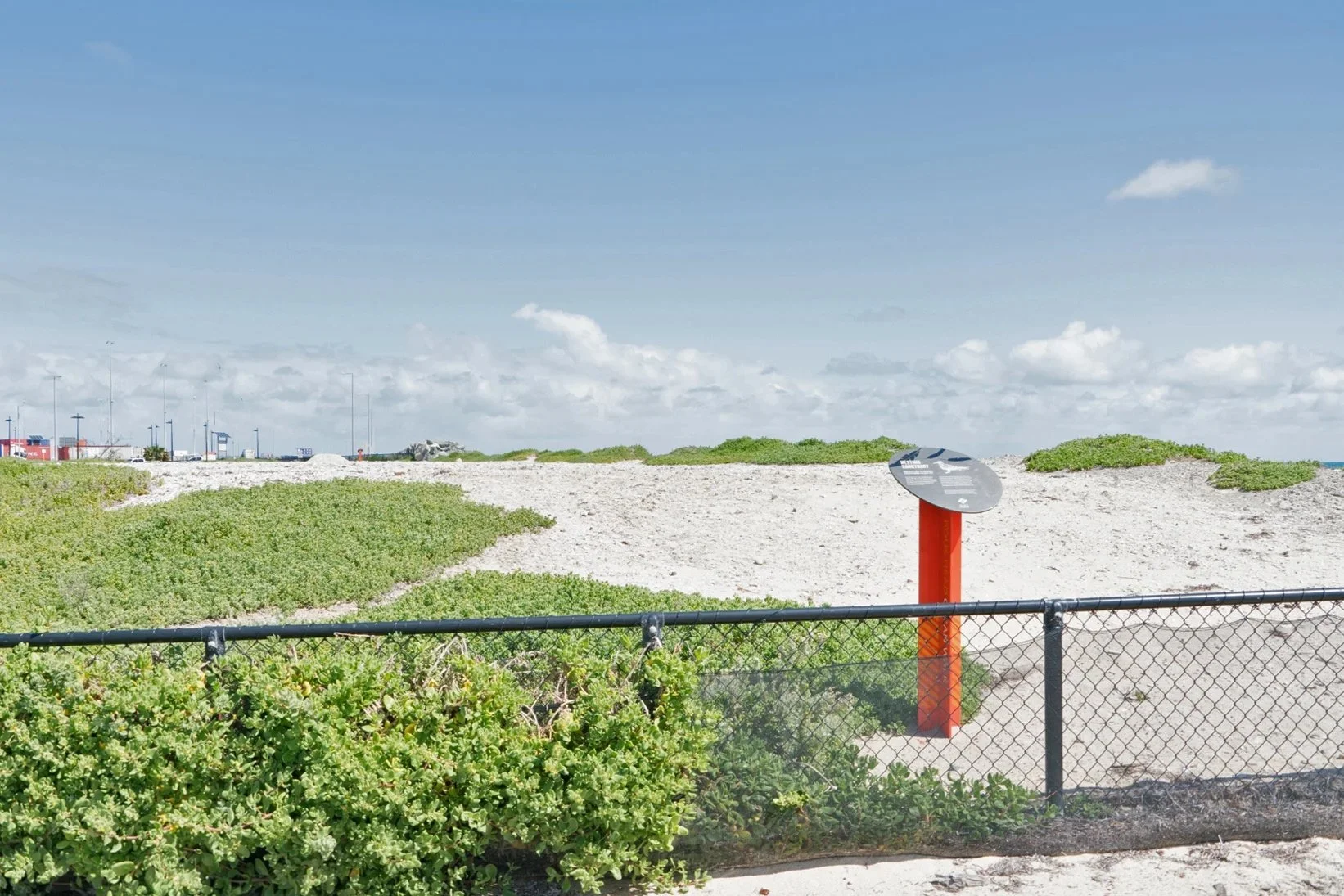
The paths continues, bends left and passes a raised area that has become a nesting area for certain migratory bird species, which has been fenced off and protected (Plate 4).
Plate 4: Protected bird nesting area
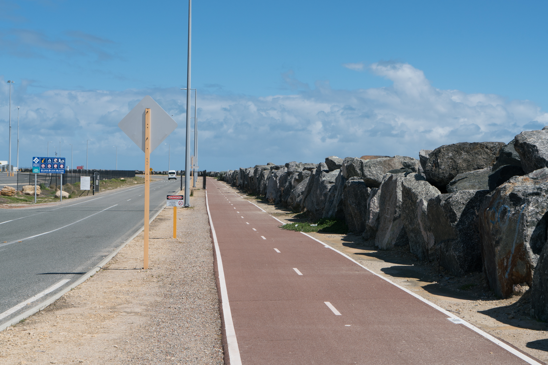
The path continues along the edge of the wall at the edge of the land reclamation area, and the wall bocks the view of the ocean in some locations (Plate 5).
Plate 5: The path next to the wall at the edge of the land reclamation area
After about 1.3km passed the bird nesting area the reclaimed area narrows significantly to be just a road and walls (Plate 6)
Plate 6: The narrowed section of the walk along the edge of the reclaimed area

Continue with caution along the road for about 750m where the road widens to a carpark and turns right and continues for another 200m passed a toilet blockon to a red lighthouse, which is the turn around point (Plate 7), and walk back the way you came.
Plate 7: Lighthouse at the end of North Mole, which is the turnaround point

There are great views from the end of the North Mole, especially down the coast (Plate 8).
Plate 8: Views from the end of North Mole

Garry Middle, February 2026.