
Overview - updated January 2026
This page has a full description of this section of the trail, including supporting photographs. You can read this page and/or
Starting point
The starting point is the small carpark at the end of Orion Road on Ormsby Terrace, Silver Sands.
Getting there using public transport
The best way to get using public transport is to catch to 584 bus from Mandurah train station. Get off the bus at the bust stop just passed Gibla Street on Mandurah Terrace. Walk about 250m north along Mandurah Terrace and turn right into Orion Road. The carpark is at the end of Orion Road, about 400m.
Turn around point
The turn around point is park and small beach part of the Keith Holmes Reserve within Mandurah Ocean Marina.
Getting back to the start from the turn around point – if you don’t want to do an out-and-back walk
The best way to get back to the start using public transport is to catch the 584 bus – a 700m walk. Walk north west along the path at the edge of the grassed area part of the Reserve. After about 300m the path comes out at the end of a Cul de Sac, which is Peel Street. Head south east along Peel Street through one round about. The next round about is at Mandurah Terrace. Continue along Peel Street and the bus stop is about 50m along. Take the bus heading north. Get off the bus at the bus stop just passed Tindale Street on Mandurah Terrace. Walk north through the park next to Mandurah Terrace and turn left into Orion Road. The carpark is at the end of Orion Road, about 400m.
Summary of the walk
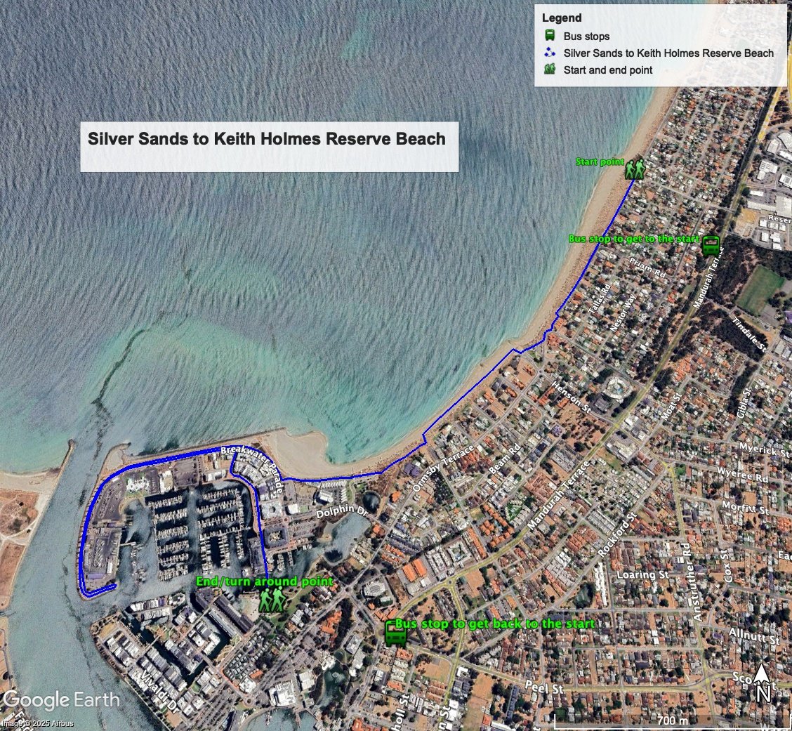
Figure 1 below shows the route. The total distance one-way distance is 4.8 km, although if you don't to the out and back along Breakwater Parade its a 3.9km one way walk. The full out and back walk without repeating the out and back along Breakwater Parade is 7.6 km.
Water and toilets
Any toilet blocks are noted below in the text in italics. These are also sources of potable water. Any additional drinking water taps and showers are also noted in italics.
Figure 1
Walking guide
There’s a small toilet block at the carpark. From the carpark at the end of Orion Road head south through the carpark and along Ormsby Terrace for about 70m where Ormsby Terrace ends as a Cul de Sac. Take the path which links to another section of Ormsby Terrace which is also a Cul de Sac (Plate 1).

Plate 1: Path linking Cul de Sac portions of Ormsby Terrace
There are two more ‘Cul de Sacs’ of Ormsby Terrace like this. The third one (after about a kilometre from the start) comes out at a substantial park with a toilet block and other amenities, including a filtered water tap – Henson Reserve (Plate 2).

Plate 2: Henson Park
There is no coastal path from here so head to the beach and walk for about 500m and take the path away from the beach (Plate 3), and you will see the start of a formal path on your right.
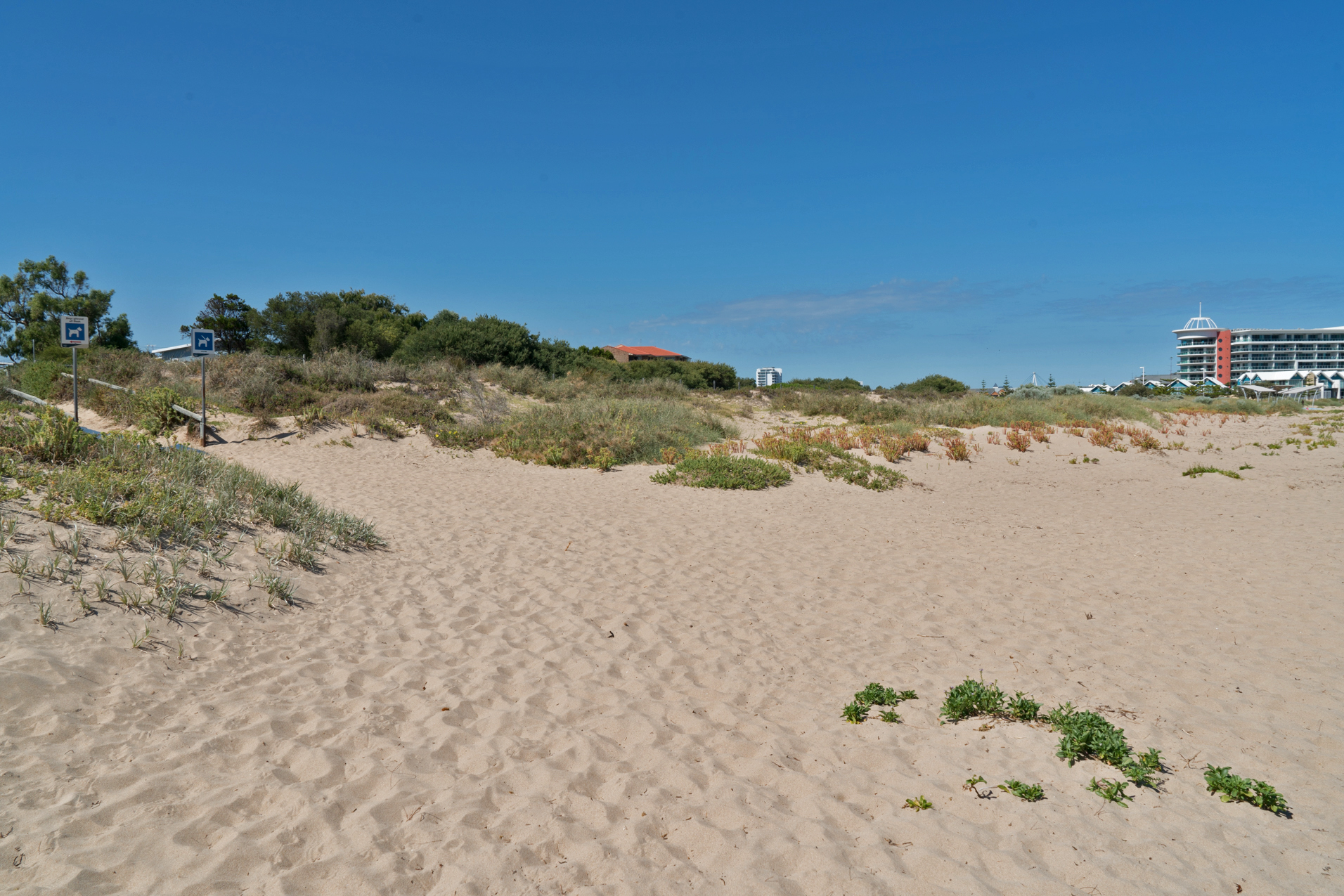
Plate 3: Path from beach to start of coastal path
Take this path for about 200m where you will come to a carpark and formal park with a toilet block. Continue along the path in front of a row of apartments, through a large carpark and then follow the path that runs along Breakwater Parade adjacent to a sea wall (Plate 4).

Plate 4: Path running along Breakwater Parade adjacent to a sea wall
After about 700m the road start to bend left and ahead of you is a lookout/viewing platform (Plate 5). This will give you a view of the mouth of the Peel-Harvey Estuary (Plate 6). This is where the short-cut start, but I will describe the full walk.

Plate 5: Lookout/viewing platform from Breakwater Parade

Plate 6: View of mouth of the Peel-Harvey Estuary from lookout/viewing platform
Head further south along Breakwater Parade for about 400m which will take you to the end of the peninsula at a circular garden with a single tree and path around it. Head back the way you came, and from the lookout walk about 50m until you get to Spinnaker Quays and take this road to the waterfront and follow this (Plate 7), which bends to the right, through a roundabout, along a shopping mall (Plate 8), over the footbridge (Plate 9) and you will arrive at park and beach – this is Keith Holmes Reserve and the turn around point (Plate 10).

Plate 7: Path along the waterfront

Plate 8: The shopping mall before the footbridge

Plate 9: Footbridge
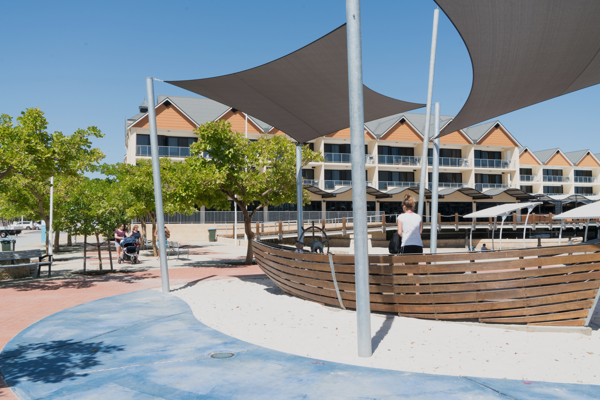
Plate 10: Park and beach at Keith Holmes Reserve
Garry Middle, January 2026