
Overview
This page has a full description of this section of the trail, including supporting photographs. You can read this page and/or
Starting point
The starting point is the carpark the western side of on Cockburn Road at the corner with O’Kane Ct.
Getting there using public transport
The best way to get using public transport is to catch the 548 Bus from either the Fremantle or Rockingham train stations. The bus stop form Fremantle is on the eastern side of the road about 120m south of the corner. The bus stop from Rockingham train station is about 100m north of the corner.
Turn around point
The turn around point is a small carpark and boat launching ramp on the road to Challenger Beach – Plate 23.
Getting back to the start from the turn around point – if you don’t want to do an out-and-back walk
The best way to get back to the start using public transport is catching the 548 Bus. There is a bus stop about 100m north of the entrance to Challenger Beach road along Cockburn Road near the small kiosk.
Important note about this walk
This walk includes the Jervoise Bay/Henderson Marine Industrial Estate, which makes up nearly 2/3 of the walk. These industries require direct access to the ocean and so there is no access to the coast in this section. Walkers may choose to ignore this section and start just to the south of the estate, which is a section of the Beeliar Regional Park. Unfortunately, this is a very short walk before the Kwinana heavy industrial area is reached – about 1.5km. There is no coastal path in the Kwinana heavy industrial area, which makes that walk almost entirely a beach walk, with no access to public transport until Governor Road in Rockingham.
Summary of the walk
Figure 1 below shows the route. The one-way length of this walk is 6.4 km, making is a 12.8 km out and back walk. This is much longer than the other recommended walks. Another option is to walk part of the way back and go to one of the 548 bus stops and return to the start. Figure 1 shows the bus stops on the way back. If you go to the bus stop near the motor cycle club the total walk is about 8.5 km.
Water and toilets
Any toilet blocks are noted below in the text in italics. These are also sources of potable water. Any additional drinking water taps and showers are also noted in italics.
NOTE: there are no toilets or drinking water taps until you get to the Naval Base shacks, near the turn around point so come prepared.

Figure 1: The walking trail
Walking guide
From the carpark (or bus stop) head south along Cockburn Road – this is a busy road so take care. After about 1km on the right is the start of the building that are part of the marine complex. Continue along the raod and before it bends left you will see a crash barrier on your right, and where that ends (before you get to the entrance to the complex, you will be able to leave Cockburn Road and cross to the road network within the complex (Plate 1).

Plate 1: Entry point to the complex passed the crash barrier down the slope to roads in the complex
There is a path on the next road west and closer to the ocean which will give you good views of the complex and the ocean (Plate 2). This is Clarence Beach Road.

Plate 2: Path on Clarence Beach Road
Keep heading south and you will eventually have to get back onto the main road within the complex – Quill Way. Quill Way takes a sharp turn to the left, and after about 200m take Nautical Drive on your right (Matrix building on the corner) and head south (Plate 3).

Plate 3: Corner of Quill Way and Nautical Drive
At the end you will see Cockburn Road behind the bushes, and a gap in the fence where a bike track passes through (Plate 4).

Plate 4: The gap in the fence at the end of Nautical Drive onto Cockburn Road
Take this track and turn right and you will see the Green Beeliar Regional Park sign (Plate 5) and the fence which is the boundary of the park and the marine complex.

Plate 5: Entrance to Beeliar Regional Park and the boundary fence
Take the firebreak track towards the ocean (Plate 6), which runs next to the boundary fence.
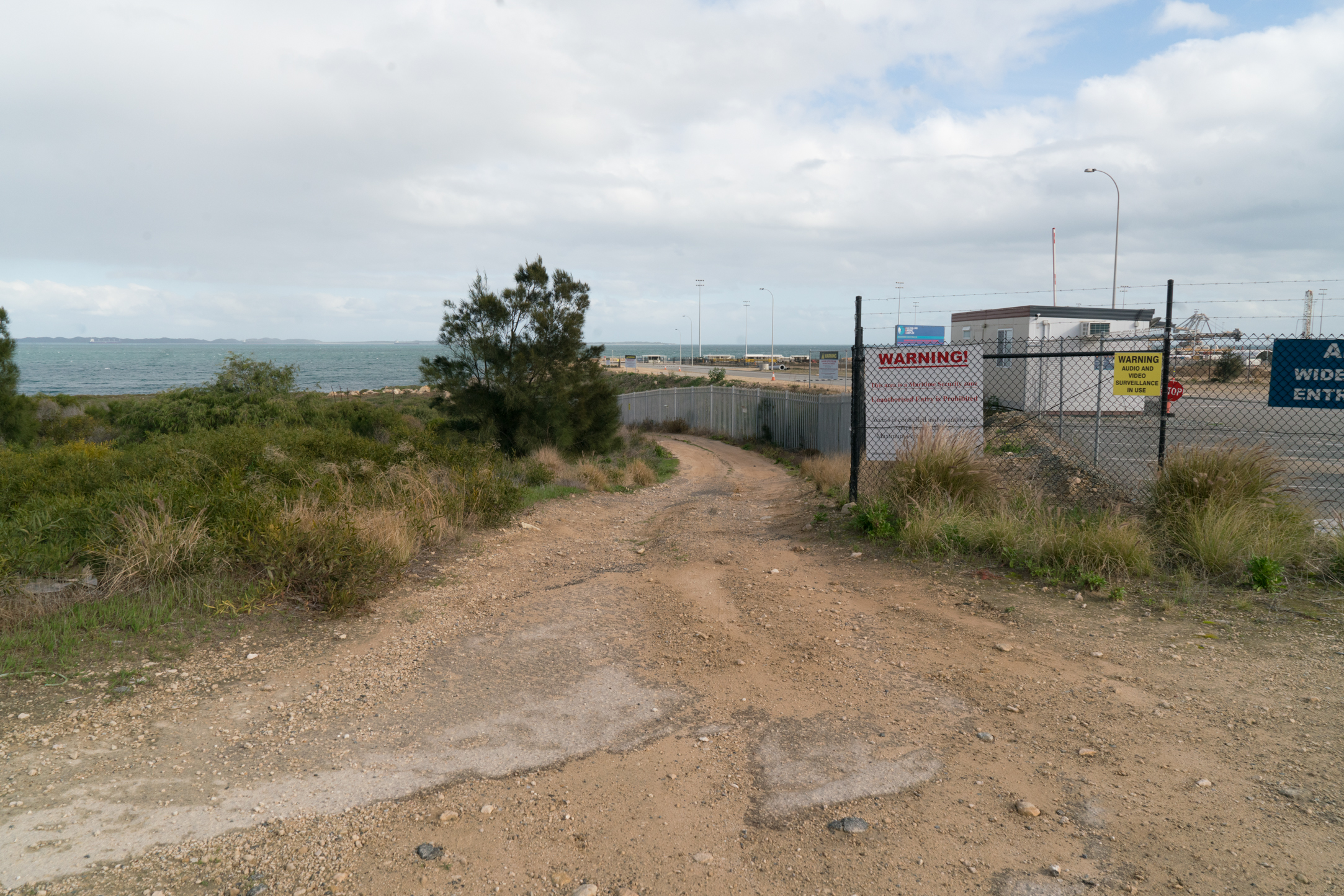
Plate 6: The track next to the boundary fence
You can walk all the way down to the ocean and you’ll notice a track off to the left – you will return to this take this track to head south (Plate 7 and 8).

Plates 7: The track though Beeliar Regional Park heading south

Plates 8: The track though Beeliar Regional Park heading south
Walk passed the track and when you arrive at the ocean you will see the limestone cliff which are the main feature of this part of Beeliar Regional Park (Plate 9).

Plate 9: View of the coastal limestone cliff in Beeliar Regional Park from the northern boundary.
You will notice a not very well formed walking track along the top of the cliffs – Plate 10. PLEASE DO NOT TAKE THIS TRACK.
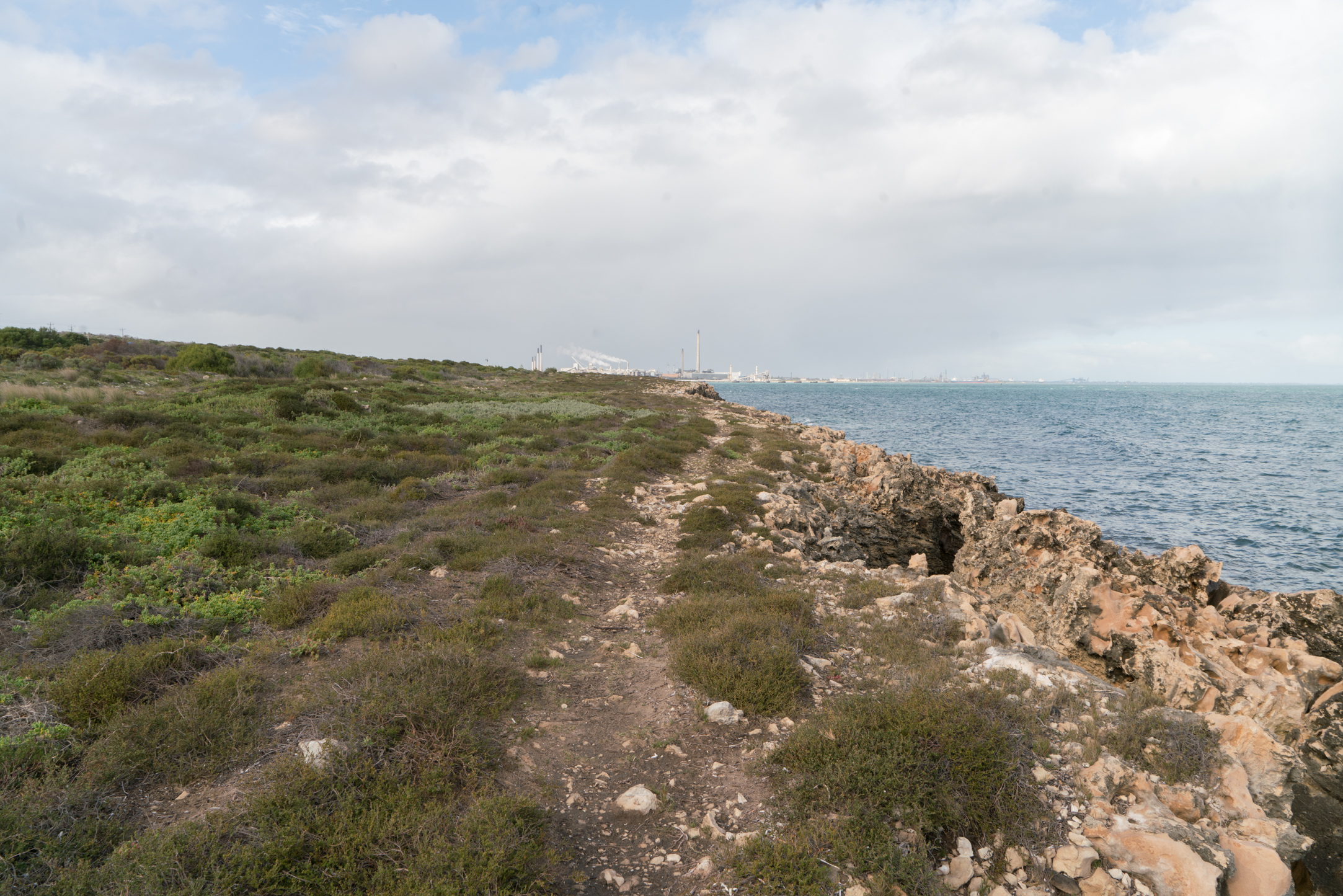
Plate 10: The informal track along the cliff – please do not take
The track passes through and over very sensitive vegetation which is being trampled. As well, the path is dangerous with the cliff eroding, breaking away and falling into the ocean (Plate 11) and several hidden deep holes which the unwary can fall into (Plate 12).

Plate 11: A section of the cliff eroding, breaking away and falling into the ocean

Plate 12: Hidden deep hole – one of several which are hazardous for walkers
About half way through the Park there is a viewing platform with spectacular views of the ocean and cliffs.
Walk back up to the track and head south. There are a couple of spots where it is overgrown, but otherwise and easy walk. You will come to a carpark on your left, and the viewing platform (Plate 13). The views are well worth seeing. (Plates 14 and 15).

Plate 13: The viewing platform
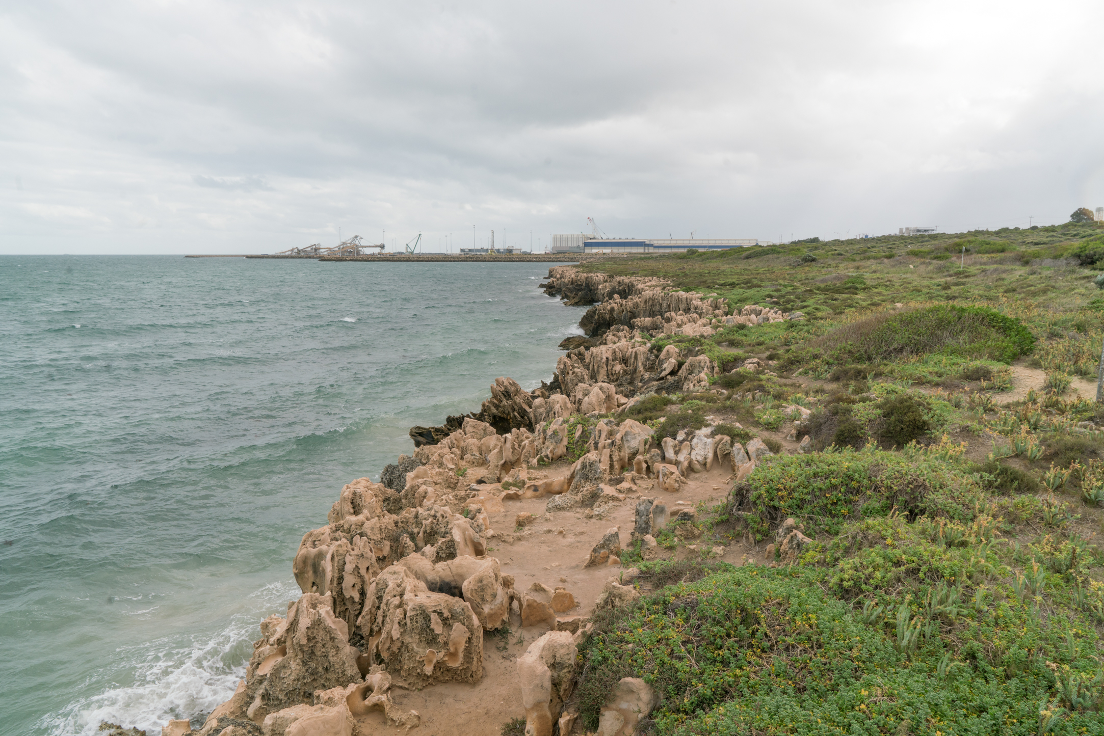
Plates 14: View north

Plates 15: View south
There is also an informal cliff top track south of here, and again please do not take this track. The continuation of the inland track is less obvious at this point but can be found to the east of where the informal track begins (Plate 16).

Plate 16: The informal cliff top track on the right of the photo and the less obvious track around the bush back to the inland track on the left of the photo.
As you proceed along the track you will a small settlement of mostly holiday shacks ahead, which is about 600m from the viewing platform (Plate 17).
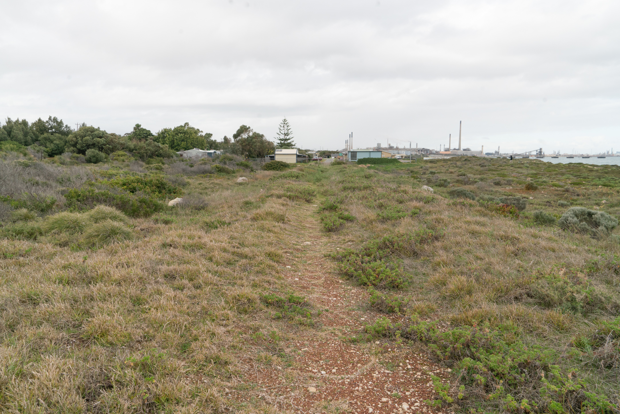
Plate 17: Approaching the shack settlement at Naval Base
Go through the gate (Plate 18) and walk through the settlement on either of the roads. It’s not possible to walk around the settlement on the coastal side as this is the southern extent of the cliffs (see Plate 19).

Plate 18: Gate into the shack settlement at Naval Base
All the shacks are old, and there are variety of designs.
Some of the shacks are between the boundary fence and the road, and some of these have a narrow path between the shack and the fence (Plate 19).

Plate 19: Narrow coastal path between some of the shacks and the fence
There are two small beaches adjacent to the settlement accessible via steps (Plate 20).

Plate 20: Steps down to one of the small beaches
There are two toilet blocks in the settlement, one about half way along near the coast and the other closer to the road near the kiosk.
At the southern boundary of the settlement is a road to Challenger Beach and an entrance road. Head down this road until you come to small carpark and boat launching ramp and toilet block on the right (Plate 21) this is the turn around point.

Plate 21: Small carpark and boat launching ramp at Challenger Beach
You could continue to walk along the beach until you come to the Alcoa jetty – about 700m (Plate 22). It is unsafe to go any further.

Plate 22: The Alcoa Jetty – it is not safe to go any further than this
NOTE: About 100m north of the entrance to Challenger Beach road along Cockburn Road is a small kiosk and the bus stop for the 548 bus (Plate 23)
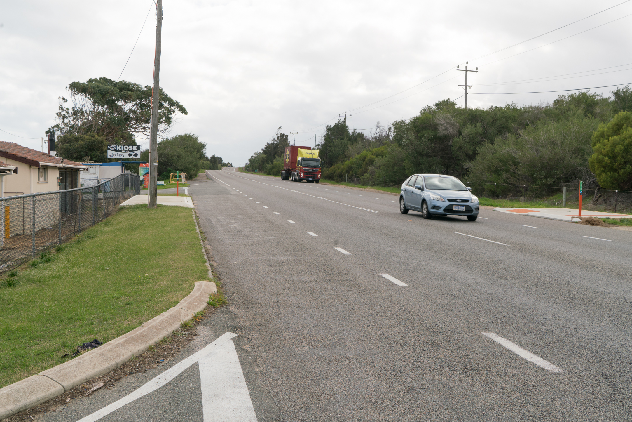
Plate 23: Small kiosk and bus stop on Cockburn Road for return trip
The photographs were taken and the walking guide information gathered when I walked the on July 18 2017.
© Garry Middle, July 2017