
Overview - updated January 2026
This page has a full description of this section of the trail, including supporting photographs. You can read this page and/or
Starting point – arriving by car
TThe starting point is the end of the main board walk in front of the cafes/restaurants at Mindarie Keys Marina.
Getting there using public transport and starting point
The best way to get to the start using public transport is to catch the train to Clarkson Station and take the 480 bus. The bus will eventually travel along Rothesay Heights. Get off on the third bus top along Rothesay Heights, just after Bayport Court. Head north for about 150m and turn left (west) into Honiara Way. Follow this road to the end through a roundabout (it becomes Swansea Promenade), about 500m. Head left (south) along the boardwalk past the boat jetty to the starting point.
Turn around point
The turn around point is the café at Burns Beach.
Getting back to the start from the turn around point – if you don’t want to do an out-and-back walk
The best way to get back to the start using public transport is to walk east along the main road (Ocean Parade) for about 90m to the terminus bus stop for the 470 bus, which goes to Joondalup train station and take the train north to Clarkson Station, then catch the 480 as bus as above.
Summary of the walk
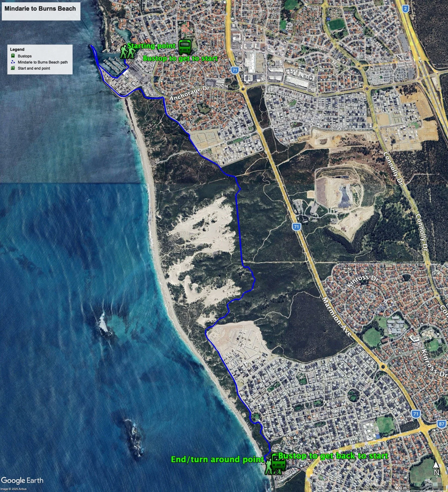
Figure 1 below shows the route. The total one-way distance is 7.3 km, making it a 14.6 km out and back walk. NOTE: if you don't walk out and back along the groyne/southern seawall on Mindarie Keys. This will take 700m off the walk. Any toilet blocks are noted below in the text in italics. These are also sources of potable water. Any additional drinking water taps and showers are also noted in italics.
Figure 1: The route
Walking guide
From the starting point (Plate 1) continue walking along the waterfront, through the carpark, along the waterfront past the main boat mooring area, and onto the boardwalk in front of the large houses, and then continue along the sand/limestone track along the groyne/southern seawall on Mindarie Keys Marina for about 300m (Plate 2) to the end and carefully climb the rocks at the end for views up the beach (Plate 3).
Plate 1: Starting point
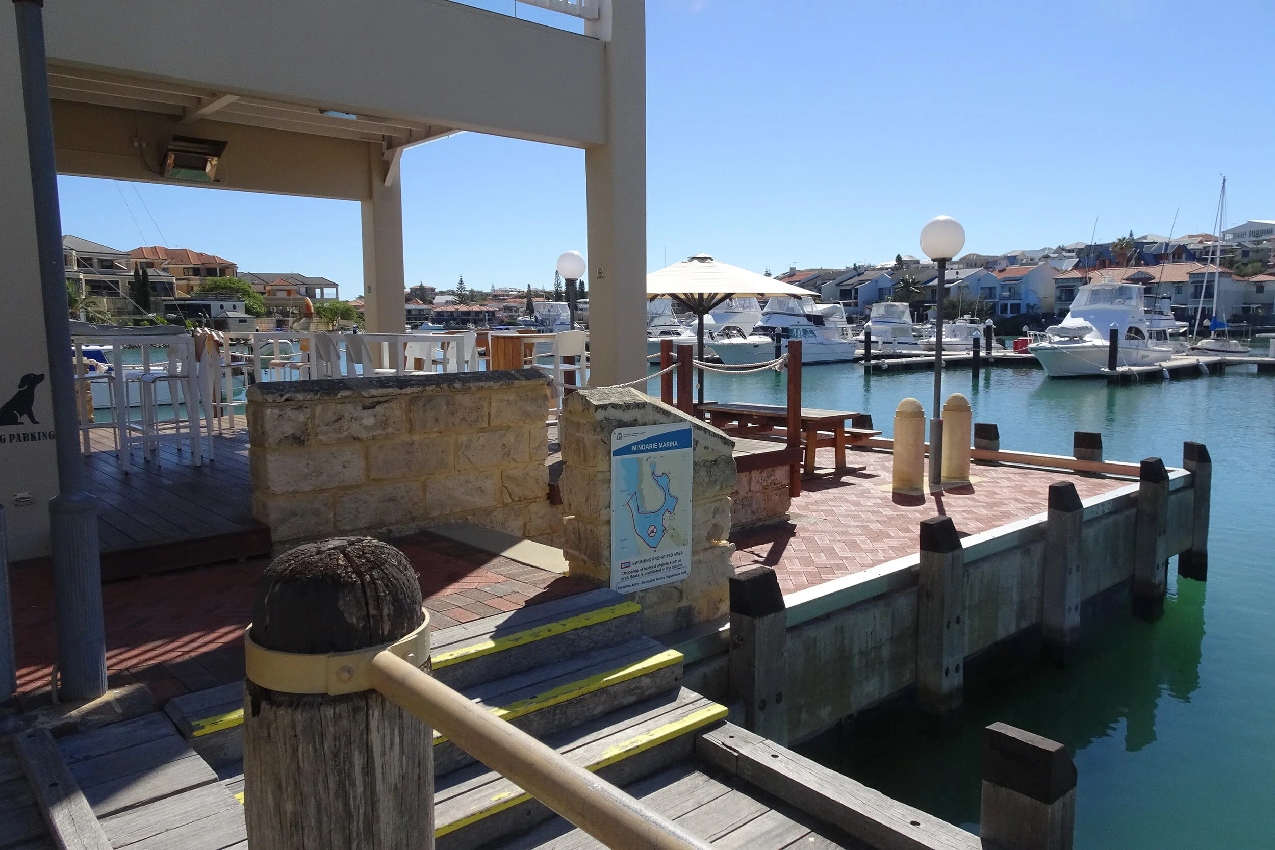
Plate 2: View along the sand/limestone track along the groyne/southern seawall

Plate 3: Viewing looking north from the end of groyne/southern seawall

Head back down the sand/limestone track and take the paths that runs next to the road that runs next to the seawall (Alexandria Drive). After about 500m, the road bends sharply to the left, and there is a carpark servicing the surf beach south of here (Plate 4).
Plate 4: View looking south from Alexandria Drive near the carpark

Take the path that starts at the north-east end of the carpark which ends after about 450m. The exit is to the left very near the end, which takes you onto Anchorage Drive. Follow the path and turn immediately into Long Beach Prom. Continue on the path adjacent to Long Beach Prom until the end (about 800m) at a roundabout with Peaceful View and Portofino Promenade. This is where the new dual use paths starts. For the most part, this path is about 1km from the coast. After about 2.5km the path starts passes next to a new subdivision and runs adjacent to Beachside Drive. The path will take you past a round grassed park, and after about 420m you will arrive at Burns Beach, which has a toilet block and café. This is the end point.